Near Munfordville in Hart County, Kentucky — The American South (East South Central)
The Woodson Farm/The Preserve
Battle for the Bridge Historic Preserve
Photographed by Lee Hattabaugh, January 25, 2011
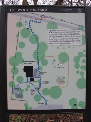
1. The Woodson Farm Marker
Anthony Woodson's fields and woods felt the ravages of war. Yet before and after, and even during the strife, the daily life of a central Kentucky farmstead carried on. As you wander the paths of the Woodson farm and visit the house, keep your senses sharp for clues to what life would have been like between the eve of war and the turn of the 20th century.
(Second Panel)
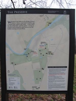
Welcome to the Battle for the Bridge Historic Preserve. Enjoy a step back to another age, a simpler time, closer to the earth…a time when the fate of the state - and the nation - swung on events in and around the small towns at an old buffalo crossing on Green River.
Erected by Battle for the Bridge Historic Preserve.
Topics. This historical marker is listed in these topic lists: Horticulture & Forestry • War, US Civil.
Location. 37° 15.425′ N, 85° 53.221′ W. Marker is near Munfordville, Kentucky, in Hart County. It can be reached from Charlie Dowling Road (U.S. 31W) north of Bragg Avenue, on the right when traveling north. Touch for map. Marker is in this post office area: Munfordville
this page online

Regionally, this marker is in Mammoth Cave Country and in the Pennyroyal Region. It is also in the American South and specifically in the Upper South. Globally, it is in North America, the Western Hemisphere, the Western World, and the Anglosphere. Historically, it finds itself in what was once the territory of the Mississippian Culture and also the Antebellum South.
Other nearby markers. At least 8 other markers are within walking distance of this marker: Anthony Woodson Farm (within shouting distance of this marker); The Raider (about 300 feet away, measured in a direct line); Kentucky and the Western War (about 300 feet away); Battle of Munfordville: Day 1 (about 700 feet away); Fort Craig (approx. 0.2 miles away); Battle of Munfordville: Siege (approx. 0.2 miles away); L&N Railroad Bridge (approx. ¼ mile away); Battle of Munfordville (approx. ¼ mile away). Touch for a list and map of all markers in Munfordville.
Also see . . . Battle for the Bridge Historic Preserve. (Submitted on February 2, 2011, by Lee Hattabaugh of Capshaw, Alabama.)
Photographed by Lee Hattabaugh
2. The Preserve Marker
Photographed by Lee Hattabaugh, January 25, 2011
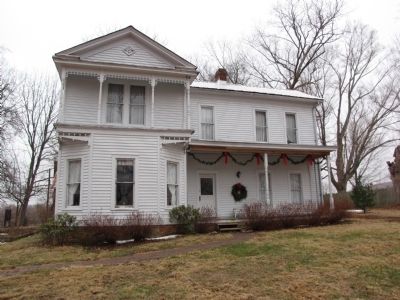
3. The Woodson Farm Marker
Marker is in the background to the left of the Woodson House.
Photographed by Duane Hall, August 9, 2015
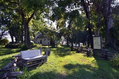
4. Markers near the Anthony Woodson House
Credits. This page was last revised on July 4, 2024. It was originally submitted on February 2, 2011. This page has been viewed 1,481 times since then and 22 times this year. Last updated on July 3, 2024. Photos: 1, 2, 3. submitted on February 2, 2011, by Lee Hattabaugh of Capshaw, Alabama. 4. submitted on September 5, 2015, by Duane Hall of Abilene, Texas. • Bernard Fisher was the editor who published this page.
