Munfordville in Hart County, Kentucky — The American South (East South Central)
The Smith Monument
Dedicated September 17, 1884
| — | Battle for the Bridge Historic Preserve | — |
Photographed by Bradley Owen, October 13, 2019
1. The Smith Monument
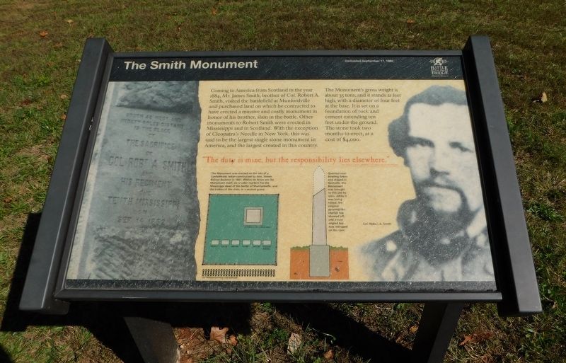
Coming to America from Scotland in the year 1884, Mr. James Smith, brother of Col. Robert A. Smith, visited the battlefield at Munfordville and purchased land on which he contracted to have erected a massive and costly monument in honor of his brother, slain in the battle. Other monuments to Robert Smith were erected in Mississippi and in Scotland. With the exception of Cleopatra's Needle in New York, this was said to be the largest single stone monument in America, and the largest created in this country.
The Monument's gross weight is about 35 tons, and it stands 21 feet high, with a diameter of four feet at the base. It is set on a foundation of rock and cement extending ten feet under the ground. The stone took two months to erect, at a cost of $4,000.
"The duty is mine, but the responsibility lies elsewhere."
[Captions:]
The Monument was erected on the site of a Confederate redan constructed by Gen. Simon Bolivar Buckner in 1861. Within its fence are the Monument itself, six smaller markers for the Mississippi dead of the battle of Munfordville, and the bodies of the slain, in a mutual grave.
Quarried near Bowling Green and shaped in Nashville, the Monument was brought to this site by train. While it was being raised, the original pyramid-like obelisk top sheared off, and a new angled top was reshaped on the spot.
Erected by Battle
this page online
Topics. This historical marker and monument is listed in this topic list: War, US Civil. A significant historical date for this entry is September 17, 1884.
Location. 37° 15.452′ N, 85° 53.741′ W. Marker is in Munfordville, Kentucky, in Hart County. It can be reached from Rush Island Bend Road 0.7 miles north of Rowletts Cave Springs Road, on the right when traveling north. The marker can be reached from Rush Island Bend Road by a 0.6 mile trail on the Battle For The Bridge Historic Preserve property. It is just west of the railroad track. Touch for map. Marker is at or near this postal address: 824 Rush Island Bend Road, Munfordville KY 42765, United States of America. Touch for directions.

Regionally, this marker and monument is in Mammoth Cave Country and in the Pennyroyal Region. It is also in the American South and specifically in the Upper South. Globally, it is in North America, the Western Hemisphere, the Western World, and the Anglosphere. Historically, it finds itself in what was once the territory of the Mississippian Culture and also the Antebellum South.
Other nearby markers. At least 8 other
Photographed by Bradley Owen, October 13, 2019
2. The Colonel Robert A. Smith Monument
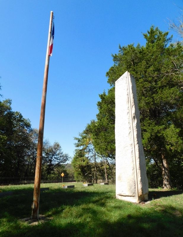
Some of the graves described on the marker can be seen behind the monument.
Credits. This page was last revised on July 4, 2024. It was originally submitted on January 19, 2021, by Bradley Owen of Morgantown, West Virginia. This page has been viewed 955 times since then and 76 times this year. Last updated on July 3, 2024. Photos: 1, 2. submitted on January 19, 2021, by Bradley Owen of Morgantown, West Virginia. • J. Makali Bruton was the editor who published this page.
