Whitneyville in Hamden in South Central Region, Connecticut — The American Northeast (New England)
1882 The Park
Photographed by Conrad Ward, May 11, 2024
1. 1882 The Park Marker
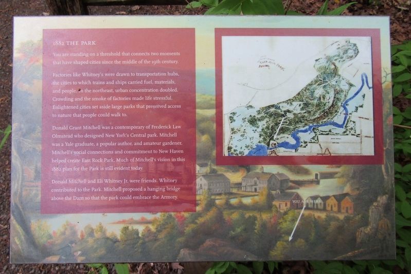
You are standing on a threshold that connects two moments that have shaped cities since the middle of the 19th century.
Factories like Whitney's were drawn to transportation hubs, the cities to which trains and ships carried fuel, materials, and people. In the northeast, urban concentration doubled. Crowding and the smoke of factories made life stressful. Enlightened cities set aside large parks that preserved access to nature that people could walk to.
Donald Grant Mitchell was a contemporary of Frederick Law Olmstead who designed New York's Central park. Mitchell was a Yale graduate, a popular author, and amateur gardener. Mitchell's social connections and commitment to New Haven helped create East Rock Park. Much of Mitchell's vision in this 1882 plan for the Park is still evident today.
Donald Mitchell and Eli Whitney Jr. were friends. Whitney contributed to the Park. Mitchell proposed a hanging bridge above the Dam so that the park could embrace the Armory.
Erected by Eli Whitney Museum and Workshop.
Topics. This historical marker is listed in these topic lists: Industry & Commerce • Parks & Recreational Areas. A significant historical year for this entry is 1882.
Location. 41° 20.15′ N,
this page online

Regionally, this marker is in the Connecticut River Valley, on the Connecticut Shoreline, and in Greater New Haven. It is also in the American Northeast and in New England. Globally, it is in North America, the Western Hemisphere, the Western World, and the Anglosphere. Historically, it finds itself in what was once New Haven County and also one of the original Thirteen Colonies.
Other nearby markers. At least 8 other markers are within walking distance of this marker: The Coal Shed (within shouting distance of this marker); The Quarry (within shouting distance of this marker); The Forge & Its Waterworks (within shouting distance of this marker); The Mill River (within shouting distance of this marker); The Town Bridge (about 300 feet away, measured in a direct
Photographed by Conrad Ward, May 11, 2024
2. 1882 The Park Marker
Credits. This page was last revised on May 19, 2026. It was originally submitted on July 4, 2024, by Conrad Ward of Guilford, Connecticut. This page has been viewed 185 times since then and 26 times this year. Photos: 1, 2. submitted on July 4, 2024, by Conrad Ward of Guilford, Connecticut. • J. Makali Bruton was the editor who published this page.
