Near Galva in McPherson County, Kansas — The American Midwest (Upper Plains)
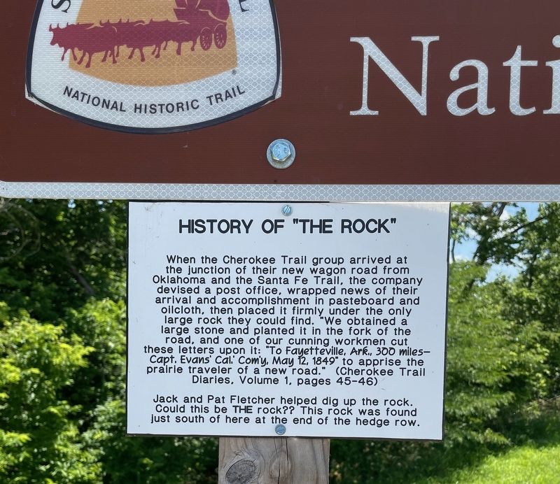
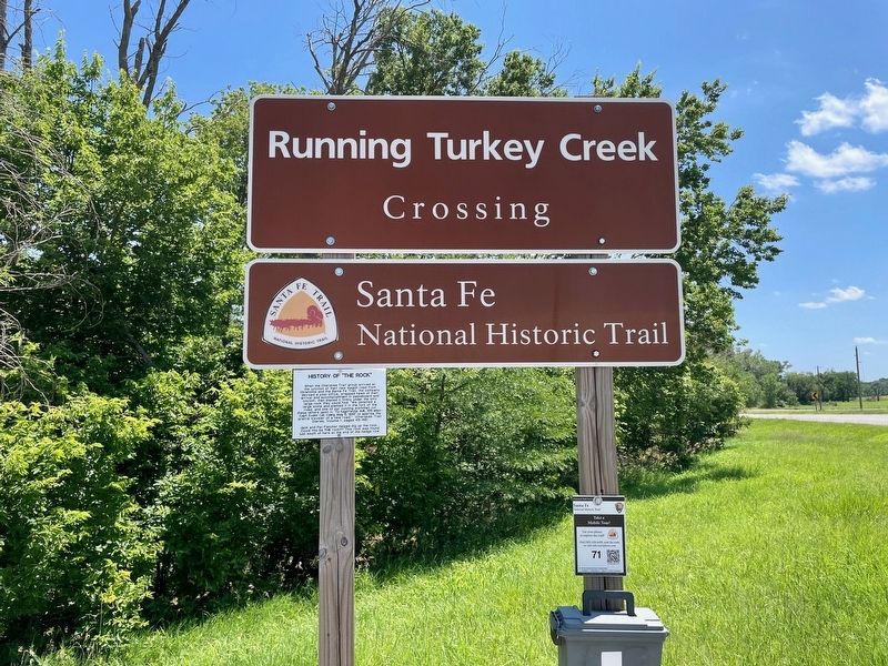
History of "The Rock"
Photographed by Mark Hilton, July 1, 2024
1. History of "The Rock" Marker
Jack and Pat Fletcher helped dig up the rock. Could this be THE rock?? This rock was found just south of here at the end of the hedge row.
Topics and series. This historical marker is listed in this topic list: Roads & Vehicles. In addition, it is included in the Santa Fe Trail series list. A significant day of the year for for this entry is May 12.
Location. 38° 20.984′ N, 97° 31.163′ W. Marker is near Galva, Kansas, in McPherson County. It is on 22nd Avenue 1.9 miles south of U.S. 56, on the left when traveling south. Touch for map.
this page online

Regionally, this marker is in Central Kansas. It is also in the American Midwest, in the Corn Belt, on the prairies, on the Southern Plains, and on the Santa Fe Trail Corridor. Globally, it is in North America, the Western Hemisphere, the Western World, and the Anglosphere. Historically, it finds itself in what was once the Louisiana Purchase.
Other nearby markers. At least 8 other markers are within 9 miles of this marker, measured as the crow flies: The Crossing at Running Turkey Creek (here, next to this marker); Santa Fe Trail (here, next to this marker); Last Built Carnegie Library (approx. 5.6 miles away); Veterans Memorial (approx. 6.8 miles away); Kansas Indian Treaty (approx. 7.1 miles away); Sora Kansas Creek (approx. 7.1 miles away); McPherson Opera House (approx. 8.1 miles away); One Main Place (approx. 8.1 miles away). Touch for a list and map of all markers in Galva.
Photographed by Mark Hilton, July 1, 2024
2. History of "The Rock" Marker
Photographed by Mark Hilton, July 1, 2024
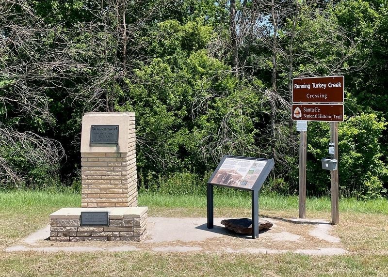
3. "Rock" can be seen under the middle interpretive marker.
Credits. This page was last revised on July 6, 2024. It was originally submitted on July 6, 2024, by Mark Hilton of Montgomery, Alabama. This page has been viewed 195 times since then and 36 times this year. Photos: 1, 2, 3. submitted on July 6, 2024, by Mark Hilton of Montgomery, Alabama.
