Norwich in Norfolk, England, United Kingdom — Northwestern Europe (the British Isles)
Augustine Steward House
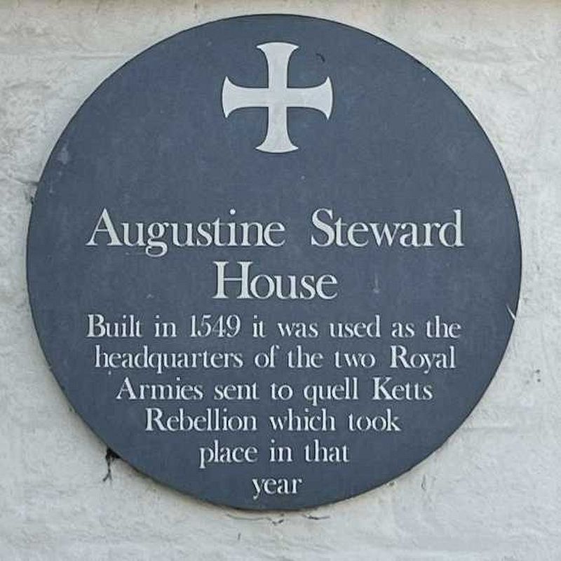
Photographed by Ray Gurganus
1. Augustine Steward House Marker
Topics. This historical marker is listed in this topic list: Wars, Non-US. A significant historical year for this entry is 1549.
Location. 52° 37.893′ N, 1° 17.921′ E. Marker is in Norwich, England, in Norfolk. It is on Tombland, on the left when traveling north. Touch for map. Marker is at or near this postal address: 14 Tombland, Norwich, England NR3 1HF, United Kingdom. Touch for directions.

Regionally, this marker is in East Anglia. Globally, it is on the Atlantic Ocean, in the North Atlantic Region, in Europe, in Atlantic Europe, on one of the British Isles, in the Western World, and in the Anglosphere. Historically, it finds itself in what was once the Roman Empire.
Other nearby markers. At least 8 other markers are within walking distance of this marker: Edith Cavell (within shouting distance of this marker); Wrights Court (about 90 meters away, measured in a direct line); Elm Hill (about 120 meters away); Paston House (about 120 meters away); St Peter Hungate (about
this page online

Photographed by Ray Gurganus
2. Augustine Steward House
Credits. This page was last revised on July 6, 2024. It was originally submitted on July 6, 2024, by Ray Gurganus of Washington, District of Columbia. This page has been viewed 193 times since then and 24 times this year. Last updated on July 6, 2024, by Sam Skeen of State College, Pennsylvania. Photos: 1, 2. submitted on July 6, 2024, by Ray Gurganus of Washington, District of Columbia. • J. Makali Bruton was the editor who published this page.
