Mount Diablo State Park near Clayton in Contra Costa County, California — The American West (Pacific Coastal)
Jeremiah Morgan

Photographed by Joseph Alvarado, April 20, 2024
1. Jeremiah Morgan Marker
born Cherokee Nation, Alabama – 1818
died Morgan Territory, California – 1906
Traveled to California gold country in 1849, soon discovering that he could earn more money hunting wild game to feed fellow miners than hunting gold ore. Returned to Iowa farm and in April 1853 family journeyed to California by wagon train. By September built home and began farming on 160 acres in Ignacio Valley.
While hunting, came across forested wilderness on east flank of Mount Diablo – “the morning side of the mountain,” as he called it. By October 1857 claimed large block of land, erected redwood barn, granary, and two-story house a mile north of this spot and brought family to what is named “Morgan Territory” in his honor. Registered brand JM in August 1858 and began raising horses, cattle, sheep, and pigs. Also hunted deer, grizzly bear, and elk to support his wife Sarah Ellis Morgan, and their 16 children. After Sarah died in 1869, married Louisa Riggs and had one more child. Acted as witness for many settlers’ claims and vigorously supported the one-room Morgan Territory School.
In 1989 Save Mount
this page online
Erected 2003.
Topics. This historical marker is listed in these topic lists: Exploration • Parks & Recreational Areas • Settlements & Settlers. A significant historical month for this entry is October 1857.
Location. 37° 51.092′ N, 121° 50.826′ W. Marker is near Clayton, California, in Contra Costa County. It is in Mount Diablo State Park. It is on Morgan Territory Road north of Morgan Territory Staging Area, on the right when traveling north. The granite boulder is near the red corral, across from the Red Corral Trailhead. Touch for map. Marker is in this post office area: Clayton CA 94517, United States of America. Touch for directions.

Regionally, this marker is in California’s San Francisco Bay Area and on the Coast Ranges. It is also on the American Pacific Coast. Globally, it is in North America, on the Ring of Fire, on the Pacific Rim, in the Western Hemisphere, in the Western World, and in the Anglosphere. Historically, it finds itself in what

Photographed by Joseph Alvarado, April 20, 2024
2. Jeremiah Morgan Marker
Other nearby markers. At least 8 other markers are within 5 miles of this marker, measured as the crow flies: Old Marsh Creek Springs (approx. 2.8 miles away); History of Marsh Creek Springs (approx. 2.8 miles away); Tassajara School (approx. 3.4 miles away); Mount Diablo (approx. 4.2 miles away); Mt Diablo State Park (approx. 4.2 miles away); Mount Diablo Beacon: (approx. 4.2 miles away); What Are Those Towers For? (approx. 4.4 miles away); Mount Diablo State Park (approx. 4.4 miles away). Touch for a list and map of all markers in Clayton.
Also see . . .
1. East Bay Regional Park District. Morgan Territory Regional Preserve website homepage (Submitted on July 6, 2024, by Joseph Alvarado of Livermore, California.)
2. Morgan Territory Regional Preserve. Wikipedia entry (Submitted on July 7, 2024, by Larry Gertner of New York, New York.)
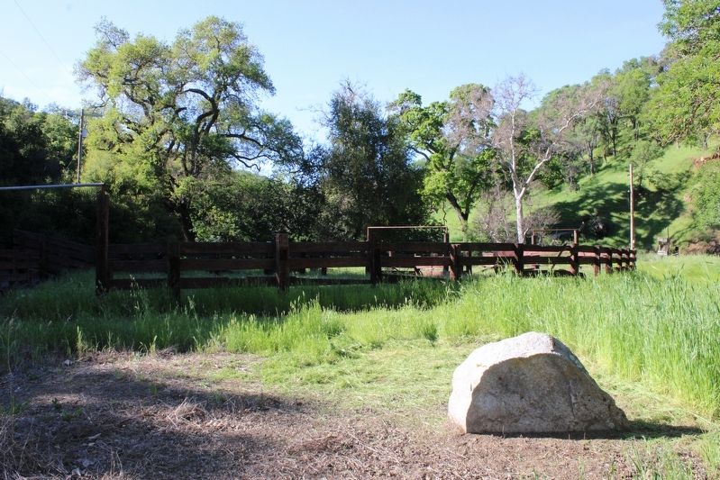
Photographed by Joseph Alvarado, April 20, 2024
3. Rear of the Marker, Looking at the Red Corral
Credits. This page was last revised on June 29, 2025. It was originally submitted on July 6, 2024, by Joseph Alvarado of Livermore, California. This page has been viewed 917 times since then and 143 times this year. Photos: 1, 2, 3. submitted on July 6, 2024, by Joseph Alvarado of Livermore, California.
