Near Elkmont in Limestone County, Alabama — The American South (East South Central)
Sims Settlement
Photographed by Darren Jefferson Clay, July 7, 2024
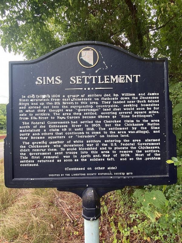
1. Sims Settlement Marker
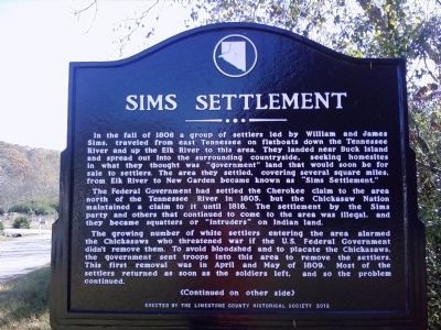
In the fall of 1806 a group of settlers led by William and James Sims, traveled from east Tennessee on flatboats down the Tennessee River and up the Elk River to this area. They landed near Buck Island and spread out into the surrounding countryside, seeking homesites in what they thought was "government" land that would soon be for sale to settlers. The area they settled, covering several square miles, from Elk River to New Garden became known as "Sims Settlement."
The Federal Government had settled the Cherokee claim to the area north of the Tennessee River in 1805, but the Chickasaw Nation maintained a claim to it until 1816. The settlement by the Sims party and others that continued to come to the area was illegal, and they became squatters or "intruders" on Indian land.
The growing number of white settlers entering the area alarmed the Chickasaws who threatened war if the U.S. Federal Government didn't remove them. To avoid bloodshed and to placate the Chickasaws, the government sent troops into this area to remove the settlers. This first removal was in April and May of 1809. Most of the settlers returned as soon as
this page online
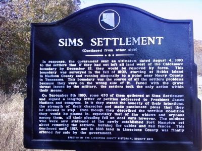
(Continued from other side)
In response, the government sent an ultimatum dated August 4, 1810 to the settlers that if they had not left all land west of the Chickasaw boundary by December 15, they would be removed by force. This boundary was surveyed in the fall of 1807, starting at Hobbs Island in Madison County and running diagonally to a point near Maury County in Tennessee. This boundary was the source of all the settlers problems because they were on the wrong side of it. Faced with the grave threat issued by the military, the settlers took the only action within their means.
On September 5th 1810, some 450 of them gathered at Sims Settlement and signed a lengthy letter or petition addressed to President James Madison and congress. In it they stated the honesty of their intentions, the strength of their character and made passionate pleas that they be allowed to stay. Even though they described the terrible condition they would be placed in, especially that of the widows and orphans among them, all their pleading fell on deaf ears however. The soldiers who
Photographed by Lee Hattabaugh, November 3, 2012
2. Sims Settlement Marker
Erected 2012 by The Limestone County Historical Society.
Topics and series. This historical marker is listed in these topic lists: Forts and Castles • Government & Politics • Indigenous Peoples and Communities • Settlements & Settlers. In addition, it is included in the Former U.S. Presidents: #04 James Madison series list. A significant historical month for this entry is May 1809.
Location. 34° 54.933′ N, 87° 2.469′ W. Marker is near Elkmont, Alabama, in Limestone County. It is on Easter Ferry Road south of Morris Road (County Road 49), on the right when traveling south. Touch for map. Marker is at or near this postal address: 25114 Easter Ferry Road, Elkmont AL 35620, United States of America. Touch for directions.

Regionally, this marker is in North Alabama and in the Huntsville Metropolitan Area. It is also in the American South, specifically in the Deep South, in Appalachia,
Photographed by Lee Hattabaugh, November 3, 2012
3. Sims Settlement Marker Reverse
Other nearby markers. At least 8 other markers are within 4 miles of this marker, measured as the crow flies: Abner Alloway Strange, Sr. (approx. 2.8 miles away); Battle of Sulphur Creek Trestle (approx. 3 miles away); Dupree Cemetery (approx. 3.2 miles away); Cunningham Cemetery (approx. 3.2 miles away); Commerce (approx. 4 miles away); Elkmont, Alabama / Tenn. & Ala. Central Railroad (approx. 4 miles away); Downtown Scenes (approx. 4 miles away); Limestone County's First High School / The Delmore Brothers (approx. 4 miles away). Touch for a list and map of all markers in Elkmont.
Additional commentary.
1. Marker stolen.
Sometime on the 18th or 19th of April, 2019, this marker, along with another marker about 5 miles away, was stolen. The 80-pound metal markers cost the Limestone
Photographed by Lee Hattabaugh, November 3, 2012
4. Sims Settlement Marker
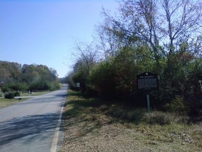
Looking south along Easter Ferry Road
Update: An Ardmore, Alabama man was arrested on June 16th in connection with the theft of this, and two other Limestone County historical markers. The markers were subsequently recovered from a storage unit.
Update: The marker was reinstalled and photographed on July 7, 2024.
— Submitted April 24, 2019, by Mark Hilton of Montgomery, Alabama.
Photographed by Lee Hattabaugh, November 3, 2012
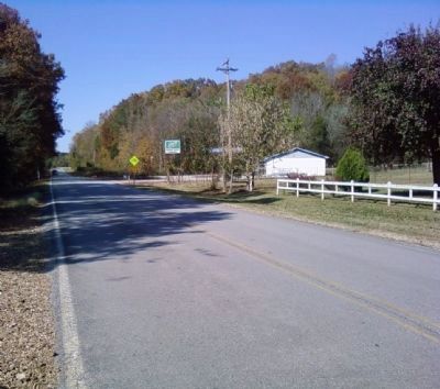
5. Sims Settlement Marker
Looking north from near the marker toward the Morris Road intersection.
Credits. This page was last revised on July 8, 2024. It was originally submitted on November 5, 2012, by Lee Hattabaugh of Capshaw, Alabama. This page has been viewed 4,357 times since then and 257 times this year. Last updated on July 7, 2024, by Darren Jefferson Clay of Duluth, Georgia. Photos: 1. submitted on July 7, 2024, by Darren Jefferson Clay of Duluth, Georgia. 2, 3, 4, 5. submitted on November 5, 2012, by Lee Hattabaugh of Capshaw, Alabama. • J. Makali Bruton was the editor who published this page.
