Hartsburg in Boone County, Missouri — The American Midwest (Upper Plains)
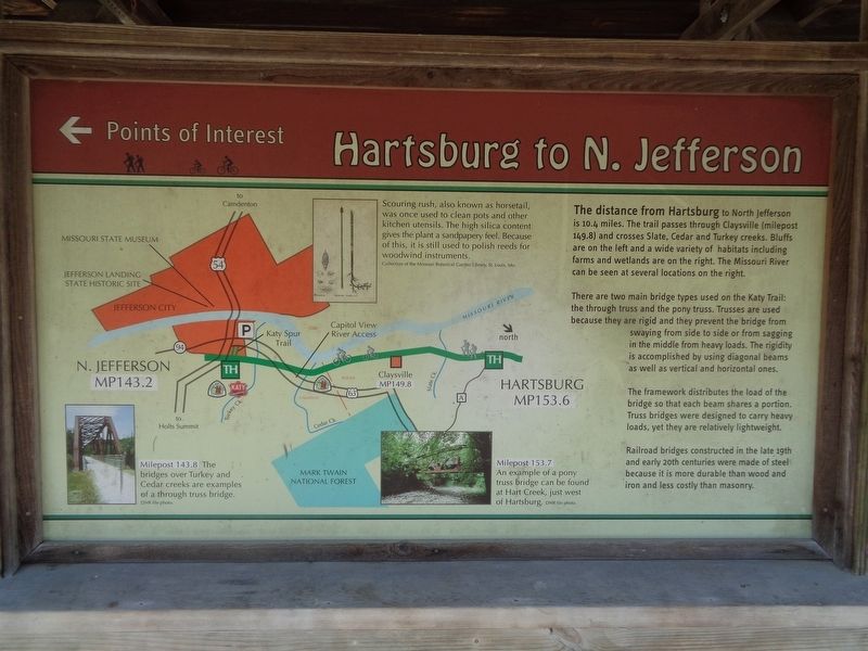
Hartsburg to N. Jefferson
Points of Interest
Photographed by Jason Voigt, June 25, 2024
1. Hartsburg to N. Jefferson Marker
There are two main bridge types used on the Katy Trail: the through truss and the pony truss. Trusses are used because they are rigid and they prevent the bridge from swaying from side to side or from sagging in the middle from heavy loads. The rigidity is accomplished by using diagonal beams as well as vertical and horizontal ones.
The framework distributes the load of the bridge so that each beam shares a portion. Truss bridges were designed to carry heavy loads, yet they are relatively lightweight.
Railroad bridges constructed in the late 19th and early 20th centuries were made of steel because it is more durable than wood and iron and less costly than masonry.
(photo captions:)
·Scouring rush, also known as horsetail, was once used to clean pots and other kitchen utensils. The high silica content gives the plant a sandpapery feel. Because of this, it is still use to polish reeds for woodwind instruments.
·Milepost 143.8 - The bridges over Turkey and Cedar creeks are examples of a through truss bridge.
·Milepost 153.7 - An example of a pony truss bridge can be found at Hart Creek, just west of Hartsburg.
Erected by Missouri
this page online
Topics and series. This historical marker is listed in these topic lists: Bridges & Viaducts • Roads & Vehicles. In addition, it is included in the Katy Trail State Park series list.
Location. 38° 41.662′ N, 92° 18.592′ W. Marker is in Hartsburg, Missouri, in Boone County. It is on South 2nd Street, on the right when traveling south. Marker is located at Katy Trail-Hartsburg Trailhead. Touch for map. Marker is at or near this postal address: 95 S 2nd St, Hartsburg MO 65039, United States of America. Touch for directions.

Regionally, this marker is in Little Dixie and in the Missouri River Corridor. It is also in the American Midwest, in the Lewis & Clark Corridor, and in the Corn Belt. Globally, it is in North America, the Western Hemisphere, the Western World, and the Anglosphere. Historically, it finds itself in what was once the territory of the Mississippian Culture, the Louisiana Purchase, and the Antebellum South.
Other nearby markers. At least 8 other markers are within 10 miles of this marker, measured as the crow flies: History of Hartsburg
Photographed by Jason Voigt, June 25, 2024
2. Hartsburg to N. Jefferson Marker
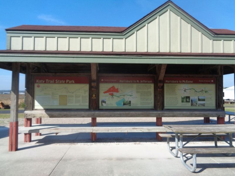
Marker is the middle panel
Also see . . . Katy Trail State Park (Missouri State Parks). (Submitted on July 8, 2024, by Jason Voigt of Glen Carbon, Illinois.)

Photographed by Jason Voigt, June 25, 2024
3. Hartsburg to N. Jefferson Marker
Marker is located at the Katy Trail-Hartsburg Trailhead (side facing the parking lot).

Photographed by Jason Voigt, June 25, 2024
4. Hartsburg to McBaine
This is to the right of the marker. It did not have any historical text to give it its own submission.
Credits. This page was last revised on July 8, 2024. It was originally submitted on July 8, 2024, by Jason Voigt of Glen Carbon, Illinois. This page has been viewed 220 times since then and 22 times this year. Photos: 1, 2, 3, 4. submitted on July 8, 2024, by Jason Voigt of Glen Carbon, Illinois.
