Hartsburg in Boone County, Missouri — The American Midwest (Upper Plains)
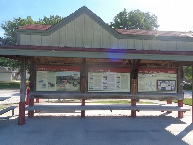
Hartsburg Bottoms and Bluffs

Photographed by Jason Voigt, June 25, 2024
1. Hartsburg Bottoms and Bluffs Marker
Stones for Homes
The people of Hartsburg cut blocks of limestone from the bluffs to make foundations for their homes. Clay, obtained by digging into the bluffs, was molded and baked into bricks. These bricks, made here in the early 1900s, are still in use in several of the town's buildings. In the 1920s, rock from the bluffs was crushed and spread on the mud streets.
Fertile Farmland
Many who settled in Hartsburg did so because they knew the value of bottomland soil. Until the mid-1900s, it only took 40 to 80 acres to support a large family through a diversified approach that included raising animals for eggs, milk and meat and growing vegetable gardens as well as growing crops of wheat and corn for sale. Much has changed, but these bottoms continue to serve as prime cropland, often producing 30 to 40 percent more than upland croplands of Missouri.
Geology and Soils Cause Bottoms and Bluffs to Differ like Night and Day
Soils in the bottoms are alluvium, having been eroded from uplands and deposited here by the flooding and meandering of the Missouri River. These bottomland soils are made up of fine silt and loam,
this page online
In contrast, soils on the bluff tops, produced from the break-down of the limestone rock over time, are high in clay content. Compounding the situation is the hilly terrain that causes much of each rainfall to run off of the bluff tops. With little moisture, there is little plant growth and thus little organic matter added to the soil. Plants well suited to the dry conditions of the rocky bluff tops include prickly pear cactus, numerous wildflowers and native grasses. Once kept open by fires, many glade ecosystems of the bluffs are now overgrown with eastern red cedar trees.
(photo captions:)
·Powered by steam engines, J.H. Nabler's threshing machines were used from 1900 to 1939 to separate grain from straw.
·Typically, in the first half of the 1900s, farmers sold most of their wheat to the mill, but some was ground and returned so that a year's supply of flour could be stored in bags in upstairs rooms of their homes.
·One of several flowering plants that inhabit dry bluff tops, lead plant is one of our more colorful legumes.
·River bulrush grows to be several feet tall and forms large colonies when it finds suitable habitat in shallow water and wet mud of sloughs and floodplains.
·Crops of soybeans, shown here, are harvested by combines and are made into a variety of food products ranging from vegetable oil to tofu.
·Held annually on the second weekend of October, the Hartsburg Pumpkin Festival is a great family outing.
·Many of the pumpkins the Hackman family grows are shipped to stores and go home with families who carve them into jack-o-lanterns. Others decorate Hartsburg for the annual festival that attracts thousands of people to this tiny town each year.
·As a reptile needing to absorb heat from its environment, five-lined skinks prefer the sunny and rocky nature of bluffs and hillsides.
·The great plains toad, restricted in its range in Missouri to the floodplain of the Missouri River, hides in underground burrows by day and feeds on ants, beetles and other insects at nights. Its chee-ga, chee-ga, chee-ga calls may be heard after dusk, April-June.
Erected by Missouri
Photographed by Jason Voigt, June 25, 2024
2. Hartsburg Bottoms and Bluffs Marker
Marker is the left column.
Topics and series. This historical marker is listed in these topic lists: Agriculture • Animals. In addition, it is included in the Katy Trail State Park series list. A significant historical year for this entry is 1900.
Location. 38° 41.662′ N, 92° 18.595′ W. Marker is in Hartsburg, Missouri, in Boone County. It is on South 2nd Street, on the right when traveling east. Marker is located at the Katy Trail-Hartsburg Trailhead. Touch for map. Marker is at or near this postal address: 95 S 2nd St, Hartsburg MO 65039, United States of America. Touch for directions.

Regionally, this marker is in Little Dixie and in the Missouri River Corridor. It is also in the American Midwest, in the Lewis & Clark Corridor, and in the Corn Belt. Globally, it is in North America, the Western Hemisphere, the Western World, and the Anglosphere. Historically, it finds itself in what was once the territory of the Mississippian Culture, the Louisiana Purchase, and the Antebellum South.
Other nearby markers. At least 8 other markers are within 10 miles of this marker, measured as the crow flies: History of Hartsburg (here, next
Photographed by Jason Voigt, June 25, 2024
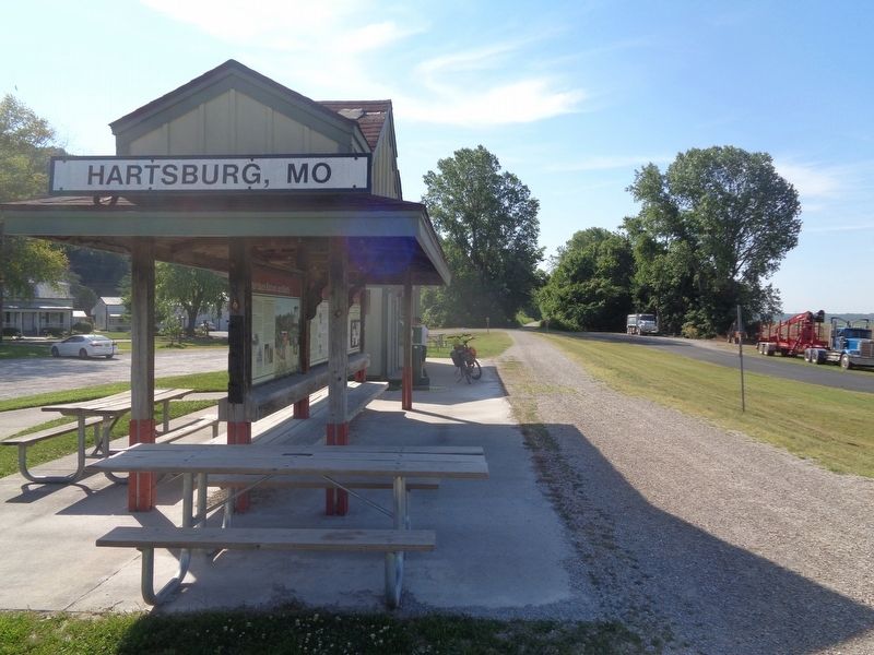
3. Hartsburg Bottoms and Bluffs Marker
Marker is located at the Katy Trail-Hartsburg Trailhead (side facing the trail)
Also see . . . Katy Trail State Park (Missouri State Parks). (Submitted on July 8, 2024, by Jason Voigt of Glen Carbon, Illinois.)
Credits. This page was last revised on July 8, 2024. It was originally submitted on July 8, 2024, by Jason Voigt of Glen Carbon, Illinois. This page has been viewed 380 times since then and 45 times this year. Photos: 1, 2, 3. submitted on July 8, 2024, by Jason Voigt of Glen Carbon, Illinois.
