Danbury in Western Region, Connecticut — The American Northeast (New England)
Danbury
Photographed by Michael Herrick, September 24, 2009
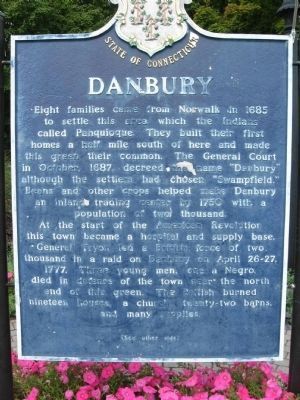
1. Danbury Marker front
Eight families came from Norwalk in 1685 to settle this area which the Indians called Pahquioque. They built their first homes a half mile south of here and made this green their common. The General Court in October 1687 decreed the name “Danbury” although the settlers had chosen “Swampfield.” Beans and other crops helped make Danbury an inland trading center by 1750 with a population of two thousand.
At the start of the American Revolution this town became a hospital and supply base. General Tyron led a British force of two thousand in a raid on Danbury on April 26 – 27, 1777. Three young men, one a Negro, died in defense of the town near the north end of the green. The British burned nineteen houses, a church, twenty-two barns and many supplies.
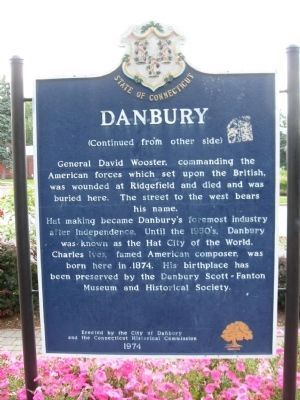
General David Wooster, commanding the American forces which set upon the British, was wounded at Ridgefield and died and was buried here. The street to the west bears his name.
Hat making became Danbury’s foremost industry after independence. Until the 1950’s, Danbury was known as the Hat City of the World. Charles Ives, famed American composer, was born here in 1874.
this page online
Erected 1974 by The City of Danbury and the Connecticut Historical Commission.
Topics. This historical marker is listed in these topic lists: Colonial Era • Political Subdivisions • Settlements & Settlers • War, US Revolutionary. A significant historical month for this entry is April 1832.
Location. 41° 23.439′ N, 73° 26.898′ W. Marker is in Danbury in Western Region, Connecticut. It is at the intersection of Main Street and Wooster Street, on the left when traveling north on Main Street. Touch for map. Marker is in this post office area: Danbury CT 06810, United States of America. Touch for directions.

Regionally, this marker is on the Connecticut Shoreline and in Greater Bridgeport. It is also in the American Northeast and in New England. Globally, it is in North America, the Western Hemisphere, the Western World, and the Anglosphere. Historically, it finds itself in what was once Fairfield County and also one of the original Thirteen Colonies.
Other nearby markers. At least 8 other markers are within walking distance
Photographed by Michael Herrick, September 24, 2009
2. Danbury Marker reverse
Photographed by Michael Herrick, September 24, 2009
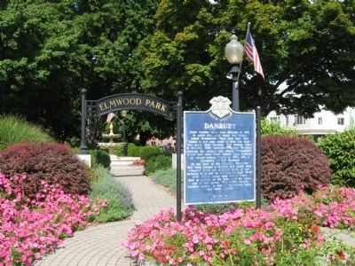
3. Danbury Marker at the South Entrance of Elmwood Park
Credits. This page was last revised on May 19, 2026. It was originally submitted on September 29, 2009, by Michael Herrick of Southbury, Connecticut. This page has been viewed 3,018 times since then and 63 times this year. Last updated on July 8, 2024, by Zachary Foti of Southington, Connecticut. Photos: 1, 2, 3. submitted on September 29, 2009, by Michael Herrick of Southbury, Connecticut. • J. Makali Bruton was the editor who published this page.
