Silver Dollar City in Branson in Stone County, Missouri — The American Midwest (Upper Plains)
Tomatoes
Have Deep Roots in The Ozarks

Photographed by Thomas Smith, June 27, 2024
1. Tomatoes Marker
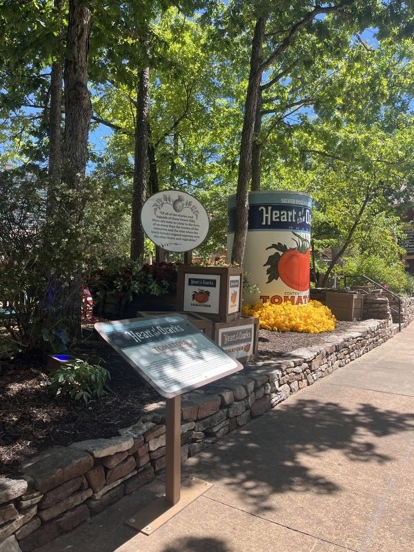
In the late 1800s, the beautiful Ozark Mountains were home to determined and hardworking hill folk living off the land. Summers were filled with steady farming in preparation for long winters. While most crops struggled to grow in the rocky Ozarks soil, locals discovered that tomatoes thrived and actually produced more than folks could use. Seeing the waste, a clever resident starting buying the extras from neighbors, canning them in his kitchen and selling them to nearby communities. And thus, the Stone County tomato canning industry was born and with it came a much needed source of income for the area.
At its peak, tomato canning was the largest trade in the county, employing more than 2,500 growers and another 2,500 residents in 38 canneries. Workers would stand shoulder-to-shoulder for long days in the blazing summer heat hand peeling the sun-kissed fruit for 5¢ per bucket. During the early days, these Ozark canneries supplied over 1.5 million cases of tomatoes annually from coast to coast across the United States. The history of this special place in time is reflected in the bright and colorful can labels that
this page online
Topics. This historical marker is listed in these topic lists: Agriculture • Industry & Commerce.
Location. 36° 40.101′ N, 93° 20.35′ W. Marker is in Branson, Missouri, in Stone County. It is in Silver Dollar City. It is on Silver Dollar City Parkway 0.2 miles north of Food Warehouse Lane, on the left when traveling north. Touch for map. Marker is at or near this postal address: 399 Silver Dollar City Pkwy, Reeds Spring MO 65737, United States of America. Touch for directions.

Regionally, this marker is in Southwest Missouri and in the Branson and Table Rock Lake Area. It is also in the American Ozarks, in the Lewis & Clark Corridor, and in the Corn Belt. Globally, it is in North America, the Western Hemisphere, the Western World, and the Anglosphere. Historically, it finds itself in what was once the territory of the Mississippian Culture, the Louisiana Purchase, and the Antebellum South.
Other nearby markers. At least 8 other markers are within 4 miles of this marker, measured as the crow flies: In Memory & Honor of Lloyd Edward "Shad" Heller
Photographed by Thomas Smith, June 27, 2024
2. Tomatoes Marker
Credits. This page was last revised on November 23, 2024. It was originally submitted on July 8, 2024, by Thomas Smith of Waterloo, Ill. This page has been viewed 255 times since then and 47 times this year. Photos: 1, 2. submitted on July 8, 2024, by Thomas Smith of Waterloo, Ill. • J. Makali Bruton was the editor who published this page.
Editor’s want-list for this marker. Confirmation of the marker's exact location and coordinates. • Can you help?
