Manitou Springs in El Paso County, Colorado — The American Mountains (Southwest)
A Town Built on Mineral Water Resources
Photographed by Mark Parker, July 2, 2024
1. A Town Built on Mineral Water Resources Marker
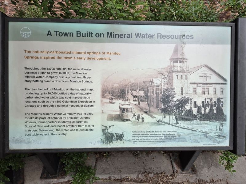
The naturally-carbonated. mineral springs of Manitou Springs inspired the town's early development.
Throughout the 1870s and 80s, the mineral water business began to grow. In 1889, the Manitou Mineral Water Company built a prominent, three- story bottling plant in downtown Manitou Springs.
The plant helped put Manitou on the national map, producing up to 20,000 bottles a day of naturally-carbonated water which was sold in prestigious locations such as the 1883 Columbian Exposition in Chicago and through a national network of dealers.
The Manitou Mineral Water Company was inspired to take its product national by president Jerome Wheeler, former partner in Macy's Department Store of New York and recent profiteer from mining in Aspen. Before long, the water was touted as the best table water in the country.
Topics. This historical marker is listed in these topic lists: Industry & Commerce • Natural Resources • Science & Medicine. A significant historical year for this entry is 1889.
Location. 38° 51.541′ N, 104° 55.099′ W. Marker is in Manitou Springs, Colorado, in El Paso County. It can be reached from Manitou
this page online

Regionally, this marker is in the Front Range and in Pikes Peak Region. It is also in the American Mountain West. Globally, it is in North America, the Rocky Mountains, the Western Hemisphere, the Western World, and the Anglosphere. Historically, it finds itself in what was once the Comanchería.
Other nearby markers. At least 8 other markers are within walking distance of this marker: Ute Pass Trail (a few steps from this marker); Spa Building (a few steps from this marker); Sacred Waters (within shouting distance of this marker); A Benefactor's Legacy (within shouting distance of this marker); The Cliff House (about 300 feet away, measured in a direct line); In Memory of Emma Crawford (about 300 feet away); Visionary Philanthropist (about 300 feet away); Manitou Springs Post Office (about 300 feet away). Touch for a list and map of all markers
Photographed by Mark Parker, July 2, 2024
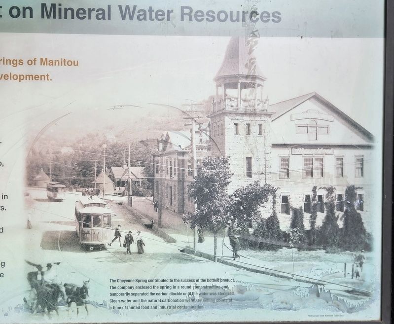
2. Historic photo of Manitou Springs
(photo caption)
The Cheyenne Spring contributed to the success of the bottled product. The company enclosed the spring in a round stone structure and temporarily separated the carbon dioxide until the water was sterilized. Clean water and the natural carbonation were key selling points at a time of tainted food and industrial contamination.
Photograph from Harrison Collection
Photograph from Harrison Collection
More about this marker. While looking for the Cheyenne spring fountain along the sidewalk of Manitou Avenue, the marker is behind a series of shrubs along an iron fence.
Photographed by Mark Parker, July 2, 2024
3. A Billion Reasons the Water is So Good (synopsis of the mineral water process)
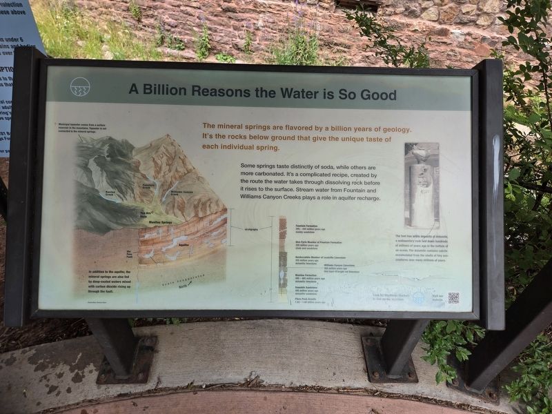
The mineral springs are flavored by a billion years of geology. It's the rocks below ground that give the unique taste of each individual spring.
Some springs taste distinctly of soda, while others are more carbonated. It's a complicated recipe, created by the route the water takes through dissolving rock before it rises to the surface. Stream water from Fountain and Williams Canyon Creeks plays a role in aquifer recharge.
(upper left) Municipal tapwater comes from a surface reservoir in the mountains. Tapwater is not connected to the mineral springs.
(lower left) In addition to the aquifer, the mineral springs are also fed by deep-seated waters mixed with carbon dioxide rising up through the fault.
(center) •Fountain Formation 295-320 milion years ago mainly sandstone.
•Glen Eyrie Member of Fountain Formation 320 million years ago shale and sandstone
•Hardscrabble Member of Leadville Limestone 955 mllon years ago dolomitic limestone.
•Williams Canyon Limestone 360 million years ago thin layer of bright red limestone.
•Manitou Formation 480-485 milion years ago dolomitic limestone.
•Sawatch Sandstone 495 million years ago dolomitic sandstone.
•Pikes Peak Granite 1.02-1.08 billion years ago
(far right)
The font has white deposits of dolomite, a sedimentary rock laid down hundreds of millions of years ago in the bottom of an ocean. The dolomite contains calcite accumulated from the shells of tiny sea creatures over many millions of years.
Illustration: Denise Dahn
Some springs taste distinctly of soda, while others are more carbonated. It's a complicated recipe, created by the route the water takes through dissolving rock before it rises to the surface. Stream water from Fountain and Williams Canyon Creeks plays a role in aquifer recharge.
(upper left) Municipal tapwater comes from a surface reservoir in the mountains. Tapwater is not connected to the mineral springs.
(lower left) In addition to the aquifer, the mineral springs are also fed by deep-seated waters mixed with carbon dioxide rising up through the fault.
(center) •Fountain Formation 295-320 milion years ago mainly sandstone.
•Glen Eyrie Member of Fountain Formation 320 million years ago shale and sandstone
•Hardscrabble Member of Leadville Limestone 955 mllon years ago dolomitic limestone.
•Williams Canyon Limestone 360 million years ago thin layer of bright red limestone.
•Manitou Formation 480-485 milion years ago dolomitic limestone.
•Sawatch Sandstone 495 million years ago dolomitic sandstone.
•Pikes Peak Granite 1.02-1.08 billion years ago
(far right)
The font has white deposits of dolomite, a sedimentary rock laid down hundreds of millions of years ago in the bottom of an ocean. The dolomite contains calcite accumulated from the shells of tiny sea creatures over many millions of years.
Illustration: Denise Dahn
Photographed by Mark Parker, July 2, 2024
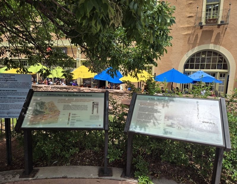
4. Marker wide wiew
Shops at the Spa in the background across the stream
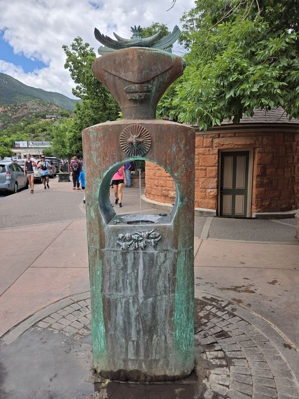
Photographed by Mark Parker, July 2, 2024
5. Cheyenne Spring fountain
Credits. This page was last revised on July 9, 2024. It was originally submitted on July 9, 2024, by Mark Parker of Hickory, North Carolina. This page has been viewed 364 times since then and 47 times this year. Photos: 1, 2, 3, 4, 5. submitted on July 9, 2024, by Mark Parker of Hickory, North Carolina. • J. Makali Bruton was the editor who published this page.
