Grayling Township in Crawford County, Michigan — The American Midwest (Great Lakes)
Outdoor Recreation
Forest Heritage Trail
Photographed by Joel Seewald, July 6, 2024
1. Outdoor Recreation Marker
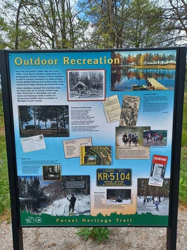
After the old growth timber was cut in the 1920s, many jobs at lumber camps and mills disappeared. Some Crawford County residents turned to outdoor recreation to make a living. Locals guided fishing and hunting trips, while resorts and lodges sprang up around the area.
Urban dwellers escaped the crowded cities on trains that ran on former lumber lines. After World War II, affordable cars and improved highways made it easier for the growing middle-class to vacation in Michigan's north woods.
Camping and State Parks
Since the early 1900s, people have enjoyed recreational camping. State and federal forest lands provide a rustic experience. Public campgrounds and state parks are family friendly, with amenities like RV hookups and camp stores.
In the 1920s, a state forest campground opened at North Higgins Lake. It was designated a state park in 1963.
The Civilian Conservation Corps built Hartwick Pines' first campground in the mid-1930s. In 1994, the state constructed a new campground with electrical and sewer hookups.
Summer's End
Here we are at the cottage. I've been here all summer. It's August, the beginning of the end of summer.
See the milkweed pods have long since opened and the brown-seeded silk flown away. By the path to the lake there are only a few snapdragons left to pop with your fingers and the goldenrod is already beginning to bloom.
Miv
this page online
Horseback Riding
In 1964, Governor George Romney dedicated the Michigan Shore to Shore Riding and Hiking Trail. It passes just north of Grayling, stretching from Lake Huron to Lake Michigan. At 220 miles, it is one of the Midwest's longer equestrian trails and attracts horseback riders from as far away as Europe.
Mason Tract
Conservationis and industrialist George W. Mason died in 1954. His will bequeathed 1,500 acres to the State of Michigan as a permanent game preserve, stipulating it never be sold or developed.
The addition of state-owned land, purchases from private citizens and land exchange with the U.S. Forest Service expanded the Mason Tract to nearly 4,500 acres by the late 1990s.
Winter Sports
Crawford County can get more than 100 inches of snow each winter. Residents and visitors enjoy snowmobiling, cross-country skiing and showshoeing in the forests and along trails. Volunteers with the Au Sable Snowmobile Association groom more than 150 miles of local trails each winter.
Erected 2023 by Michigan History Center and Michigan Department of Natural Resources.
Topics and series. This historical

Photographed by Michigan Department of Natural Resources
2. Outdoor Recreation Marker — bottom left image
The Mason Tract Pathway follows the South Branch of the Au Sable River. It is a beloved destination for fly fishing, hunting, canoeing, hiking and cross-country skiing.
Location. 44° 36.244′ N, 84° 42.477′ W. Marker is near Grayling, Michigan, in Crawford County. It is in Grayling Township. It can be reached from Tuskegee Airmen Memorial Highway east of Interstate 75. Marker is alongside the east route of the Iron Belle Trail, behind the Kirtland Community College field house building and near Interstate Highway 75. Touch for map. Marker is at or near this postal address: 4800 W 4 Mile Road, Grayling MI 49738, United States of America. Touch for directions.

Regionally, this marker is in Northern Michigan Lower Peninsula. It is also in the American Midwest. Globally, it is in North America, the Great North Woods, the Western Hemisphere, the Western World, and the Anglosphere. Historically, it finds itself in what was once the Northwest Territory.
Other nearby markers. At least 8 other markers are within 4 miles of this marker, measured as the crow flies: Forest Heritage Trail (here, next to this marker);

Top: Crawford County Historical Society; bottom: Hillary Pine, Mich. Department of Natural Resources
3. Outdoor Recreation Marker — bottom right images
Bottom image caption: Since the 1930s, Hartwick Pines State Park has hosted programs like this guided snowshoe tour.
Photographed by Joel Seewald, July 6, 2024
4. Outdoor Recreation Marker
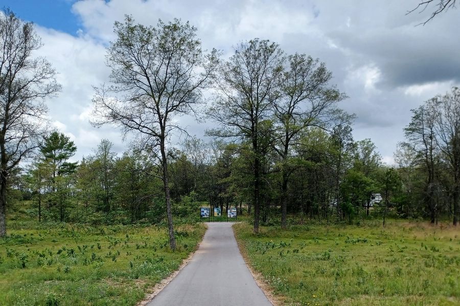
This marker is the one on the left.
Credits. This page was last revised on July 27, 2024. It was originally submitted on July 9, 2024, by Joel Seewald of Madison Heights, Michigan. This page has been viewed 158 times since then and 16 times this year. Photos: 1, 2, 3, 4. submitted on July 9, 2024, by Joel Seewald of Madison Heights, Michigan.
