Moraine Hills State Park near McHenry in McHenry County, Illinois — The American Midwest (Great Lakes)
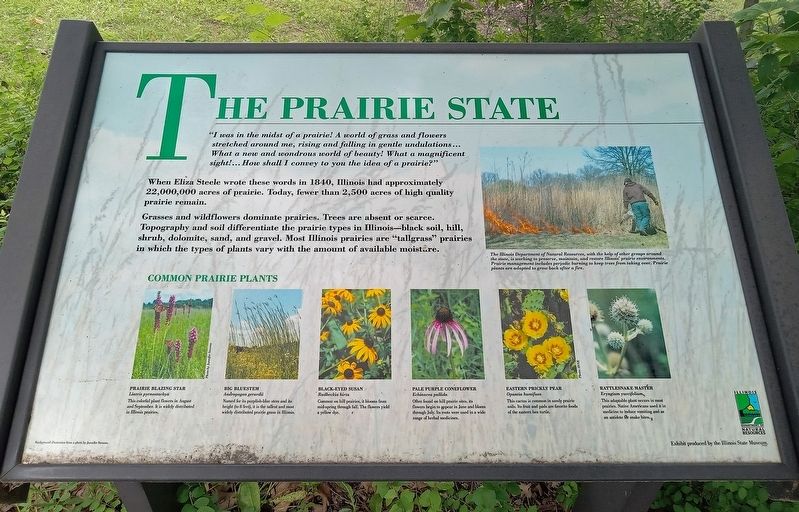
The Prairie State
Photographed by McGhiever, July 5, 2024
1. The Prairie State Marker
"I was in the midst of a prairie! A world of grass and flowers stretched around me, rising and falling in gentle undulations... What a new and wondrous world of beauty! What a magnificent sight!... How shall I convey to you the idea of a prairie?"
When Eliza Steele wrote these words in 1840, Illinois had approximately 22,000,000 acres of prairie. Today, fewer than 2,500 acres of high quality prairie remain.
Grasses and wildflowers dominate prairies. Trees are absent or scarce. Topography and soil differentiate the prairie types in Illinois—black soil, hill, shrub, dolomite, sand, and gravel. Most Illinois prairies are "tallgrass" prairies in which the types of plants vary with the amount of available moisture.
The Illinois Department of Natural Resources, with the help of other groups around the state, is working to preserve, maintain, and restore Illinois' prairie environments. Prairie management includes periodic burning to keep trees from taking over. Prairie plants are adapted to grow back after a fire.
Common Prairie Plants
Prairie Blazing Star
Liatris pycnostachya
This colorful plant flowers in August and September. It is widely distributed in Illinois prairies.
Big Bluestem
Andropogon gerardii
Named for its purplish-blue stem and its height (to 8 feet), it is the tallest and most widely distributed prairie grass in Illinois.
Black-Eyed Susan
Rudbeckia hirta
Common on hill prairies, it blooms from mid-spring through fall. The flowers yield a yellow dye.
Pale Purple Coneflower
Echinacea pallida
Often found on hill prairie sites, its flowers begin to appear in June and bloom through July. Its roots were used in a wide range of herbal medicines.
Eastern Prickly Pear
Opuntia humifusa
This cactus is common in sandy prairie soils. Its fruit and pads are favorite foods of the eastern box turtle.
Rattlesnake Master
Eryngium yuccifolium
This adaptable plant occurs in most prairies. Native Americans used it in medicine to induce vomiting and as an antidote for snake bites.
Exhibit produced by the Illinois State Museum.
Erected by Illinois
this page online
Topics. This historical marker is listed in this topic list: Environment. A significant historical year for this entry is 1840.
Location. 42° 19.29′ N, 88° 13.11′ W. Marker is near McHenry, Illinois, in McHenry County. It is in Moraine Hills State Park. It can be reached from the intersection of the Main Park road and a service road, on the left when traveling north. The marker is at the entrance to a parking area marked "Scenic Overlook". Touch for map. Marker is in this post office area: McHenry IL 60051, United States of America. Touch for directions.

Regionally, this marker is in Greater Chicago. It is also in the American Midwest. Globally, it is in North America, on the Great Lakes, in the Western Hemisphere, in the Western World, and in the Anglosphere. Historically, it finds itself in what was once the territory of the Mississippian Culture and also the Northwest Territory.
Other nearby markers. At least 8 other markers are within 6 miles of this marker, measured as the crow flies: Connected by Water (about 400 feet away, measured in a direct line); River of History (approx. 1.8 miles
Photographed by McGhiever, July 5, 2024
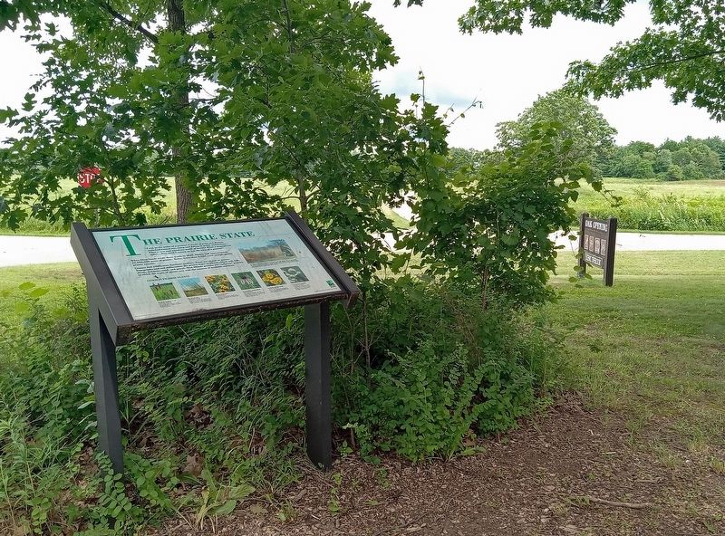
2. The Prairie State Marker at the Scenic Overlook pullout in Moraine Hills State Park
Credits. This page was last revised on July 9, 2024. It was originally submitted on July 9, 2024, by McGhiever of Minneapolis, Minnesota. This page has been viewed 189 times since then and 21 times this year. Photos: 1, 2. submitted on July 9, 2024, by McGhiever of Minneapolis, Minnesota.
