Bethel Springs in McNairy County, Tennessee — The American South (East South Central)
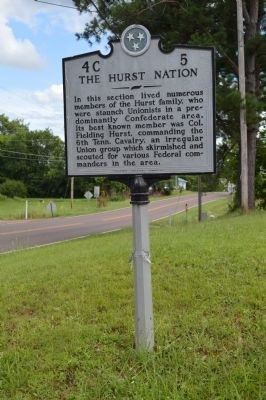
The Hurst Nation
Photographed by Phillip Knecht, June 27, 2015
1. The Hurst Nation Marker
Erected by Tennessee Historical Commission. (Marker Number 4C 5.)
Topics and series. This historical marker is listed in this topic list: War, US Civil. In addition, it is included in the Tennessee Historical Commission series list.
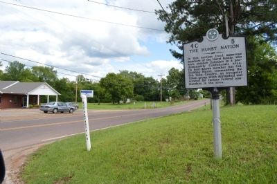
Location. 35° 13.949′ N, 88° 36.339′ W. Marker is in Bethel Springs, Tennessee, in McNairy County. It is at the intersection of Buena Vista Road and Main Street, on the right when traveling east on Buena Vista Road. This sign has been moved to the TN Department of Transportation property, South of the former location. Touch for map. Marker is in this post office area: Bethel Springs TN 38315, United States of America. Touch for directions.

Regionally, this marker is in West Tennessee. It is also in the American South, specifically in the Deep South, in the Upper South, and in the Black Belt. Globally, it is in North America, the Western Hemisphere, the Western World, and the Anglosphere. Historically, it finds itself in what was once the territory of the Mississippian Culture, one of the Confederate States of America, and the Antebellum South.
Other nearby markers. At least 8 other markers are within 5 miles of this marker, measured as the crow flies: Bethel Springs School (approx. 0.2 miles away); Elvis Presley Performs at Bethel Springs School (approx. ¼ mile away); The Trail of Tears (approx. 3.1 miles away); First Courthouse of McNairy County (approx. 3.4 miles away); Liberty Church (approx. 3.4 miles away);
this page online
Photographed by Phillip Knecht, June 27, 2015
2. The Hurst Nation Marker

Photographed by David Austin
3. The Hurst Nation Marker
Credits. This page was last revised on July 11, 2024. It was originally submitted on June 28, 2015, by Phillip Knecht of Holly Springs, Mississippi. This page has been viewed 1,896 times since then and 114 times this year. Last updated on July 10, 2024, by David Austin of Scotts Hill, Tennessee. Photos: 1, 2. submitted on June 28, 2015, by Phillip Knecht of Holly Springs, Mississippi. 3. submitted on July 10, 2024, by David Austin of Scotts Hill, Tennessee. • J. Makali Bruton was the editor who published this page.
