Near Hanging Rock in Hampshire County, West Virginia — The American South (Appalachia)
Ice Mountain
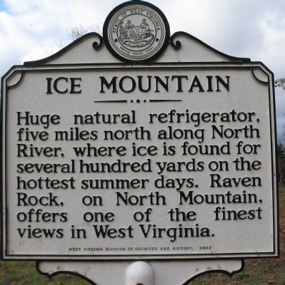
Photographed by Craig Swain, November 27, 2009
1. Ice Mountain Marker
Erected 2003 by West Virginia Division of Archives & History.
Topics and series. This historical marker is listed in this topic list: Natural Features. In addition, it is included in the West Virginia Archives and History series list.
Location. 39° 17.988′ N, 78° 36.213′ W. Marker is near Hanging Rock, West Virginia, in Hampshire County. It is at the intersection of U.S. 50 and State Highway 29, on the right when traveling west on U.S. 50. Touch for map. Marker is in this post office area: Augusta WV 26704, United States of America. Touch for directions.

Regionally, this marker is in the Eastern Panhandle. It is also in the American South, specifically in the Upper South, in Appalachia, and specifically in Northern Appalachia. Globally, it is in North America, the Western Hemisphere, the Western World, and the Anglosphere. Historically, it finds
this page online
Other nearby markers. At least 8 other markers are within 9 miles of this marker, measured as the crow flies: Blue's Gap Battle (approx. 3 miles away); Oriskany Sand (approx. 3.9 miles away); The Guns Of Jacob Sheetz (approx. 6.6 miles away); Mount Bethel Church (approx. 7.6 miles away); Grapeshot Among the Pines (approx. 8.4 miles away); Town of Romney (approx. 8.4 miles away); W. Va School for the Deaf and Blind (approx. 8½ miles away); Stonewall Jackson's Headquarters (approx. 8½ miles away).
Another marker is no longer nearby. Romney In The Civil War (was approx. 8.4 miles away but has been confirmed missing).
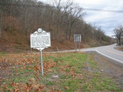
Photographed by Craig Swain, November 27, 2009
2. Ice Mountain Marker
Credits. This page was last revised on June 16, 2016. It was originally submitted on December 3, 2009, by Craig Swain of Leesburg, Virginia. This page has been viewed 1,627 times since then and 39 times this year. Photos: 1, 2. submitted on December 3, 2009, by Craig Swain of Leesburg, Virginia.
