Moraine Hills State Park near McHenry in McHenry County, Illinois — The American Midwest (Great Lakes)
River of History
Photographed by McGhiever, July 5, 2024
1. River of History Marker
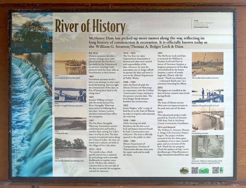
McHenry Dam has picked up more names along the way, reflecting its long history of construction and recreation. It is officially known today as the William G. Stratton/Thomas A. Bolger Lock & Dam.
1910
Boat leaving lock of the Fox River dam.
1910
Fox River Navigable Waterway Association.
1916
Working on the dam.
1918
The Fox River shoreline near McHenry Dam.
Pre 1816
Historic accounts describe a number of large stone slabs placed across the Fox River (probably by the Potatatomi) to aid river crossings. Early pioneers used the stone slabs as hearthstones in their homes.
1887
Steamboat operators build a dam in an attempt to raise water levels for boating. Farmers fight the construction of the dam, in fear of losing their land to the rising water.
1901
Senator William Lorimer aids the newly formed Fox River Navigable Waterway Association by lobbying for a new dam. Senator Lorimer was later removed from office for corruption.
1907
The Fox River Navigable Waterway Association secures a federal permit and builds a wooden dam, raising Fox Lake's water level by six feet. The dam created recreational
this page online
1912 – 1915
The wooden dam, which is quickly rotted out, is replaced by steel pilings with removable flashboards to regulate water levels. Workers also added a concrete lock to the east side of the dame to provide for navigation around the structure.
1919 – 1923
The Fox River & Lakes Improvement Association is formed and takes over control and responsibility of the dam. However, by 1923 the association can no longer afford to operated the dam and turns it over to the Illinois Department of Public Works.
1938 – 1939
After the flood of 1938, the Illinois Division of Waterways, in cooperation with the Civilian Conservation Corps, constructs the present concrete dam. The local Bolger family donates boulders for construction.
1953
James Hughes "sells" a strip of land for $1 to the State of Illinois in order to improve and maintain the waterway.
1958 – 1960
Public hearings are held. Residents decide that a new lock and bypass channel should be built. Construction costs $285,000. The lock is officially opened
Photographed by McGhiever, July 5, 2024
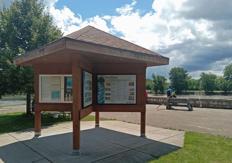
2. River of History Marker on a kiosk next to the dam
1982 – 1983
Illinois Department of Transportation, Division of Waterworks allocates $150,000 for repair work and to study the basin.
1991
The McHenry Lock and Dam is renamed the William G. Stratton Lock and Dam in honor of Governor Stratton, a longtime proponent of the dam. Overwhelmed by the honor, Stratton, a native of nearby Ingleside, Illinois, tells the crowd, "Thank you, thank you – a thousand thank yous" at a ceremony honoring his efforts.
2002
Floodgates are installed at the dam to better control water levels during floods.
2003
The State of Illinois invests $800,000 on improvements to the park area east of the dam.
2013
This educational project made possible by Friends of Moraine Hills State Park & McHenry County Community Foundation.
2014 and Beyond
The William G. Stratton/Thomas A. Bolger Life Extension Project begins. The project includes removal of the five sluice gates, installation of new water control gates, and an extension of the lock. Watch for our progress. Check for updates at http://www.dnr.illinois.gov/WaterResources/Pages/StrattonLockandDam.aspx
1939
The new dam is shown under construction.
1940
Folks from Chicago fishing off the lock wall.
1940
Friends fishing at the dam.
1991
Former Gov. William G. Stratton pushes control buttons to open the lock renamed in his honor.
Erected by The McHenry County Community Foundation.
Topics. This historical marker is listed in these topic lists: Charity & Public Work • Waterways & Vessels.
Location. 42° 18.545′ N, 88° 15.014′ W. Marker is near McHenry, Illinois, in McHenry County. It is in Moraine Hills State Park. It is on McHenry Dam Road south of S. River Road, on the right when traveling south. The marker is on a kiosk at the east end of the dam. Touch for map. Marker is in this post office area: McHenry IL 60051, United States of America. Touch for directions.

Regionally, this marker is in Greater Chicago. It is also in the American Midwest. Globally, it is in North America, on the Great Lakes, in the Western Hemisphere, in the Western World, and in the Anglosphere. Historically, it finds itself in what was once the territory of the Mississippian Culture and also the Northwest Territory.
Other nearby markers. At least 8 other markers are within 6 miles of this marker, measured as the crow flies: Connected by Water (approx. 1.8 miles away); The Prairie State (approx. 1.8 miles away); McHenry County’s First Courthouse (approx. 2.6 miles away); A Unique Park with a Unique History (approx. 5.4 miles away); A Showcase of Diversity (approx. 5.4 miles away); Downtown Crystal Lake (approx. 5.6 miles away); Veterans Memorial (approx. 5.7 miles away); El Tovar Theatre (approx. 5.8 miles away). Touch for a list and map of all markers in McHenry.
Credits. This page was last revised on July 11, 2024. It was originally submitted on July 11, 2024, by McGhiever of Minneapolis, Minnesota. This page has been viewed 404 times since then and 84 times this year. Photos: 1, 2. submitted on July 11, 2024, by McGhiever of Minneapolis, Minnesota.
