South Cumminsville in Cincinnati in Hamilton County, Ohio — The American Midwest (Great Lakes)
Sara Mayrant Walker Fossett
⎯⎯⎯
Peter Farley Fossett
Photographed by Grant & Mary Ann Fish, July 6, 2024
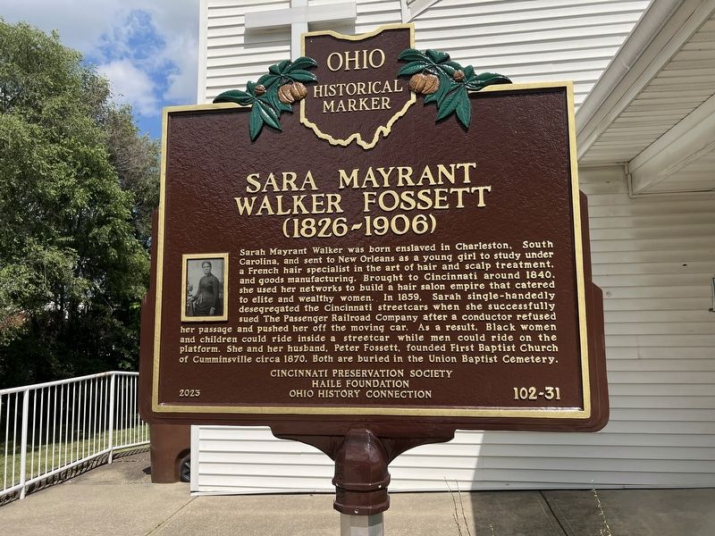
1. Sara Mayrant Walker Fossett Marker
Sarah Mayrant Walker Fossett (1826-1906). Sarah Mayrant Walker was born enslaved in Charleston, South Carolina, and sent to New Orleans as a young girl to study under a French hair specialist in the art of hair and scalp treatment, and goods manufacturing. Brought to Cincinnati around 1840, she used her networks to build a hair salon empire that catered to elite and wealthy women. In 1859, Sarah single-handedly desegregated the Cincinnati streetcars when she successfully sued The Passenger Railroad Company after a conductor refused her passage and pushed her off the moving car. As a result, Black women and children could ride inside a streetcar while men could ride on the platform. She and her husband, Peter Fossett, founded First Baptist Church of Cumminsville circa 1870. Both are buried in the Union Baptist Cemetery.
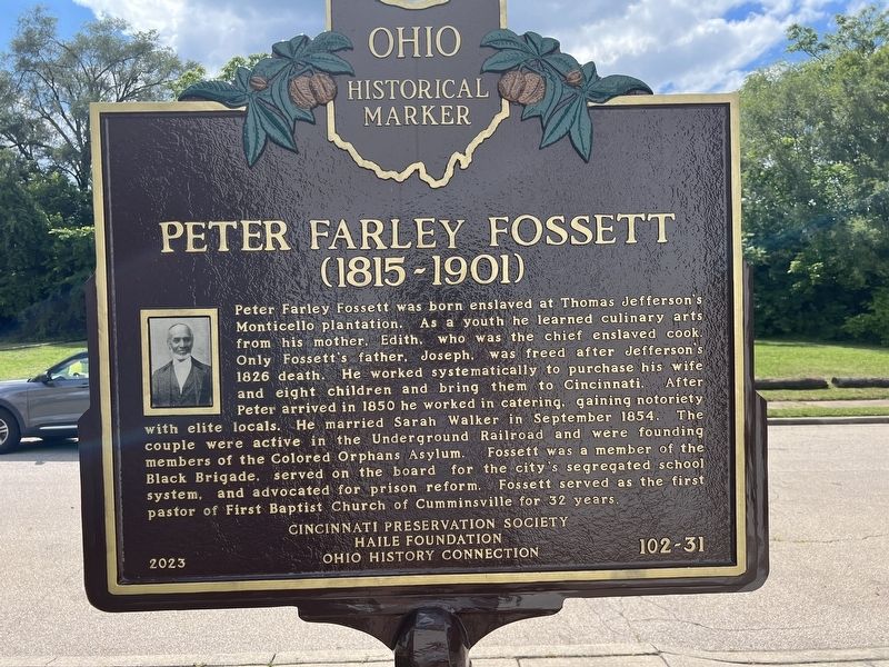
Peter Farley Fossett (1815-1901). Peter Farley Fossett was born enslaved at Thomas Jefferson’s Monticello plantation. As a youth he learned culinary arts from his mother, Edith, who was the chief enslaved cook. Only Fossett’s father, Joseph, was freed after Jefferson’s 1826 death. He worked systematically
this page online
Erected 2023 by Cincinnati Preservation Society, Haile Foundation and Ohio History Connection. (Marker Number 102-31.)
Topics and series. This historical marker is listed in these topic lists: Abolition & Underground RR • African Americans • Religion & Religious Structures. In addition, it is included in the Ohio Historical Society / The Ohio History Connection series list. A significant historical year for this entry is 1870.
Location. 39° 9.158′ N, 84° 32.79′ W. Marker is in Cincinnati, Ohio, in Hamilton County. It is in South Cumminsville. It is on Roll Avenue, on the left when traveling south.
Photographed by Grant & Mary Ann Fish, July 6, 2024
2. Peter Farley Fossett Marker

Regionally, this marker is in the American Midwest and in the Ohio River Valley. Globally, it is in North America, the Western Hemisphere, the Western World, and the Anglosphere. Historically, it finds itself in what was once the Haudenosaunee (Iroquois) Confederacy, the territory of the Mississippian Culture, and the Northwest Territory.
Other nearby markers. At least 8 other markers are within 2 miles of this marker, measured as the crow flies: Maj. Gen. Arthur St. Clair (approx. 0.6 miles away); Camp Washington World War Memorial (approx. 0.8 miles away); Ludlow's Station (approx. 0.8 miles away); Clifton Jewish Cemetery (approx. one mile away); Spring Grove Cemetery & Arboretum (approx. 1.3 miles away); The Probasco Fountain (approx. 1½ miles away); Spring Grove Cemetery (approx. 1½ miles away); Lloyd House (approx. 1.6 miles away). Touch for a list and map of all markers in Cincinnati.

Photographed by Grant & Mary Ann Fish, July 6, 2024
3. Sara Mayrant Walker Fossett / Peter Farley Fossett Marker with the church in the background
Credits. This page was last revised on July 18, 2025. It was originally submitted on July 11, 2024, by Grant & Mary Ann Fish of Galloway, Ohio. This page has been viewed 415 times since then and 73 times this year. Photos: 1, 2, 3. submitted on July 11, 2024, by Grant & Mary Ann Fish of Galloway, Ohio. • J. Makali Bruton was the editor who published this page.
