Clinton Township near Sidney in Shelby County, Ohio — The American Midwest (Great Lakes)
Big Rock
Photographed by Craig Doda, June 29, 2024
1. Big Rock Marker
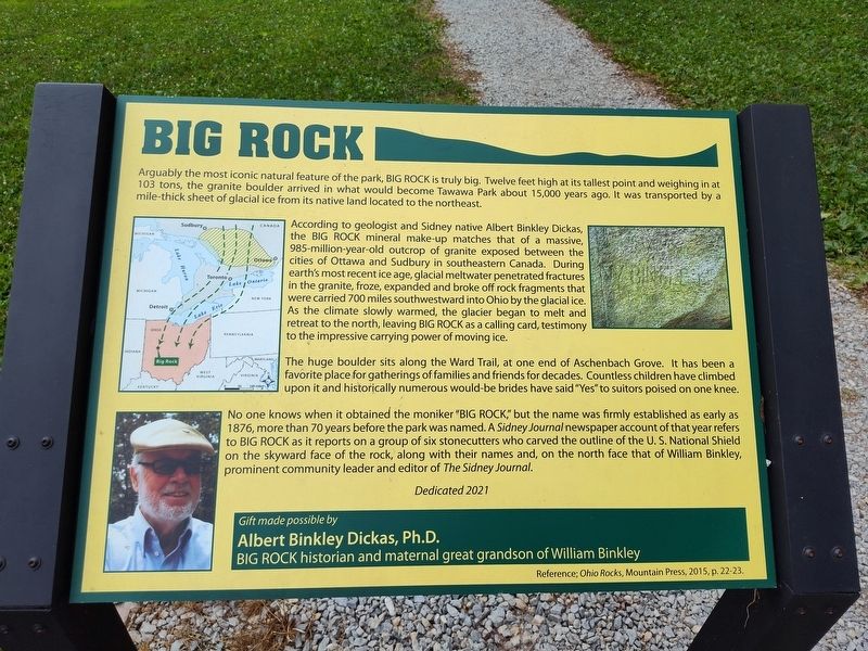
Arguably the most iconic natural feature of the park, Big Rock is truly big. Twelve feet high at its tallest point and weighing in at 103 tons, the granite boulder arrived in what would become Tawawa Park about 15,000 years ago. It was transported by a mile-thick sheet of glacial ice from its native land located to the northeast.
According to geologist and Sidney native Albert Binkley Dickas, the Big Rock mineral make-up matches that of a massive, 985-million-year-old outcrop of granite exposed between the cities of Ottawa and Sudbury in southeastern Canada. During earth's most recent ice age, glacial meltwater penetrated fractures in the granite, froze, expanded and broke off rock fragments that were carried 700 miles southwestward into Ohio by the glacial ice. As the climate slowly warmed, the glacier began to melt and retreat to the north, leaving Big Rock as a calling card, testimony to the impressive carrying power of moving ice.
The huge boulder sits along the Ward Trail, at one end of Aschenbach Grove. It has been a favorite place for gatherings of families and friends for decades. Countless children have
this page online
Gift made possible by
Albert Binkley Dickas, Ph.D.
Big Rock historian and maternal great grandson of William Binkley
Reference; Ohio Rocks, Mountain Press, 2015, p. 22-23.
Erected 2021 by Albert Binkley Dickas, Ph.D.
Topics. This historical marker is listed in this topic list: Parks & Recreational Areas. A significant historical year for this entry is 1876.
Location. 40° 17.266′ N, 84° 8.101′ W. Marker is near Sidney, Ohio, in Shelby County. It is in Clinton Township. It is on Tawawa Drive, on the right when traveling east. Touch for map.

Photographed by Craig Doda, June 29, 2024
2. Big Rock Marker

Regionally, this marker is in the Till Plains. It is also in the American Midwest and in the Corn Belt. Globally, it is in North America, the Western Hemisphere, the Western World, and the Anglosphere. Historically, it finds itself in what was once the Haudenosaunee (Iroquois) Confederacy, the territory of the Mississippian Culture, and the Northwest Territory.
Other nearby markers. At least 8 other markers are within walking distance of this marker: Ross Bridge (approx. 0.2 miles away); Swamp White Oak (Quercus bicolor) (approx. ¼ mile away); Zenas King Bowstring Bridge (approx. 0.4 miles away); Tawawawa Park 5k Path Start (approx. 0.4 miles away); Site of the First Football Game played in Sidney (approx. 0.4 miles away); Tawawa Park (approx. 0.4 miles away); Sidney (approx. half a mile away); North Street Bridge, State Route 47 (approx. ¾ mile away). Touch for a list and map of all markers in Sidney.

Photographed by Craig Doda, July 11, 2026
3. Big Rock Marker

Photographed by Craig Doda, July 11, 2026
4. Big Rock Marker
Credits. This page was last revised on July 30, 2026. It was originally submitted on July 12, 2024, by Craig Doda of Napoleon, Ohio. This page has been viewed 504 times since then and 123 times this year. Photos: 1, 2. submitted on July 12, 2024, by Craig Doda of Napoleon, Ohio. 3, 4. submitted on July 21, 2026, by Craig Doda of Napoleon, Ohio. • Devry Becker Jones was the editor who published this page.
