Watkins in Benton County, Iowa — The American Midwest (Upper Plains)
The Lincoln Highway
⎯⎯⎯
Youngville Cafe

Photographed by Mark Parker, June 25, 2024
1. The Lincoln Highway side of marker
The Lincoln Highway
The Lincoln Highway became the first transcontinental highway in the nation. It opened the way for motorists to explore the country from the coastline of New York City all the way to the shoreline of San Francisco.
Before the Lincoln Highway Association disbanded in the 1930's, the association ordered concrete markers honoring Abraham Lincoln. In 1928 Boy Scouts placed over 2,400 markers along the route. One of the original markers is on display at the Youngville Café.
In the 1920's there were national auto trails of which the Lincoln Highway was one. Iowa's portion of the Lincoln Highway is on or near Highway 30 with approximately 85 percent of the original highway still driveable, although portions are gravel.
The Glad Hand Club was formed in Belle Plaine, lowa in the mid 20's to serve the Lincoln Highway Tourist.
After construction began on the Lincoln Highway individuals and organizations built seedling miles to promote the highway and to garner government backed financial support. lowa's seedling mile is outside Cedar Rapids.
Youngville Cafe
Joseph Young built the Youngville Cafe on
this page online
Joe was a widower in his seventies when he built Youngville. Elizabeth continued to operate the café and service station for several years after her father had passed. Several operators followed until closing in 1967. The main reason for closing was parking was no longer permitted along Route 30. Youngville was a popular place for travelers and locals. In the 1930's it was the only open-all-night fuel stop between Cedar Rapids and Tama. It was also a rest stop for truck drivers and others who liked to play pinball and punch boards before the state put a stop to games of chance. The Cedar Rapids Gazette November 22, 1971
The Youngville Highway Association had three 1920s cabins

Photographed by Mark Parker, June 25, 2024
2. Youngville Cafe side of marker
The Youngvlle Restoration Project began as a Benton County Sesquicentennial project. The Youngville Highway History Association (YHHA) was organized in 1995 to preserve and restore the Youngville Café.
The Youngville Café re-opened serving lunches on Tuesdays and Thursdays from May through October. Homemade pies, bottle pop and friendly conversation continue to create a unique living history experience for visitors interested in learning about the Lincoln Highway and one of the few remaining rural filling station/ eateries in the state.
Topics. This historical marker is listed in these topic lists: Entertainment • Roads & Vehicles. A significant historical year for this entry is 1931.
Location. 41° 57.844′ N, 92° 1.52′ W. Marker is in Watkins, Iowa, in Benton County. It is on 73rd Street 0.3 miles east of U.S. 218, on the right when traveling east. The markers are along a frontage road north of U.S. 30. Touch for map. Marker is at or near this postal address: 2409 73rd St, Watkins IA 52354, United States
Photographed by Mark Parker, June 25, 2024
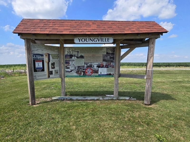
3. Entire Lincoln Highway / Youngville Cafe Marker

Regionally, this marker is in Eastern Iowa. It is also in the American Midwest and in the Corn Belt. Globally, it is in North America, the Western Hemisphere, the Western World, and the Anglosphere. Historically, it finds itself in what was once the territory of the Mississippian Culture and also the Louisiana Purchase.
Other nearby markers. At least 8 other markers are within 14 miles of this marker, measured as the crow flies: High Amana Saal (approx. 11.9 miles away); Shellsburg's Spandrel Bridge (approx. 12 miles away); The Freedom Rock of Benton County (approx. 12 miles away); All Gave Some... Some Gave All (approx. 12 miles away); Gold Medal Flour Mural (approx. 12 miles away); Site of the 35th World Plowing Matches (approx. 12.9 miles away); Lily Lake, Amana Colonies (approx. 13.2 miles away); Windmill House (approx. 13.7 miles away).
More about this marker. To access the markers and Youngville Cafe from U.S. 30, take exit 231. For westbound travelers, at U.S. 218, go straight across to the cafe driveway on the right. For eastbound travelers, turn right on U.S. 218. Go .2 miles
Photographed by Mark Parker, June 25, 2024
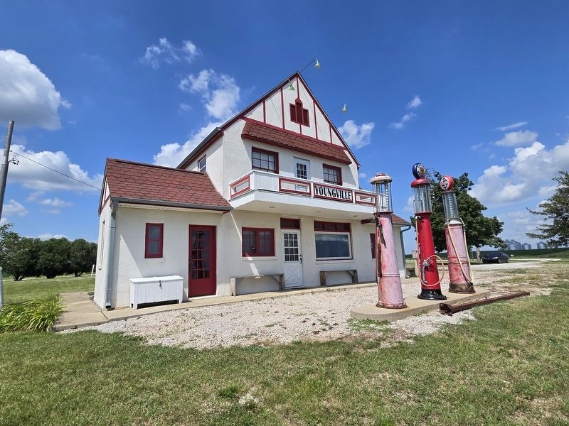
4. Youngville Cafe and filling station

Photographed by Mark Parker, June 25, 2024
5. Original Lincoln Highway Association concrete marker
Placed by the Boy Scouts in 1928.
Photographed by Mark Parker, June 25, 2024
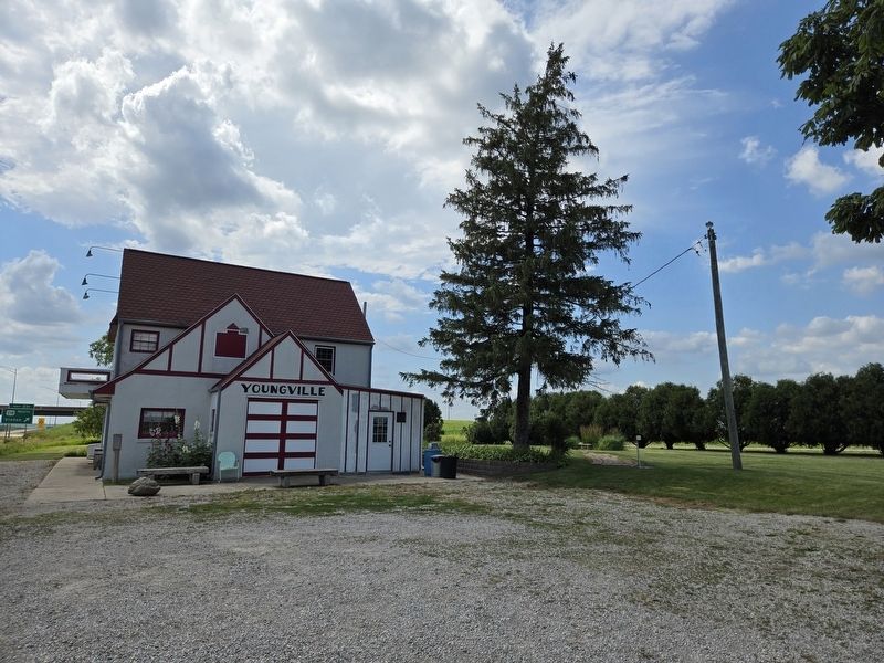
6. Youngville Cafe
U.S. Hwy 30 West to the left, frontage road (73rd Street) to the right
Credits. This page was last revised on July 15, 2024. It was originally submitted on July 13, 2024, by Mark Parker of Hickory, North Carolina. This page has been viewed 474 times since then and 100 times this year. Photos: 1, 2, 3, 4, 5, 6. submitted on July 13, 2024, by Mark Parker of Hickory, North Carolina. • J. Makali Bruton was the editor who published this page.
