
Nevada in Story County, Iowa — The American Midwest (Upper Plains)
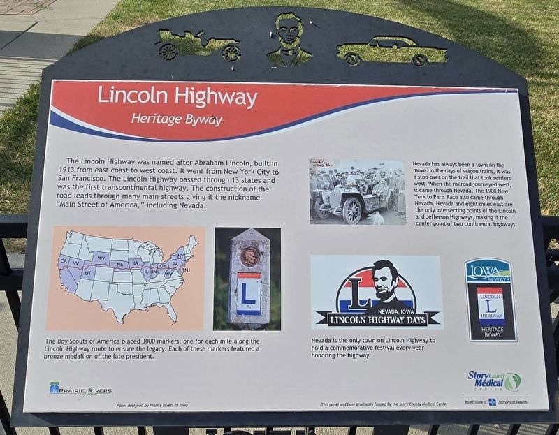
Lincoln Highway
Heritage Byway
Photographed by Mark Parker, June 25, 2024
1. Lincoln Highway Marker
The Lincoln Highway was named after Abraham Lincoln, built in 1913 from east coast to west coast. It went from New York City to San Francisco. The Lincoln Highway passed through 13 states and was the first transcontinental highway. The construction of the road leads through many main streets giving it the nickname "Main Street of America," including Nevada.
Captions
Bottom left: The Boy Scouts of America placed 3000 markers, one for each mile along the Lincoln Highway route to ensure the legacy. Each of these markers featured a bronze medallion of the late president.
Nevada has always been a town on the move. In the days of wagon trains, it was a stop-over on the trail that took settlers west. When the railroad journeyed west, it came through Nevada. The 1908 New York to Paris Race also came through Nevada. Nevada and eight miles east are the only intersecting points of the Lincoln and Jefferson Highways, making it the center point of two continental highways.
Nevada is the only town on Lincoln Highway to hold a commemorative festival every year honoring the highway.
Panel designed by Prairie Rivers of Iowa
Erected by Story
this page online
Topics. This historical marker is listed in this topic list: Roads & Vehicles. A significant historical year for this entry is 1913.
Location. 42° 1.369′ N, 93° 27.125′ W. Marker is in Nevada, Iowa, in Story County. It is at the intersection of West Lincoln Highway (Iowa Route 930) and 6th Street, on the right when traveling west on West Lincoln Highway. The marker is at Lincoln Jefferson Highways Heritage Park. Touch for map. Marker is at or near this postal address: 605 W Lincoln Hwy, Nevada IA 50201, United States of America. Touch for directions.

Regionally, this marker is in Greater Des Moines. It is also in the American Midwest and in the Corn Belt. Globally, it is in North America, the Western Hemisphere, the Western World, and the Anglosphere. Historically, it finds itself in what was once the territory of the Mississippian Culture and also the Louisiana Purchase.
Other nearby markers. At least 8 other markers are within 10 miles of this marker, measured as the crow flies: Jefferson Highway (a few steps from this marker); Maxwell Veterans Memorial (approx. 9.7 miles away); Maxwell Freedom Rock Veterans Memorial

Photographed by Mark Parker, June 25, 2024
2. Wide view of Lincoln Highway Marker
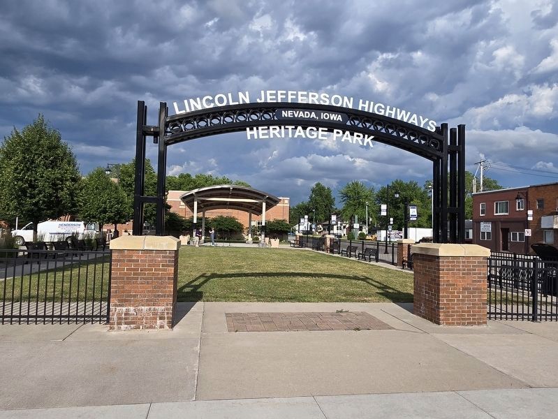
Looking towards stage area of Lincoln Jefferson Highways Heritage Park.
More about this marker. The marker is attached to a metal stand along the iron fence on the south side of the park.

Photographed by Mark Parker, June 25, 2024
3. Lincoln Highway Cement Marker
Photographed by Mark Parker, June 25, 2024
4. Lincoln Jefferson Highways Heritage Park entrance
The marker is around to the right, south-facing side of the fence.
Credits. This page was last revised on July 15, 2024. It was originally submitted on July 13, 2024, by Mark Parker of Hickory, North Carolina. This page has been viewed 383 times since then and 31 times this year. Photos: 1, 2, 3, 4. submitted on July 13, 2024, by Mark Parker of Hickory, North Carolina. • J. Makali Bruton was the editor who published this page.
