Near Juniata in Adams County, Nebraska — The American Midwest (Upper Plains)
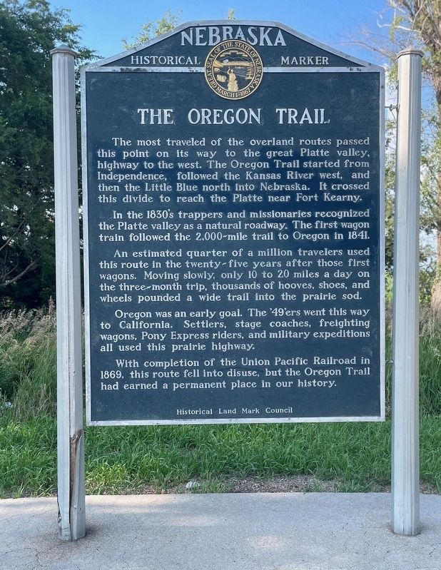
The Oregon Trail
Photographed by Mark Hilton, July 10, 2024
1. The Oregon Trail Marker
In the 1830’s trappers and missionaries recognized the Platte Valley as a natural roadway. The first wagon train followed the 2,000 mile trail to Oregon in 1841.
An estimated quarter of a million travelers used this route in the twenty-five years after those first wagons. Moving slowly, only 10 to 20 miles a day on the three-month trip, thousands of hooves, shoes, and wheels pounded a wide trail into the prairie sod.
Oregon was an early goal. The ‘49’ers went this way to California. Settlers, stage coaches, freighting wagons, Pony Express riders, and military expeditions all used this prairie highway.
With completion of the Union Pacific Railroad in 1869, this route fell into disuse, but the Oregon Trail had earned a permanent place in our history.
Erected by Historical Land Mark Council. (Marker Number 9.)
Topics and series.
this page online
Location. 40° 34.092′ N, 98° 33.558′ W. Marker is near Juniata, Nebraska, in Adams County. It is on Grand Army of the Republic Highway (U.S. 34) 0.3 miles west of South Roseland Avenue, on the right when traveling west. Located at a roadside pull-off. Touch for map. Marker is in this post office area: Juniata NE 68955, United States of America. Touch for directions.

Regionally, this marker is in the Smoky Hills and in Eastern Nebraska. It is also in the American Midwest, in the Corn Belt, and on the prairies. Globally, it is in North America, the Western Hemisphere, the Western World, and the Anglosphere. Historically, it finds itself in what was once the Louisiana Purchase.
Other nearby markers. At least 8 other markers are within 9 miles of this marker, measured as the crow flies: Pony Express (a few steps from this marker); Hastings Chautauqua Pavilion (approx. 7.8 miles
Photographed by Mark Hilton, July 10, 2024
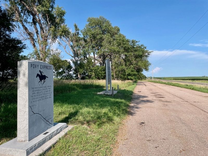
2. The Oregon Trail Marker looking east on U.S. 34.
Also see . . . The Oregon Trail in Adams County - Adams County Historical Society. (Submitted on July 14, 2024, by Mark Hilton of Montgomery, Alabama.)

Photographed by Mark Hilton, July 10, 2024
3. The Oregon Trail Marker
Credits. This page was last revised on July 14, 2024. It was originally submitted on July 14, 2024, by Mark Hilton of Montgomery, Alabama. This page has been viewed 892 times since then and 127 times this year. Photos: 1, 2, 3. submitted on July 14, 2024, by Mark Hilton of Montgomery, Alabama.
