Newport in Newport County, Rhode Island — The American Northeast (New England)
Rochambeau's Army in Rhode Island
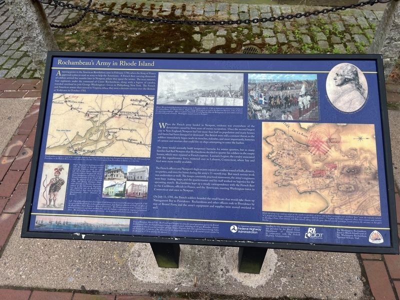
A turning point in the American Revolution came in February 1780, when the King of France approved a plan to send an army to help the Americans. A French fleet carrying thousands of soldiers arrived five months later in Newport, where they spent the winter. The next summer, four regiments under the command of Count Rochambeau, along with a legion of cavalry, traveled overland to join George Washington's forces in Philipsburg, New York. The French and American armies then moved to Virginia, where they won a decisive victory over the British at Yorktown in October 1781.
When the French army landed in Newport, evidence was everywhere of the devastation caused by three years of enemy occupation. Once the second largest city in New England, Newport had lost more than half its population and many houses and farms had been damaged or destroyed. The British were still a constant threat, so the soldiers immediately began work on trenches, redoubts, and most importantly, batteries of cannon and mortars that could fire on ships attempting to enter the harbor.
The army would normally build temporary barracks for winter quarters,
this page online
The French officers and Newport's high society enjoyed an endless round of balls, dinners, tea parties, and even fox hunts during the army's 11-month stay. But much serious work was undertaken as well. The troops constantly practiced maneuvers, the army's engineers were busy making maps, and the quartermaster and his staff worked on logistics for the upcoming march. Rochambeau kept up a steady correspondence with the French fleet in the Caribbean, officials in France, and the Americans, meeting Washington twice in Connecticut and once in Newport.
On July 11, 1781, the French soldiers boarded the small boats that would take them up Narragansett Bay to Providence. Rochambeau and other officers rode to Providence by way of Bristol Ferry, and the army's equipment and supplies were moved overland as well.
[Captions:]
French military engineer's map of the campaign, showing the army's transport by ship from Newport as a dotted line, the 1781 march from Providence to the Hudson River as a solid colored line, and the 1782 return march from Providence to Boston as a clear line.
Right: Many of the buildings associated with the French in Newport remain standing. Clockwise from the upper left: the Vernon House, Rochambeau's residence while in Newport; the Hunter House, headquarters of Charles Louis de Termay, commander of the French fleet, before his untimely death in December 1780, the Thomas Robinson House, where Viconte de Noailles, lieutenant-colonel of the Soissonnais Regiment, was quartered; and the Buliod-Perry House, said to have been occupied by Quartermaster Pierre Francois de Beville.
Left: One of the delegates from the Iroquois Confederacy who arrived in Newport on August 29, 1780 to confer with Rochambeau, as drawn by an eyewitness, Jean Baptiste-Antoine de Verger, an officer of the Royal Deux-Ponts Regiment (Brown University). The French entertained the emissaries with military maneuvers and mock artillery fire, and the Indians reciprocated by staging a ceremonial dance. The meeting had an important outcome: the Iroquois promised to remain neutral.
Above: The arrival of Rochambeau and his army in Newport, July 11, 1780, as depicted in a diorama on display at the Colony House, 127 Thames Street; Right: George Washington arrived in Newport on March 6, 1781, to discuss the upcoming campaign. After a reception aboard the French flagship, Duc de Bourgoyne, he came ashore and was greeted with great ceremony. Washington stayed a week in Newport.
While the army was making camp on the southern outskirts of town (the yellow rectangles and artillery "parc" near the redoubts labeled "6"), preparations began immediately to protect against a British attack. This plan by French engineers shows how cannon and mortars on Brenton's Point, Goat Island, and Rose Island, along with the grass aboard several warships, would protect the entrance to Newport.
View of Newport, March 1781. The French used Newport as a base for naval operations against the British. In February 1781, the French brought back ten captured vessels, including the 44-gun Romulus. Another expedition in March was less successful; off Cape Henry, Virginia, both sides suffered heavy damage before the French fleet withdrew. (The shipwreck in the foreground may be one of the several vessels scuttled by the British in 1779 to obstruct the channel.)
Erected by Federal
Photographed by Devry Becker Jones (CC0), July 10, 2024
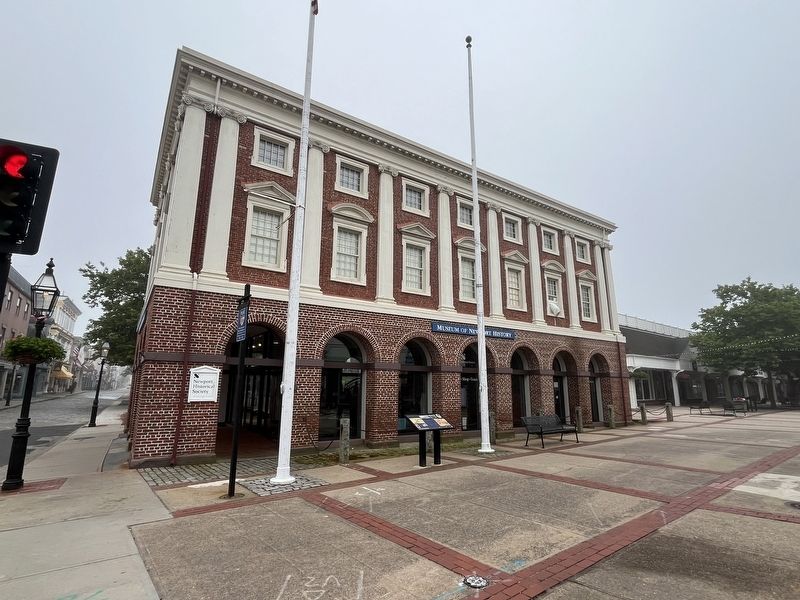
2. Rochambeau's Army in Rhode Island Marker in front of the Museum of Newport History
Topics. This historical marker is listed in these topic lists: War, US Revolutionary • Waterways & Vessels. A significant historical month for this entry is February 1780.
Location. 41° 29.399′ N, 71° 18.925′ W. Marker is in Newport, Rhode Island, in Newport County. It is at the intersection of Long Wharf Mall and Thames Street, on the left when traveling west on Long Wharf Mall. Touch for map. Marker is at or near this postal address: 127 Thames St, Newport RI 02840, United States of America. Touch for directions.

Regionally, this marker is on Rhode Island’s Narragansett Bay and in Newport and Aquidneck Island. It is also in the American Northeast, in New England, and on the Eastern Seaboard. Globally, it is in the North Atlantic Region, North America, the Western Hemisphere, the Western World, and the Anglosphere. Historically, it finds itself in what was once one of the original Thirteen Colonies.
Other nearby markers. At least 8 other markers are within walking distance of this marker: Buliod-Perry House (about 300 feet away, measured in a direct line); Perry (about 300 feet away); John Coddington House (about 400 feet away); Eisenhower Park (about 400 feet away); Jail House Inn (about 500 feet away); 79 Thames Street (about 500 feet away); Washington Square (about 500 feet away); Wilbour-Ellery House (about 500 feet away). Touch for a list and map of all markers in Newport.
Credits. This page was last revised on July 14, 2024. It was originally submitted on July 14, 2024, by Devry Becker Jones of Washington, District of Columbia. This page has been viewed 304 times since then and 36 times this year. Photos: 1, 2. submitted on July 14, 2024, by Devry Becker Jones of Washington, District of Columbia.
