Tiffany in Socorro County, New Mexico — The American Mountains (Southwest)
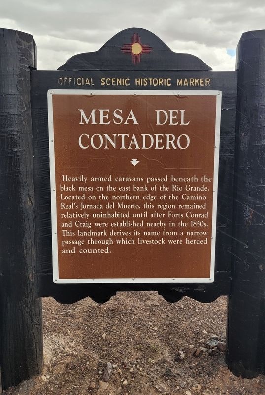
Mesa Del Contadero
Official Scenic Historic Marker
Photographed by James Hulse, June 24, 2024
1. Mesa Del Contadero Marker
Erected by New Mexico Historic Preservation Division.
Topics. This historical marker is listed in these topic lists: Animals • Roads & Vehicles.
Location. 33° 44.423′ N, 106° 58.003′ W. Marker is in Tiffany, New Mexico, in Socorro County. It is on Old US Highway 85 (State Highway 1) west of State Route 178, on the right when traveling west. The marker is located along the highway. Touch for map. Marker is in this post office area: San Antonio NM 87832, United States of America. Touch for directions.

Regionally, this marker is in Southwest New Mexico and in the Rio Grande Valley. It is also in the American Southwest. Globally, it is in North America, the Western Hemisphere, the Western World, and the Anglosphere. Historically, it finds itself in what was once New Spain and also the Republic of Texas.
Other nearby markers. At least 8 other markers are within 8 miles of this marker, measured as the crow flies: In Memory of Texas Mounted Volunteers (approx. 2.3 miles away); The Battle of Valverde (approx. 7.7 miles away); Canby and Sibley at Fort Craig (approx. 7.7 miles away); "New" Hospital (approx. 7.7 miles away); Officers' Quarters (approx. 7.7 miles away); The Buffalo Soldiers (approx. 7.7 miles away); Hospital Row (approx. 7.7 miles away); Guard House and Sally Port (approx. 7.7 miles away). Touch for a list and map of all markers in Tiffany.
Another marker
this page online
Also see . . . Mesa del Contadero. Wikipedia
Mesa del Contadero, sometimes called Black Mesa, also appeared on a 1773 Spanish map as Mesa de Senecú, is a basalt mesa that stands out on the east bank of the Rio Grande over three miles southwest of Val Verde in Socorro County, New Mexico. The mesa rises up dramatically from its lower surroundings in steep sides of 250 to 300 feet, particularly on the three sides where the river must pass around it to the west. It then levels off to a level area on top of an elevation of 4,810 feet (1,470 meters), with a high point summit called Mesa Peak at 4,916 feet on the northeast edge of the Mesa.(Submitted on July 14, 2024, by James Hulse of Medina, Texas.)
Photographed by James Hulse, June 24, 2024
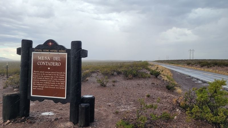
2. The view of the Mesa Del Contadero Marker along the street
Credits. This page was last revised on July 14, 2024. It was originally submitted on July 14, 2024, by James Hulse of Medina, Texas. This page has been viewed 381 times since then and 45 times this year. Photos: 1, 2. submitted on July 14, 2024, by James Hulse of Medina, Texas.
