Falls City in Richardson County, Nebraska — The American Midwest (Upper Plains)
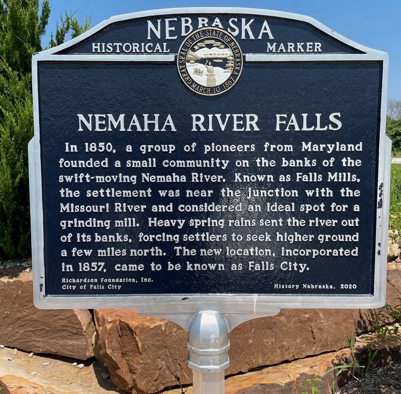
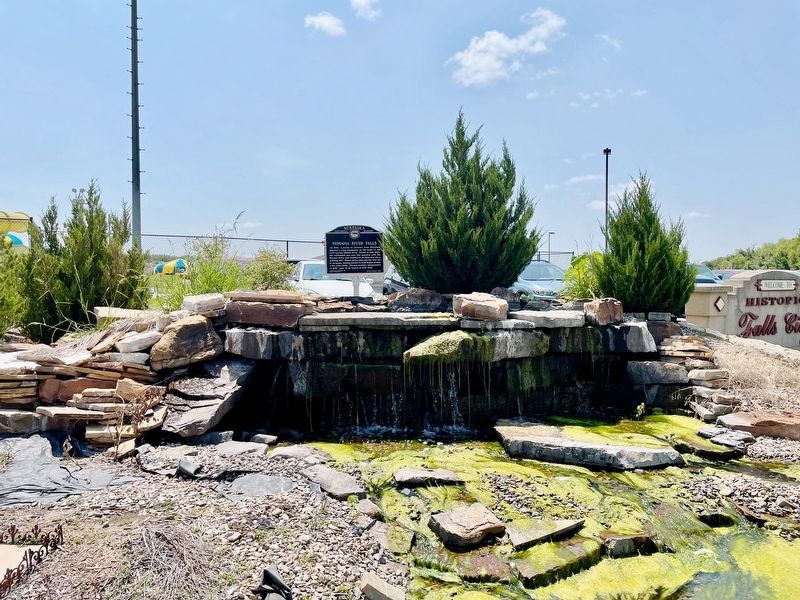
Nemaha River Falls
Photographed by Mark Hilton, July 11, 2024
1. Nemaha River Falls Marker
Erected 2020 by History Nebraska, Richardson Foundation, Inc., City of Falls City.
Topics and series. This historical marker is listed in these topic lists: Settlements & Settlers • Waterways & Vessels. In addition, it is included in the Nebraska State Historical Society series list. A significant historical year for this entry is 1850.
Location. 40° 4.518′ N, 95° 36.151′ W. Marker is in Falls City, Nebraska, in Richardson County. It can be reached from Bill Schock Boulevard 0.3 miles north of Harlan Street (U.S. 73), on the right when traveling north. Located on the east side of the Aquatic Center, near the stone parking lot. Touch for map. Marker is at or near this postal address: 3002
this page online

Regionally, this marker is in Eastern Nebraska. It is also in the American Midwest, in the Lewis & Clark Corridor, in the Corn Belt, and on the prairies. Globally, it is in North America, the Western Hemisphere, the Western World, and the Anglosphere. Historically, it finds itself in what was once the Louisiana Purchase.
Other nearby markers. At least 8 other markers are within 10 miles of this marker, measured as the crow flies: To the Pioneers of Richardson County (approx. 0.9 miles away); In Memory of Sgt. Nicholas Santo Nolte (approx. 0.9 miles away); Richardson County Veterans Memorial (approx. 0.9 miles away); The Dorrington House (approx. one mile away); First Oil Well (approx. 3.7 miles away); Missouri River (approx. 9½ miles away); Lewis and Clark Campsite (approx. 9½ miles away); Lewis and Clark (approx. 9½ miles away). Touch for a list and map of all markers in Falls City.
Photographed by Mark Hilton, July 11, 2024
2. Nemaha River Falls Marker
Photographed by Mark Hilton, July 11, 2024
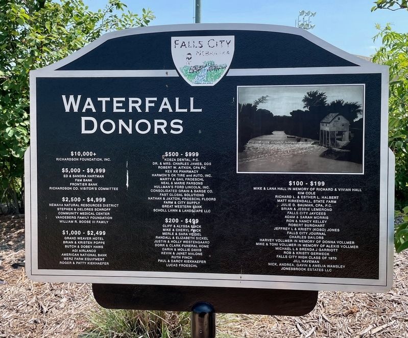
3. Marker showing donors for waterfalls.
Credits. This page was last revised on July 14, 2024. It was originally submitted on July 14, 2024, by Mark Hilton of Montgomery, Alabama. This page has been viewed 429 times since then and 50 times this year. Photos: 1, 2, 3. submitted on July 14, 2024, by Mark Hilton of Montgomery, Alabama.
