Cloudcroft in Otero County, New Mexico — The American Mountains (Southwest)
A Place of Plenty

Photographed by James Hulse, June 25, 2024
1. A Place of Plenty Marker
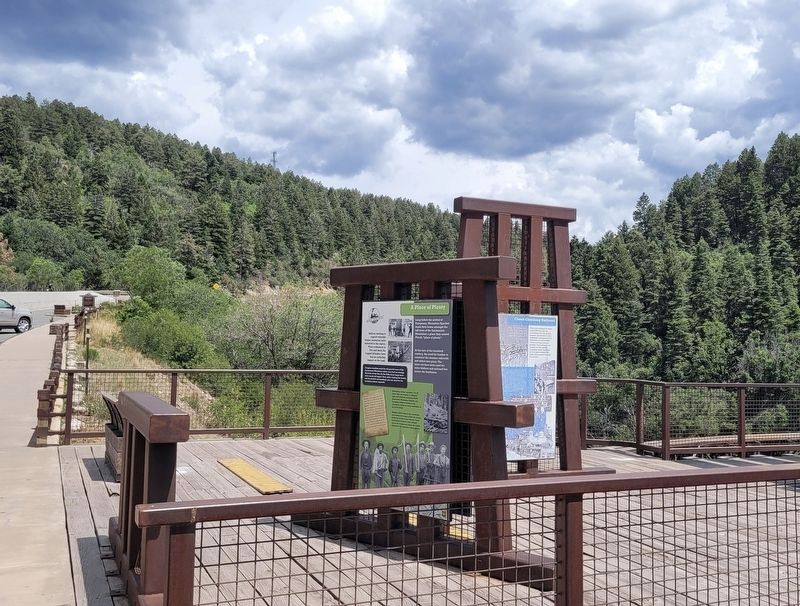
At the turn of the twentieth century, the need for lumber to construct the western railroads and mines was great. The trees cut here were used for mine timbers and railroad ties across the Southwest.
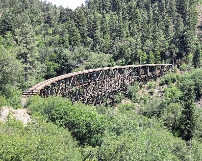
Settlers seeking to exploit valuable timber resources were attracted to the region. Their endeavors to live and work the rugged hillsides have had an enduring impact on the land. Imagine standing amid the old-growth trees of the Sacramento Mountains which once had an average diameter of two feet. By the 1940s these large trees were nearly all logged. Now, while visiting the trestle and its wooded surroundings you can observe the secondary forest regrowth.
Harvesting timber required a lot of labor. Men and women of different ages and ethnicity, including Native Americans, Mexicans, Chinese, and European settlers worked in the mountains, either as camp caretakers or out in the forest. Workers felled trees in the mountains and horses and mules pulled the timber down log chutes to the railroad. There log-loaders loaded it onto railroad cars to be transported down the A&SM Railroad to the sawmill in Alamogordo.
Captions
Images courtesy of Tularosa Basin HistoricalSociety
Erected by US Forest Service.
Topics. This historical marker is listed in these topic lists: Indigenous Peoples and Communities • Industry & Commerce.
Location. 32° 57.862′ N, 105° 44.897′ W. Marker is in Cloudcroft, New Mexico, in Otero County. It is on Route 82, on the right when traveling east. The marker is located at the parking lot of the Mexican Canyon Trestle. Touch for map. Marker is at
this page online

Regionally, this marker is in New Mexico’s Pecos Valley. It is also in the American Borderlands and in the Southwest. Globally, it is in North America, the Western Hemisphere, the Western World, and the Anglosphere. Historically, it finds itself in what was once New Spain, the Comanchería, and the Republic of Texas.
Other nearby markers. At least 8 other markers are within walking distance of this marker: Trabajando en las Nubes / Working in the Clouds (here, next to this marker); Cloud-Climbing Railroad (here, next to this marker); A Mountain Excursion (here, next to this marker); Historic Route of the Alamogordo & Sacramento Mountain Railroad (a few steps from this marker); Boarding the "Balley-Claire" (within shouting distance of this marker); Restoring a Local Treasure (within shouting distance of this marker); a different marker also named Cloud-Climbing Railroad (within shouting distance of this marker); Excursion Train (approx. half a mile away). Touch for a list and map of all markers in Cloudcroft.
Photographed by James Hulse, June 25, 2024
2. The view of the marker along the viewing platform for the trestle
Photographed by James Hulse, June 25, 2024
3. Mexican Canyon Trestle
Credits. This page was last revised on July 15, 2024. It was originally submitted on July 15, 2024, by James Hulse of Medina, Texas. This page has been viewed 327 times since then and 26 times this year. Photos: 1, 2, 3. submitted on July 15, 2024, by James Hulse of Medina, Texas.
