Near Clay in Jefferson County, Alabama — The American South (East South Central)
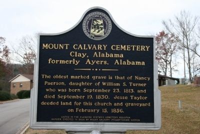
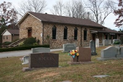
Mount Calvary Cemetery
Clay, Alabama
— formerly Ayers, Alabama —
Listed in the Alabama Historic Cemetery Register.
Erected 2006 by Alabama Historical Commission / Mount Calvary Presbyterian Church.
Topics and series. This historical marker is listed in these topic lists: Cemeteries & Burial Sites • Churches & Religion • Settlements & Settlers. In addition, it is included in the Alabama Historical Commission series list. A significant historical month for this entry is February 1808.
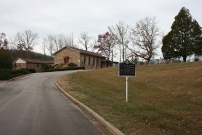
Location. 33° 44.1′ N, 86° 33.972′ W. Marker is near Clay, Alabama, in Jefferson County. Marker is on Cedar Mountain Road, on the right when traveling west. Touch for map. Marker is at or near this postal address: 9392 Cedar Mountain Road, Pinson AL 35126, United States of America. Touch for directions.
Other nearby markers. At least 8 other markers are within 8 miles of this marker, measured as the crow flies. The Cahaba Heart River of Alabama (approx. 1˝ miles away); Wear Cemetery (approx. 2.1 miles away); Clay Methodist Cemetery (approx. 3 miles away); The Clay Community (approx. 3.2 miles away); Pioneer Massey Cemetery (approx. 4.4 miles away); Town of Margaret (approx. 6.3 miles away); First Baptist Church Of Springville (approx. 6.4 miles away); Pinson, Alabama (approx. 7.3 miles away). Touch for a list and map of all markers in Clay.
Credits. This page was last revised on June 16, 2016. It was originally submitted on December 5, 2009, by Timothy Carr of Birmingham, Alabama. This page has been viewed 2,083 times since then and 33 times this year. Photos: 1, 2, 3, 4, 5. submitted on December 5, 2009, by Timothy Carr of Birmingham, Alabama. • Kevin W. was the editor who published this page.
