Near Amsterdam in Montgomery County, New York — The American Northeast (Mid-Atlantic)
Barge Canal
Schoharie Crossing
| — | State Historic Site | — |
Photographed by Steve Stoessel, July 14, 2024
1. Barge Canal Marker
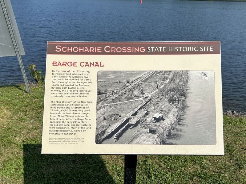
By the close of the 19 century, technology had advanced to a point where the Mohawk River itself could be modified for traffic. Both the original and Enlarged Erie Canals had avoided the Mohawk, but new dam-building, steel- making, and dredging techniques were now available to tame the previously uncontrollable river.
The "Erie Division" of the New York State Barge Canal System is still in operation and is comprised of 35 locks, each 300 feet long by 45 feet wide. Its boat channel ranges from 160 to 200 feet wide and is 14 feet deep. After the Barge Canal opened in the early 20 century, the old Erie Canal and its structures were abandoned. Much of the land was subsequently auctioned off into private ownership.
View of Mohawk Valley looking west. The Narge Canal/Mohawk River is on the right. On the lower left is the abandoned Enlarged Erie Canal and Yankee Hill Lock, Lock 28.
Topics. This historical marker is listed in this topic list: Waterways & Vessels.
Location. 42° 57.188′ N, 74° 14.337′ W. Marker is near Amsterdam, New York, in Montgomery County.
this page online

Regionally, this marker is in Upstate New York and in the Mohawk Valley. It is also in the American Northeast and in the Mid-Atlantic. Globally, it is in North America, the Western Hemisphere, the Western World, and the Anglosphere. Historically, it finds itself in what was once the Haudenosaunee (Iroquois) Confederacy, New Netherland, and one of the original Thirteen Colonies.
Other nearby markers. At least 8 other markers are within walking distance of this marker: Canal Culverts (here, next to this marker); The Last Improvements (within shouting distance of this marker); Two Problems Solved (within shouting distance of this marker); Putman's Lock Grocery (about 300 feet away, measured in a direct line); Lock 28 - Yankee Hill Lock (about 300 feet away); Schoharie Crossing (about 300 feet away); Fort Johnson, 1749 (approx. 0.3 miles away); a different marker also named Fort Johnson (approx.
Photographed by Steve Stoessel, July 14, 2024
2. Barge Canal Marker
Also see . . . Erie Canal (Wikipedia). (Submitted on July 16, 2024, by Steve Stoessel of Niskayuna, New York.)
Credits. This page was last revised on July 16, 2024. It was originally submitted on July 15, 2024, by Steve Stoessel of Niskayuna, New York. This page has been viewed 178 times since then and 18 times this year. Photos: 1, 2. submitted on July 15, 2024, by Steve Stoessel of Niskayuna, New York.
