Fort Hunter in Montgomery County, New York — The American Northeast (Mid-Atlantic)
The Aqueduct/History of Lock 28 and 29/The Visitors Center
Photographed by Steve Stoessel, July 14, 2024
1. The Aqueduct
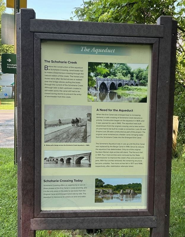
The Schoharie Creek
Before the construction of the aqueduct at Schohane Crossing, canal boats had to make a treacherous crossing through the natural waters of the creek. The horses and mules were often ferried across or walked over the bridge above, pulling the boats through the current of the Schoharie Creek Although later a dam upstream created a still-water pond, the canal still had to be closed during storms to prevent the entry of stormwater from the creek.
[photo caption:] Mules pull a barge across the Svhoharie Creek c. 1885
A Need for the Aqueduct
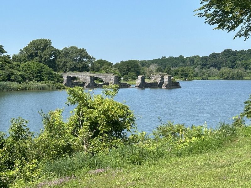
When the Erie Canal was enlarged due to increasing demand, a safe crossing at Schoharie Creek became a priority. Construction began on the aqueduct in 1839, and it was opened for use in 1845. The aqueduct was built downstream from the original crossing, and a new section of canal had to be built to create a connection. Lock 30 and Empire Lock 29 were constructed as part of this project. The original canal remained as a feeder canal, bringing water from the Schoharie Creek into the Enlarged Erie Canal.
The Schoharie Aqueduct was in use up
this page online
Schoharie Crossing Today
Schoharie Crossing offers an opportunity to see all three phases of the Erie Canal in close proximity, and it is the only place in the state to see locks from the Original Canal and Enlarged Canal side by side. The aqueduct is impressive to visitors on land and water.
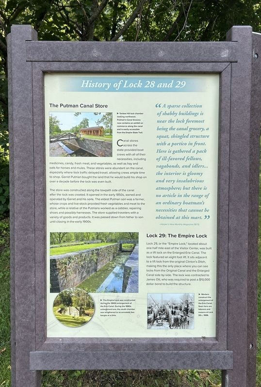
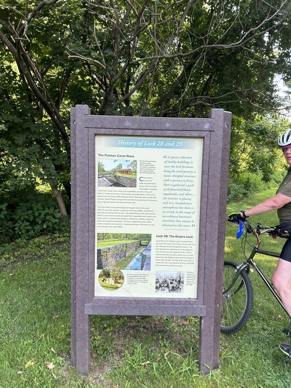
The Putman Canal Store
Canal stores across the state provided boat crews with all of their necessities, including medicines, candy, fresh meat and vegetables, as well as hay and oats for horses and mules. These stores were abundant on the canal. especially where lock traffic delayed travel, allowing crews ample time to shop. Garret Putman bought the
Photographed by Steve Stoessel, July 14, 2024
2. History of Lock 28 and 29
The store was constructed along the towpath side of the canal after the lock was created opened in the early 1850s, owned and operated by Garret and his sons. The oldest Putman son was a farmer whose crops and live-stock provided fresh vegetables and meat to the store, while a relative of the Putmans worked as a cobbler, repairing shoes and possibly harnesses. The store supplied travelers with a variety of goods and products. It was passed down from father to son until closing in the early 1900s.
"A sparse collection of shabby buildings is near the lock foremost being the canal grocery, a squat, shingled structure with a portico in front. Here is gathered a pack of ill-favored fellows, vagabonds, and idlers... the interior is gloomy and very insalubrious atmosphere; but there is no article in the range of an ordinary boatman's necessities that cannot be obtained at this mart. " - Harper's New Monthly Magazine (1873)
Lock 29: The Empire Lock
Lock 29, or the "Empire Lock” located about one half mile east of the Visitor Center, was built as a lift
Photographed by Steve Stoessel, July 14, 2024
3. The Visitors Center
[Photo captions;]
- Yankee Hill lock chamber looking northwest. Putman's Canal Grocery now contains an exhibit on commerce along the canal and is easily accessible from the Empire State Trail.
- The Empire Lock was constructed during the 1840s enlargement of the Erie Canal. Durina the 1880s enlargement era, the south chamber was lengthened to accommodate two barges at a time.
- Workers construct the enlargement of the trie canal. Seen here are laborers and masons at Lock 28 c. 1888.
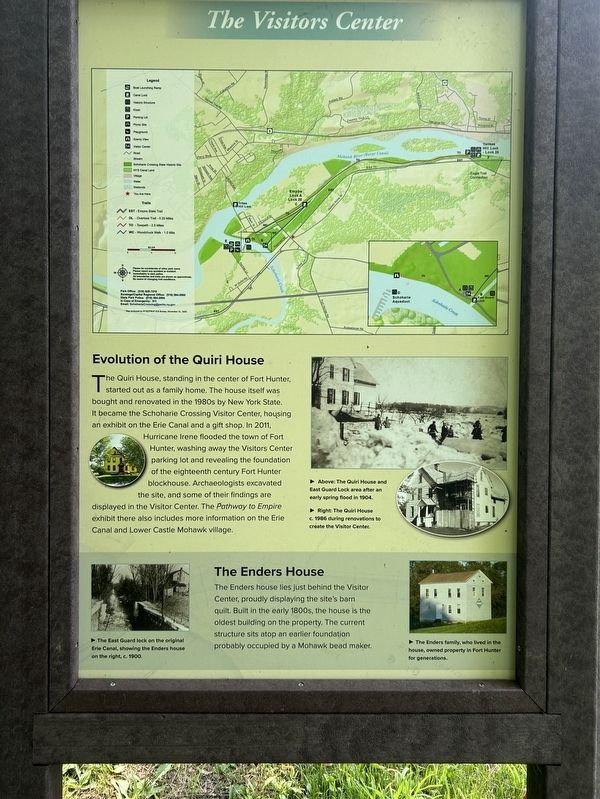
Evolution of the Quiri House
The Quiri House standing in the center of Fort Hunter, started out as a family home. The house itself was bought and renovated in the 1980s by New York State. It became the Schoharie Crossing Visitor Center, housing an exhibit on the Erie Canal
Photographed by Steve Stoessel, July 14, 2024
4. The Aqueduct/History of Lock 28 and 29/The Visitors Center Marker
The Enders House
The Enders house lies just behind the Visitor Center, proudly displaying the site's barn quilt. Built in the early 1800s, the house is the oldest building on the property. The current structure sits atop an earlier foundation probably occupied by a Mohawk bead maker.
[Photo captions:]
- Above: The Quiri House and East Guard Lock area after an early spring flood in 1904.
- Right: The Quiri House c. 1986 during renovations to create the Visitor Center.
- The East Guard lock on the original Erie Canal, showing the Enders house on the right, c. 1900.
- The Enders family, who lived in the house, owned property in Fort Hunter for generations.
Topics. This historical marker is listed in this topic
Photographed by Steve Stoessel, July 14, 2024
5. The Aqueduct/History of Lock 28 and 29/The Visitors Center Marker
Location. 42° 56.446′ N, 74° 16.605′ W. Marker is in Fort Hunter, New York, in Montgomery County. It is at the intersection of Empire State Trail and Main Street (County Route 27), on the right when traveling west on Empire State Trail. Touch for map. Marker is in this post office area: Amsterdam NY 12010, United States of America. Touch for directions.

Regionally, this marker is in Upstate New York and in the Mohawk Valley. It is also in the American Northeast and in the Mid-Atlantic. Globally, it is in North America, the Western Hemisphere, the Western World, and the Anglosphere. Historically, it finds itself in what was once the Haudenosaunee (Iroquois) Confederacy, New Netherland, and one of the original Thirteen Colonies.
Other nearby markers. At least 8 other markers are within walking distance of this marker: Gesundheit! (approx. ¼ mile away); A Mohawk House Unearthed (approx. ¼ mile away); East Guard Lock (approx. ¼ mile away); Original Erie Canal (approx. ¼ mile away); Site of Old Fort Hunter (approx. ¼ mile away); Site of Last Mohawk Indian Village
Photographed by Steve Stoessel, July 14, 2024
6. The Aqueduct
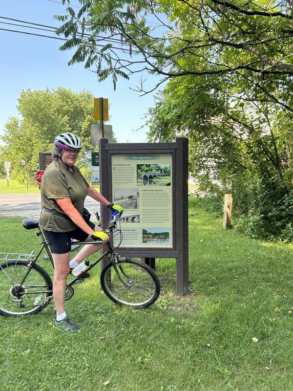
More about this marker. This is a three-sided marker. It is located where the bike trail first enters Fort Hunter from the east. It is several yards east of Main Street.
Also see . . .
1. Schoharie Crossing (Wikipedia). (Submitted on July 16, 2024, by Steve Stoessel of Niskayuna, New York.)
2. The Erie Canal (Wikipedia). (Submitted on July 16, 2024, by Steve Stoessel of Niskayuna, New York.)
Credits. This page was last revised on July 16, 2024. It was originally submitted on July 16, 2024, by Steve Stoessel of Niskayuna, New York. This page has been viewed 298 times since then and 55 times this year. Photos: 1, 2, 3, 4, 5, 6. submitted on July 16, 2024, by Steve Stoessel of Niskayuna, New York.
