
Logan in Logan County, West Virginia — The American South (Appalachia)
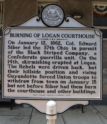
Burning of Logan Courthouse
Photographed by Dave W, July 13, 2024
1. Burning of Logan Courthouse Marker
On January 12, 1862, Col. Edward Siber led the 37th Ohio in pursuit of the Black Striped Company, a Confederate guerrilla unit. On the 14th, skirmishing erupted at Logan. The Rebels were driven back, but their hillside position and rising Guyandotte forced Union troops to withdraw from town on January 15 but not before Siber had them burn the courthouse and other buildings.
Erected 2016 by West Virginia Archives & History.
Topics. This historical marker is listed in this topic list: War, US Civil. A significant historical date for this entry is January 12, 1862.
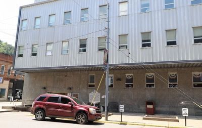
Location. 37° 50.812′ N, 81° 59.464′ W. Marker is in Logan, West Virginia, in Logan County. It is on Jefferson Street north of Main Street, on the left when traveling north. Touch for map. Marker is at or near this postal address: 112 Jefferson St, Logan WV 25601, United States of America. Touch for directions.

Regionally, this marker is in the Southern Coalfields. It is also in the American South, specifically in the Upper South, in Appalachia, and specifically in Southern Appalachia. Globally, it is in North America, the Western Hemisphere, the Western World,
this page online
Other nearby markers. At least 8 other markers are within 4 miles of this marker, measured as the crow flies: Princess Aracoma (a few steps from this marker); Logan (about 600 feet away, measured in a direct line); Mamie Thurman (approx. 2½ miles away); Chesapeake & Ohio 2755 Steam Locomotive (approx. 3.3 miles away); Chesapeake and Ohio Kanawha (approx. 3.3 miles away); The Courthouse Bell (approx. 3.3 miles away); Logan County Coal Miners Memorial (approx. 3.3 miles away); Tom "Rose" Tomblin (approx. 3.3 miles away). Touch for a list and map of all markers in Logan.
Photographed by Dave W, July 13, 2024
2. Burning of Logan Courthouse Marker
Credits. This page was last revised on July 17, 2024. It was originally submitted on July 16, 2024, by Dave W of Co, Colorado. This page has been viewed 365 times since then and 53 times this year. Photos: 1, 2. submitted on July 16, 2024, by Dave W of Co, Colorado. • Bernard Fisher was the editor who published this page.
