Valley Falls in Cumberland in Providence County, Rhode Island — The American Northeast (New England)
c 1820 - 1934
The Making of the Mill
pre-1800's
Prehistoric and historic Indian peoples, and English colonists, fished at Valley Falls leaving few traces.
1812 - 1820
Twin brothers Abraham and Isaac Wilkinson bought land and water rights on both sides of the river here, and built the first timber dam c1813. They sold some land to the Harris brothers -- William, Samuel, and Daniel -- who built a wooden cotton mill and probably a stone picker house by 1820.
1820 - 1837
The Wilkinsons built a second timber dam in 1828, higher than the first. The new dam flooded waterwheels of upriver mill owners, whose complaints forced a lowering of the Valley Falls dam in 1835. Crawford Allen, from another prominent Rhode Island family of mill operators, bought the Harris property in 1833. He rebuilt the Harris mill in stone and probably replaced the picker house before going bankrupt in 1837.
1839 - 1868
Oliver Chace, a Quaker industrialist, bought mill properties on both sides of the river in 1839 and leased them to his sons, Harvey and Samuel. They enlarged the mill in the 1840's, taking advantage of the 1847 construction of the Providence & Worcester Railroad.
this page online
1868 - 1912
The Chace brothers divided their holdings in 1868. Samuel Chace took over the property here, and quickly added two brick mills and waterpower improvements on the Cumberland side. His firm built bleach and dye works on the Central Falls side of the river.
1912 - 1934
Sayles Finishing Plants, one of America's largest textile finishing firms, bought the Valley Falls mills in 1912. During World War I, the mill made materials for explosives. After the war, many small textile firms rented space. Decline of the New England textile industry by the late 1920's led Sayles Finishing Plants to demolish the mill in 1934.
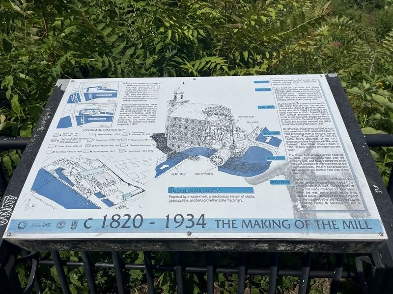
Maps A & B summarize the historical development of the mill complex at this park, beginning with the construction of the first timber dam west of Broad Street c1813. Before the present stone dam was built in 1853, there were three mills, one or two picker houses used to store and begin processing cotton, and several smaller storage buildings.
The stone dam required the Chaces to modify their raceway system, but allowed for an
The Allen Mill (1833)
Powered by a waterwheel, a mechanical system of shafts, gears, pulleys, and belts drove the textile machinery.
Erected by Blackstone Valley Tourism Council; Town of Cumberland, Rhode Island; Rhode Island Department of Environmental Management.
Topics and series. This historical marker is listed in these topic lists: Industry & Commerce • Waterways & Vessels. In addition, it is included in the Quakerism series list. A significant historical year for this entry is 1812.
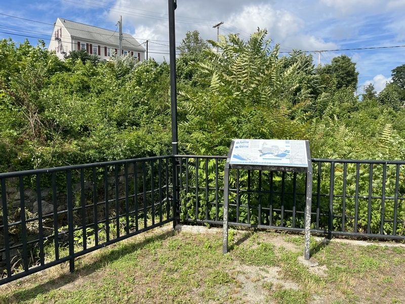
Location. 41° 53.998′ N, 71° 23.386′ W. Marker is in Cumberland, Rhode Island, in Providence County. It is in Valley Falls. It can be reached from the intersection of Broad Street (Rhode Island Route 114) and Meeting Street, on the right when traveling north. The marker stands on the grounds of Valley Falls Heritage Park. Touch for map. Marker is at or near this postal address: 17 Mill St, Cumberland RI 02864, United States of America. Touch for directions.

Regionally, this marker is in the Blackstone Valley and in Greater Providence. It is also in the American Northeast, in New England, and on the Eastern Seaboard. Globally, it is in the North Atlantic Region, North America, the Western Hemisphere, the Western World, and the Anglosphere. Historically, it finds itself in what was once one of the original Thirteen Colonies.
Other nearby markers. At least 8 other markers are within walking distance of this marker: A Bit About Arches (a few steps from this marker); Turbine Power (within shouting distance of this marker); Your Key to the Past / End of an Era (within shouting distance of this marker); Waterpower & Dams (within shouting distance of this marker); The Old Neighborhood (within shouting distance of this marker); Veterans Memorial (about 300 feet away, measured in a direct line); Sri Chinmoy Peace Bridge (about 300 feet away); a different marker also named Veterans Memorial (about 300 feet away). Touch for a list and map of all markers in Cumberland.
Credits. This page was last revised on October 8, 2026. It was originally submitted on July 17, 2024, by Devry Becker Jones of Washington, District of Columbia. This page has been viewed 267 times since then and 57 times this year. Last updated on October 7, 2026, by Carl Gordon Moore Jr. of North East, Maryland. Photos: 1, 2. submitted on July 17, 2024, by Devry Becker Jones of Washington, District of Columbia.
