
Franklin Park in Cook County, Illinois — The American Midwest (Great Lakes)
Connections!
Explore!

Photographed by Sean Flynn, July 17, 2024
1. Connections! Marker
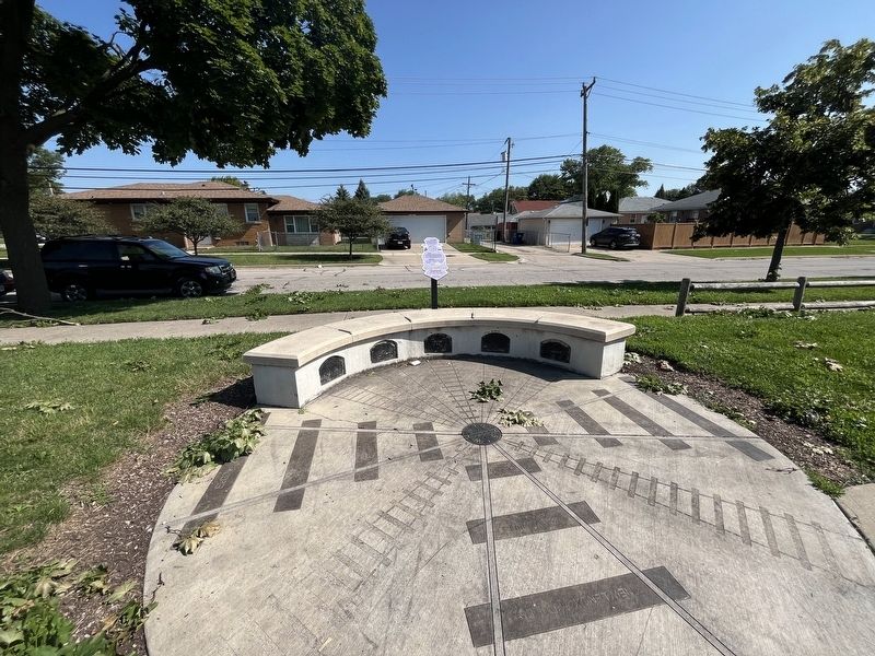
Coast to Coast
The world's First Transcontinental Railroad was built in the US! The rail line was built from 1863 to 1869 and connected Sacramento, California, to Omaha, Nebraska. While some parts of the original line were rerouted or abandoned, much of the line is currently used by Amtrak's California Zephyr!
Check out the map below!
Local Railroads
The Milwaukee District West Line has a long history. Construction began on July 10th, 1872 and was known at that time as the Chicago & Pacific Railraod. The rail line was built for both commuter and freight trains. In 1874, there were four round trips from Chicago to Elgin offered daily and a one way ticket only cost $1.25! Today there are over 20 trips from Chicago to Elgin! The train stops in Franklin Park, too! Most people call it the 'Metra.' Have you ever taken a ride on the Metra?
Erected 2014 by Park District of Franklin Park.
Topics. This historical marker is listed in these topic lists: Education • Parks & Recreational Areas • Railroads & Streetcars. A significant historical date for this entry is July 10, 1874.
Location. 41° 55.862′ N, 87° 52.691′ W. Marker is in Franklin Park, Illinois, in Cook County. It is on Chestnut Avenue east of Sarah Street, on the right when traveling east. The marker is on the northern edge of Chestnut Park. Touch for map. Marker is at or near this postal address: 10105 Chestnut Ave, Franklin Park IL 60131, United States of America. Touch for directions.

Regionally, this marker is in Greater Chicago. It is also in the American Midwest. Globally, it is in North America, on the Great Lakes, in the Western Hemisphere, in the Western World, and in the Anglosphere. Historically, it finds itself in what was once the Viceroyalty of New France, the territory of the Mississippian Culture, and the Northwest
this page online
Other nearby markers. At least 8 other markers are within walking distance of this marker: Music Evolution! (a few steps from this marker); Gone Wild! (a few steps from this marker); Leyden Township Veterans Memorial (approx. half a mile away); Gouin Park (approx. 0.6 miles away); M42A1 Dusters (approx. 0.6 miles away); B-12 Tower (approx. 0.6 miles away); Veterans Memorial (approx. 0.8 miles away); Joe Thomas, Sr. Park (approx. one mile away). Touch for a list and map of all markers in Franklin Park.
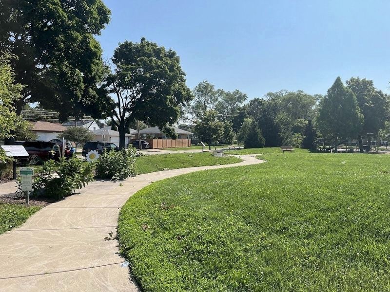
More about this marker. The marker is one of five educational markers erected around Chestnut Park, a small park a block north of Grand Avenue in Franklin Park.
Photographed by Sean Flynn, July 17, 2024
2. Connections! Marker
Photographed by Sean Flynn, July 17, 2024
3. Chestnut Park
A marker about music is on the left, this marker about railroads is near the middle, and a marker about trees is on the far right. Two other markers about art and physical fitness are off camera to the rear.

Photographed by Sean Flynn
4. Chestnut Park Map
This "map" of Chestnut Park shows the five educational markers found on the pathway around the park.
Credits. This page was last revised on July 18, 2024. It was originally submitted on July 18, 2024, by Sean P. Flynn of Oak Park, Illinois. This page has been viewed 118 times since then and 20 times this year. Photos: 1, 2, 3, 4. submitted on July 18, 2024, by Sean P. Flynn of Oak Park, Illinois.
