
Riverside in East Providence in Providence County, Rhode Island — The American Northeast (New England)
Pomham Rocks Lighthouse
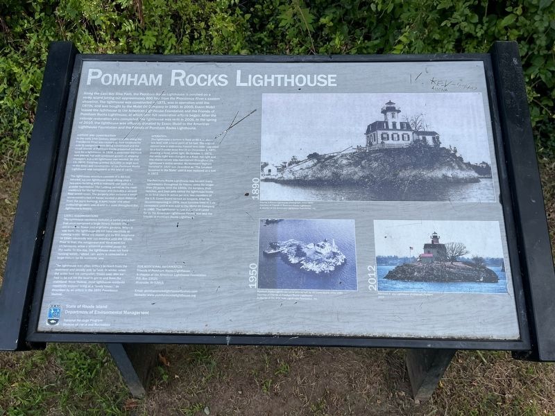
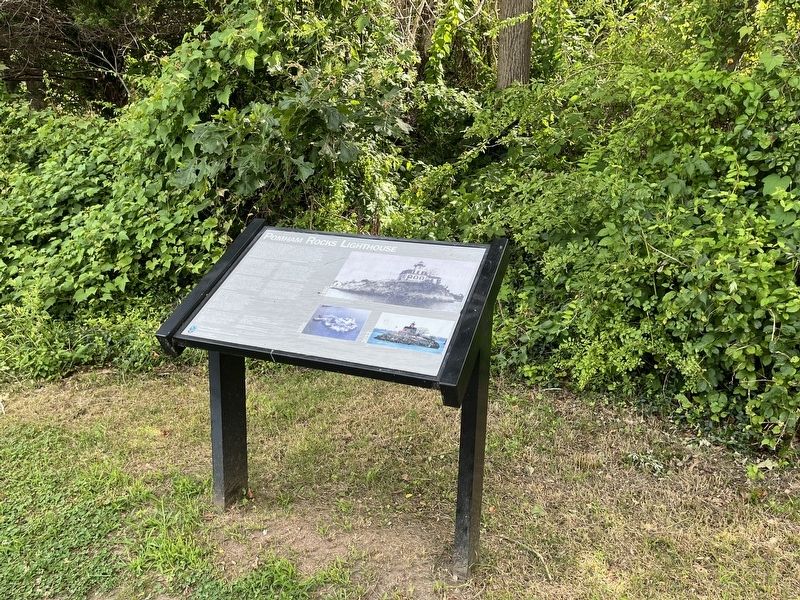
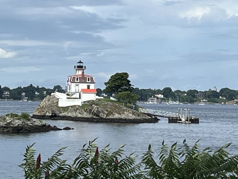
Along the East Bay Bike Path, the Pomham Rocks Lighthouse is perched on a rocky island jutting out approximately 800 feet from the Providence River's eastern shoreline. The lighthouse was constructed in 1871, was in operation until the 1970s, and was bought by the Mobile Oil Company in 1980. In 2005, Exxon Mobil lease the lighthouse to the American Lighthouse Foundation and the Friends of Pomham Rocks Lighthouse, at which time full restoration efforts began. After the exterior restoration was completed, the lighthouse was re-lit in 2006. In the spring of 2010, the lighthouse was officially donated by Exxon Mobil to the American Lighthouse Foundation and the Friends of Pomham Rocks Lighthouse.
History and Construction
In the early 19th Century, shipping traffic along the Providence River was increasing. New locations for aids to navigation were being established and the small islands of Pomham Rocks presented an ideal spot for a lighthouse. In 1828, a pyramidal daymark was placed, but with continued growth of shipping transport, a proper lighthouse was needed. On July 15, 1870, Congress granted $20,000 (a large sum
this page online
The lighthouse structure consists of a 40-foot, beveled, square lighthouse tower sitting atop a two-story building with a mansard roof built on a granite foundation. The building served as the main residence for the lightkeeper and includes a second floor watch room. The property also includes a small stone-constructed oil house located a short distance from the main building. A boat house and other outbuildings were added and removed throughout the lighthouses history.
Living Accommodations
The lighthouse residence includes a parlor and a hall that once contained a large library. Outside there are areas for flower and vegetable gardens. When it was built, the lighthouse did not have electricity or running water. While the station got its first telephone in 1940, electricity was not installed until the 1950s. Prior to that, the refrigerator and stove were run on kerosene, while a windmill provided power for the radio. To this day, the lighthouse does not have running water; instead, rain water is collected in a large cistern for its
The lighthouse was often difficult to reach from the mainland and usually only by boat. In winter, when the water had not completely frozen over, thin ice had to be cut for the boat to get to and from the mainland. Nevertheless, most lighthouse residents reportedly enjoyed living at a "lovely house," as described by an article in the 1891 Providence Journal.
Operation
The lighthouse's lantern is fixed at 69 feet above sea level with a focal point of 54 feet. The original lantern was a sixth-order Fresnel lens (later upgraded to a fourth-order lens) first lit on December 1, 1871, showing a fixed, white light. On October 1, 1872, the white light was changed to a fixed, red light and this characteristic was maintained throughout the lighthouse's active service. An incessant foghorn installed in 1900 was described as "The Greatest Nuisance in the State" until it was replaced by a bell in 1903.
The Pomham Rocks Lighthouse has housed many lightkeepers throughout its history, some for longer than 20 years. Until the 1950s, the keepers, their families, and their pets called the lighthouse home. In its final years in
Erected by State of Rhode Island Department of Environmental Management.
Topics and series. This historical marker is listed in these topic lists: Communications • Industry & Commerce • Waterways & Vessels. In addition, it is included in the Lighthouses, and the Windmills series lists. A significant historical date for this entry is July 15, 1870.
Location. 41° 46.691′ N, 71° 21.929′ W. Marker is in East Providence, Rhode Island, in Providence County. It is in Riverside. It is on East Bay Bike Path 0.3 miles north of Bullocks Point Avenue, on the right when traveling north. Touch for map. Marker is at or near this postal address: 31 Bullocks Point Ave, Riverside RI 02915, United States of America. Touch for directions.

Regionally, this marker is in Greater Providence and on Narragansett Bay. It is also in the American Northeast, in New England, and on the Eastern Seaboard. Globally, it is in the North Atlantic Region, North America, the Western Hemisphere, the Western World, and the Anglosphere. Historically, it finds itself in what was once one of the original Thirteen Colonies.
Other nearby markers. At least 8 other markers are within 2 miles of this marker, measured as the crow flies: The Bicknell-Armington "Lightning Splitter House" (approx. 0.2 miles away); Sowams (approx. half a mile away); World War II (approx. half a mile away); Roll of Honor (approx. 0.7 miles away); Little Neck Cemetery (approx. one mile away); Elizabeth Tilley Howland (approx. one mile away); Thomas Willett 1610-1674 (approx. one mile away); Crescent Park Looff Carousel (approx. 1½ miles away). Touch for a list and map of all markers in East Providence.
Credits. This page was last revised on July 18, 2024. It was originally submitted on July 18, 2024, by Devry Becker Jones of Washington, District of Columbia. This page has been viewed 196 times since then and 23 times this year. Photos: 1, 2, 3. submitted on July 18, 2024, by Devry Becker Jones of Washington, District of Columbia.
