
Statesboro in Bulloch County, Georgia — The American South (South Atlantic)
Dover & Statesboro Railroad
(D&S Railroad)
Photographed by Rodney J. Harville, May 17, 2024
1. Dover & Statesboro Railroad Marker
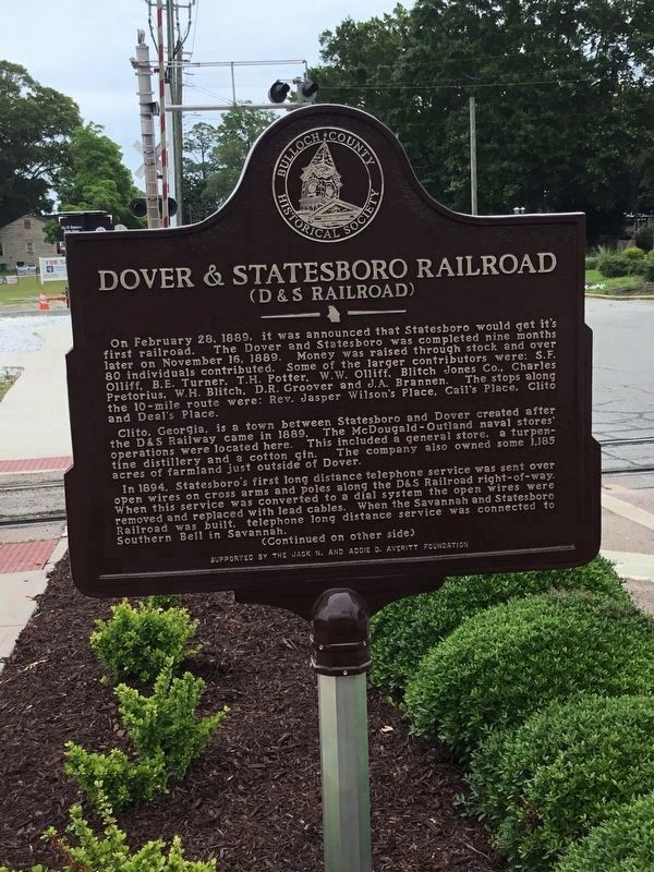
On February 28, 1889, it was announced that Statesboro would get it's first railroad. The Dover and Statesboro was completed nine months later on November 16, 1889. Money was raised through stock and over 80 individuals contributed. Some of the larger contributors were: S.F. Olliff, B.E. Turner, T.H. Potter, W.W. Olliff, Blitch Jones Co., Charles Pretorius, W.H. Blitch, D.R. Groover and J.A. Brannen. The stops along the 10-mile route were: Rev. Jasper Wilson's Place, Cail's Place, Clito and Deal's Place.
Clito, Georgia, is a town between Statesboro and Dover created after the D&S Railway came in 1889. The McDougald-Outland naval stores operations were located here. This included a general store, a turpentine distillery and a cotton gin. The company also owned some 1,185 acres of farmland just outside of Dover.
In 1894, Statesboro's first long distance telephone service was sent over open wires on cross arms and poles along the D&S Railroad right-of-way. When this service was converted to a dial system the open wires were removed and replaced with lead cables. When the Savannah and Statesboro Railroad was built,
this page online
(Continued on other side)
Reverse
(Continued from other side)
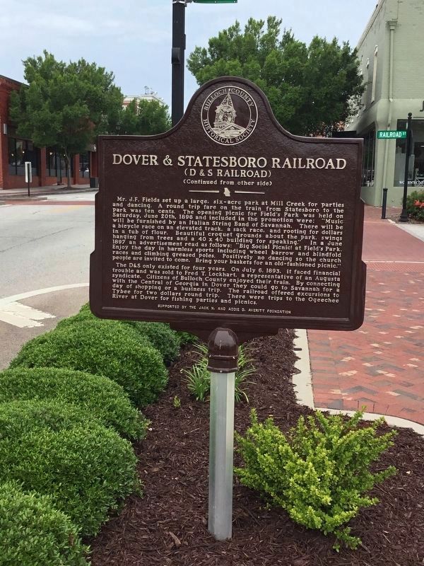
Mr. J.F. Fields set up a a large, six-acre park at Mill Creek for parties and dancing. A round trip fare on the train from Statesboro to the park was ten cents. The opening picnic for Field's Park was held on Saturday, June 20th, 1896 and included in the promotion were: "Music will be furnished by an Italian String Band of Savannah. There will be a bicycle race on an elevated track, a sack race, and rooting for dollars in a tub of flour. Beautiful croquet grounds about the park, swings hanging from trees and a 40 x 40 building for speaking." In a June 1897 an advertisement read as follows: "Big Social Picnic! at Field's Park. Enjoy the day in harmless sports including wheel barrow and blindfold races and climbing greased poles. Positively no dancing so church people are invited to come. Bring your baskets for an old-fashioned picnic."
The D&S only existed for four years. On July 6, 1893, it faced financial trouble and was sold to Fred T. Lockhart, a representative of an Augusta syndicate. Citizens
Photographed by Rodney J. Harville, May 17, 2024
2. Dover & Statesboro Railroad Marker Reverse
Erected by Bulloch County Historical Society, Supported by the Jack N. and Addie D. Averitt Foundation.
Topics. This historical marker is listed in these topic lists: Parks & Recreational Areas • Railroads & Streetcars. A significant historical date for this entry is February 28, 1889.
Location. 32° 26.929′ N, 81° 46.819′ W. Marker is in Statesboro, Georgia, in Bulloch County. It is at the intersection of East Main Street and Railroad Street, on the left when traveling east on East Main Street. Touch for map. Marker is in this post office area: Statesboro GA 30458, United States of America. Touch for directions.

Regionally, this marker is in Georgia’s Coastal Plain. It is also in the American South and specifically in the Deep South. Globally, it is in North America, the Western Hemisphere, the Western World, and the Anglosphere. Historically, it finds itself in what was once the territory of the Mississippian Culture, one of the original Thirteen Colonies, one of the Confederate States of America, and the Antebellum South.
Other nearby markers. At least 8 other markers are within walking distance of this marker: Statesboro, Georgia (within shouting distance of this marker); Willie McTell Trail (within shouting distance of this marker); Statesboro Vietnam Memorial (within shouting distance of this marker); Mathews Building (about 300 feet away, measured in a direct line); Jaeckel Hotel (about 400 feet away); “Flame of Freedom” (about 400 feet away); The Fabulous Fifty of 1906 / The Delegates (about 400 feet away); Preetorius Building (about 600 feet away). Touch for a list and map of all markers in Statesboro.
Credits. This page was last revised on July 21, 2024. It was originally submitted on July 18, 2024, by Rodney J. Harville of Statesboro, Georgia. This page has been viewed 301 times since then and 19 times this year. Photos: 1, 2. submitted on July 18, 2024. • Bernard Fisher was the editor who published this page.
