Burlington in Kit Carson County, Colorado — The American Mountains (Southwest)
The Open Range
Burlington Colorado
Photographed by Mark Hilton, July 2, 2024
1. The Open Range Marker
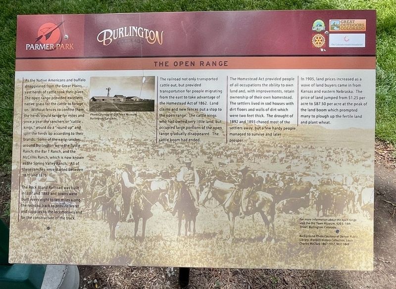
As the Native Americans and buffalo disappeared from the Great Plains, vast herds of cattle took their place. The open range provided excellent native grass for the cattle to forage on. Without fences to confine them, the herds would range for miles and once a year the ranchers or "cattle kings," would do a "round up" and split the herds up according to their brands. Some of the early ranches around Burlington were the Tuttle Ranch, the Bar T Ranch, and the McCrillis Ranch, which is now known as the Spring Valley Ranch. All of these ranches were started between 1870 and 1876.
The Rock Island Railroad was built in 1887 and 1888 and towns were). built every eight to ten miles along the railroad track to provide water and supplies to the locomotives and for the construction of the track.
The railroad not only transported cattle out, but provided transportation for people migrating from the east to take advantage of the Homestead Act of 1862. Land claims and new fences put a stop to the open range. The cattle kings who had owned very little land, but occupied large portions of the open range
this page online
The Homestead Act provided people of all occupations the ability to own land and, with improvements, retain ownership of their own homestead. The settlers lived in sod houses with dirt floors and walls of dirt which were two feet thick. The drought of 1892 and 1893 chased most of the settlers away, but a few hardy people managed to survive and later prosper.
In 1905, land prices increased as a wave of land buyers came in from Kansas and eastern Nebraska. The price of land jumped from $1.25 per acre to $87.50 per acre at the peak of the land boom which prompted many to plough up the fertile land and plant wheat.
Erected by City of Burlington, Burlington Rotary Club, Great Outdoors Colorado, Colorado Health Foundation.
Topics and series. This historical marker is listed in these topic lists: Agriculture • Animals • Railroads & Streetcars. In addition, it is included in the Rotary International series list. A significant historical year for this entry is 1870.
Location. 39° 17.729′ N, 102° 16.444′ W. Marker is in Burlington, Colorado, in Kit Carson County.

Photographed by Mark Hilton, July 2, 2024
2. The Open Range Marker

Regionally, this marker is in the Eastern Plains. It is also in the American Mountain West, on the Great Plains, and specifically on the High Plains. Globally, it is in North America, the Western Hemisphere, the Western World, and the Anglosphere. Historically, it finds itself in what was once the Comanchería, the Dust Bowl, and the Louisiana Purchase.
Other nearby markers. At least 8 other markers are within walking distance of this marker: The Early People (a few steps from this marker); What's In a Name (within shouting distance of this marker); Our Community Welcomes You (within shouting distance of this marker); The Dust Bowl Years (within shouting distance of this marker); As the Dust Settled (about 300 feet away, measured in a direct line); A Farming Revolution (about 400 feet away); Farm Equipment - Then and Now (about 500 feet away); What Lies Beneath (about 500 feet away). Touch for a list and map of all markers in Burlington.
Credits. This page was last revised on July 18, 2024. It was originally submitted on July 18, 2024, by Mark Hilton of Montgomery, Alabama. This page has been viewed 189 times since then and 28 times this year. Photos: 1, 2. submitted on July 18, 2024, by Mark Hilton of Montgomery, Alabama.
