Burlington in Kit Carson County, Colorado — The American Mountains (Southwest)
Farm Equipment - Then and Now
Burlington Colorado
Photographed by Mark Hilton, July 2, 2024
1. Farm Equipment - Then and Now Marker
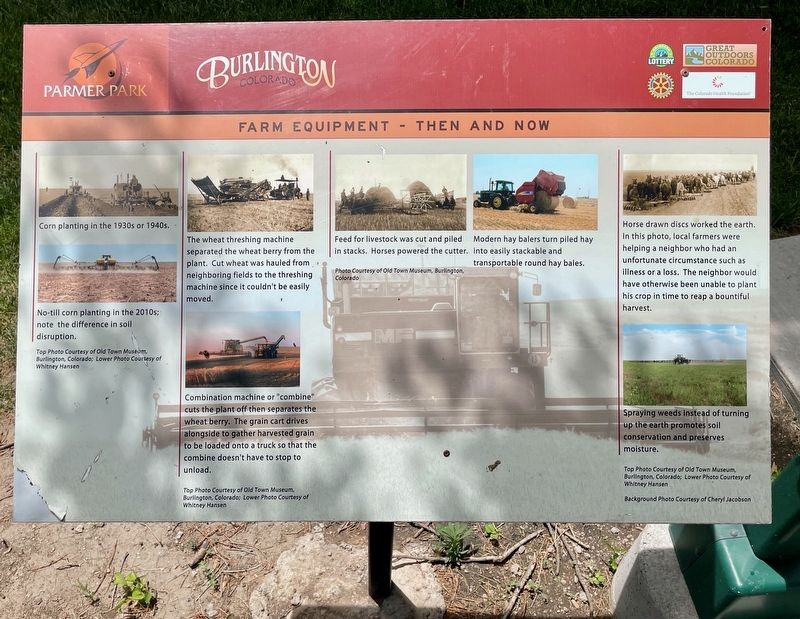
No-till corn planting in the 2010s; note the difference in soil disruption.
The wheat threshing machine separated the wheat berry from the plant. Cut wheat was hauled from neighboring fields to the threshing machine since it couldn't be easily moved.
Combination machine or "combine" cuts the plant off then separates the wheat berry. The grain cart drives alongside to gather harvested grain to be loaded onto a truck so that the combine doesn't have to stop to unload.
Feed for livestock was cut and piled in stacks. Horses powered the cutter.
Modern hay balers turn piled hay into easily stackable and transportable round hay bales.
Horse drawn discs worked the earth. In this photo, local farmers were helping a neighbor who had an unfortunate circumstance such as illness or a loss. The neighbor would have otherwise been unable to plant his crop in time to reap a bountiful harvest.
Spraying weeds instead of turning up the earth promotes soil conservation and preserves moisture.
Erected by City of Burlington, Burlington Rotary Club, Great Outdoors
this page online
Topics and series. This historical marker is listed in this topic list: Agriculture. In addition, it is included in the Rotary International series list.
Location. 39° 17.727′ N, 102° 16.552′ W. Marker is in Burlington, Colorado, in Kit Carson County. It is on Ben Street west of Judy Street, on the left when traveling west. Located in Parmer Park. Touch for map. Marker is in this post office area: Burlington CO 80807, United States of America. Touch for directions.

Regionally, this marker is in the Eastern Plains. It is also in the American Mountain West, on the Great Plains, and specifically on the High Plains. Globally, it is in North America, the Western Hemisphere, the Western World, and the Anglosphere. Historically, it finds itself in what was once the Comanchería, the Dust Bowl, and the Louisiana Purchase.
Other nearby markers. At least 8 other markers are within walking distance of this marker: What Lies Beneath (here, next to this marker); The Winds of Change (within shouting distance of this marker); A Farming Revolution

Photographed by Mark Hilton, July 2, 2024
2. Farm Equipment - Then and Now Marker (on left)
Credits. This page was last revised on July 19, 2024. It was originally submitted on July 18, 2024, by Mark Hilton of Montgomery, Alabama. This page has been viewed 125 times since then and 10 times this year. Photos: 1, 2. submitted on July 18, 2024, by Mark Hilton of Montgomery, Alabama.
