
Lock Haven in Clinton County, Pennsylvania — The American Northeast (Mid-Atlantic)
Bald Eagle Cross Cut Canal
Photographed by William Fischer, Jr., July 12, 2024
1. Bald Eagle Cross Cut Canal Marker
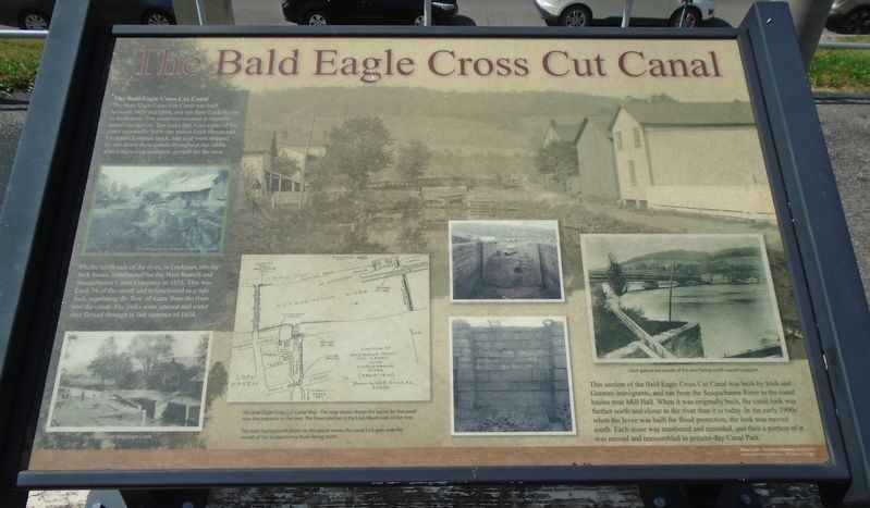
The Bald Eagle Cross Cut Canal
The Bald Eagle Cross Cut Canal was built between 1828 and 1834, and ran from Lock Haven to Bellefonte. The canal was created to improve inland navigation. The locks that were a part of the canal eventually led to the names Lock Haven and Lockport. Lumber, brick, and coal were shipped by raft down these canals throughout the 1800s which increased economic growth for the area.
On the north side of the river, in Lockport, sits the lock house, constructed for the West Branch and Susquehanna Canal Company in 1833. This was Lock 34 of the canal, and it functioned as a tide lock, regulating the flow of water from the river into the canal. The locks were opened and water first flowed through in late summer of 1834.
This section of the Bald Eagle Cross Cut Canal was built by Irish and German immigrants, and ran from the Susquehanna River to the canal basins near Mill Hall. When it was originally built, the canal lock was further north and closer to the river than it is today. In the early 1990s when the levee was built for flood protection, the lock was moved south. Each stone was numbered and
this page online
[Photo captions, clockwise from left center, read]
• The lock house on the north side of the river in Lockport.
• The main background photo on this panel shows the canal lock gate near the mouth of the Susquehanna River facing north.
• Lock gate at the mouth of the river facing north toward Lockport.
• The Bald Eagle Cross Cut Canal Map - The map above shows the layout for the canal near the entrance to the river. The lower portion is the Lock Haven side of the river.
• Lock gate near Bald Eagle Creek.
Topics. This historical marker is listed in these topic lists: Industry & Commerce • Settlements & Settlers • Waterways & Vessels. A significant historical year for this entry is 1828.
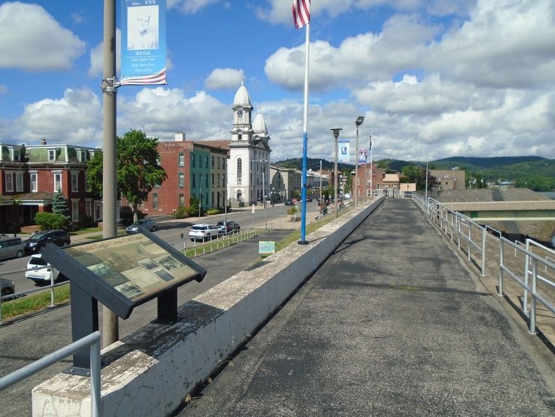
Location. 41° 8.283′ N, 77° 26.464′ W. Marker is in Lock Haven, Pennsylvania, in Clinton County. It is on Water Street east of Jay Street (Pennsylvania Route 664), on the left when traveling east. Marker is atop the levee, adjacent to the J. Doyle Corman Amphitheater. Touch for map. Marker is in this post office area: Lock Haven PA 17745, United States
Photographed by William Fischer, Jr., July 12, 2024
2. Bald Eagle Cross Cut Canal Marker

Regionally, this marker is in the Pennsylvania Wilds and in the Susquehanna Valley. It is also in the American Northeast, in the Mid-Atlantic, in Appalachia, and specifically in Northern Appalachia. Globally, it is in North America, the Western Hemisphere, the Western World, and the Anglosphere. Historically, it finds itself in what was once the Haudenosaunee (Iroquois) Confederacy and also one of the original Thirteen Colonies.
Other nearby markers. At least 8 other markers are within walking distance of this marker: Lock Haven (within shouting distance of this marker); The History of the Jay Street Bridges (within shouting distance of this marker); SOC David M. Collins (within shouting distance of this marker); The Susquehanna Greenway (within shouting distance of this marker); Discover Lock Haven (within shouting distance of this marker); Fort Reed Stockade (within shouting distance of this marker); Veterans Bridge (about 300 feet away, measured in a direct line); Lock Haven Flood Protection Project (about 300 feet away). Touch for a list and map of all markers in Lock Haven.
Credits. This page was last revised on July 19, 2024. It was originally submitted on July 19, 2024, by William Fischer, Jr. of Reynoldsburg, Ohio. This page has been viewed 545 times since then and 107 times this year. Photos: 1, 2. submitted on July 19, 2024, by William Fischer, Jr. of Reynoldsburg, Ohio.
