Altadena in Los Angeles County, California — The American West (Pacific Coastal)
The Old Mill
Photographed by Craig Baker, July 16, 2024
1. The Old Mill Marker
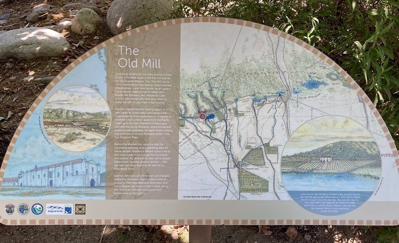
Look down El Molino ('the mill') Avenue in front of you. Five miles south is the first mill built for the San Gabriel Mission. The "Old Mill" (circa 1810) is among the San Gabriel Valley's earliest infrastructure — and now houses an art gallery. Local canyon water turned its wheel and flowed into Mission Lake. Altadena's Lake Avenue was named after this lake, which is today the site of Lacy Park in San Marino.
The San Gabriel Mission (built by Spain in 1771) was fueled by Indian labor and became the most powerful of all California's 21 missions. It covered a half a million acres from the Pacific coast up to the San Gabriel mountains and included the future Altadena, where horses and livestock were pastured. Its easternmost holding was a rancho of several thousand acres in the San Gorgonio Pass.
Before the Mission Era, canyons near the mountains were key acorn gathering sites for native people. Altadena's Millard Canyon led to their main trade route through the mountains and beyond. By land and by sea, native people traded food, baskets, jewelry, and tar — this last item has been found as far east as the Mississippi
this page online
Spanish, Mexican, and American rule changed Gabrielino life forever. Native trade routes and economy were degraded and destroyed, and native people lost much of their culture, along with their lives, through subjugation and exposure to foreign germs.
Lake Avenue was named for Mission Lake, pictured above. The Old Mill was on the hillside above it, and canyon waters flowed through it and into the lake. This mill was used for only a few years, and replaced by Chapman's Mill which had a superior design. Mission Lake was the San Gabriel Mission's main source of power and water.
Erected by County of Los Angeles, Amigos de los Rios, and Altadena Heritage.
Topics. This historical marker is listed in these topic lists: Indigenous Peoples and Communities • Industry & Commerce • Religion & Religious Structures. A significant historical year for this entry is 1810.
Location. 34° 11.388′ N, 118° 7.924′ W. Marker is in Altadena, California, in Los Angeles County. It is at the intersection of Altadena Drive and Lake Avenue, on the right when traveling east on Altadena Drive. Located in Altadena Triangle Park.

Photographed by Craig Baker, July 16, 2024
2. The Old Mill Marker

Regionally, this marker is in Greater Los Angeles and in the Transverse Ranges. It is also on the American Pacific Coast. Globally, it is in North America, on the Ring of Fire, on the Pacific Rim, in the Western Hemisphere, in the Western World, and in the Anglosphere. Historically, it finds itself in what was once New Spain and also Mexico’s Alta California.
Other nearby markers. At least 8 other markers are within walking distance of this marker: Owen Brown, Abolitionist (here, next to this marker); Altadena Founders Tree (a few steps from this marker); Altadena’s Beginnings (within shouting distance of this marker); Transit to Nature (within shouting distance of this marker); Woodbury–Story House (about 500 feet away, measured in a direct line); Andrew McNally House (approx. ¼ mile away); Greetings from Altadena (approx. 0.3 miles away); Zane Grey Estate (approx. half a mile away). Touch for a list and map of all markers in Altadena.
Related marker. Click here for another marker that is related to this marker. - The Old Mill in San Marino.
Credits. This page was last revised on July 22, 2024. It was originally submitted on July 19, 2024, by Craig Baker of Sylmar, California. This page has been viewed 1,591 times since then and 31 times this year. Photos: 1, 2. submitted on July 19, 2024, by Craig Baker of Sylmar, California.
