Altadena in Los Angeles County, California — The American West (Pacific Coastal)
Transit to Nature
A Lost Railway
| — | Mount Lowe | — |

Photographed by Craig Baker, July 16, 2024
1. Transit to Nature Marker
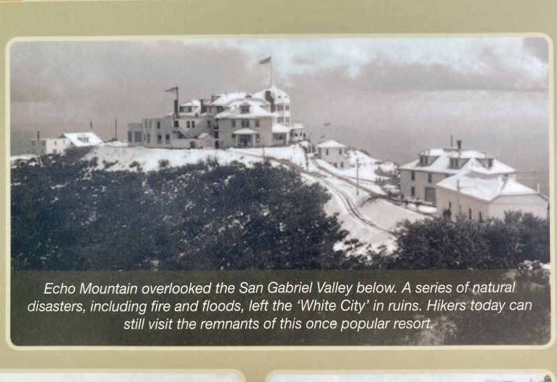
Getting up into the mountains above Altadena from downtown Los Angeles used to be as easy as hopping Lowe Railway, which at the time was the most advanced civil engineering project in the world. Passengers from Altadena boarded the railway at Calaveras Street and Lake Avenue and transferred at Rubio station to the exciting "Incline" department of the railroad. Using improved upon technology developed for San Francisco's cable cars, this lifted them in open cars 3,000 feet to Echo Mountain to what Lowe called "the Switzerland of America."
Three hotels, cabins, restaurants, miles of hiking trails, a zoo, museum, post office, beer garden, mink farm, and other delights attracted a brisk business, especially among well- to-do tourists. In its first year, 60,000 people ascended the mountains to one of the world's first vertically integrated, multifaceted resorts.
In 1906, fires and financial catastrophes forced Lowe to sell his railway and resort to Henry Huntington, who integrated it into his vast Pacific Electric inter-urban railway, the largest such system in the world that ultimately connected
this page online
The Mount Lowe Division of the Pacific Electric Railway closed in 1936 due to the Great Depression and more fires.
From the 1940s through the 1960s, the greatest public transportation system ever built was dismantled as the American love affair with automobiles triggered a frenzy of highway building. Today, clogged freeways and increased commute times have inspired a new round of transportation intrastructure building - as we try to recapture the "freedom" of easily moving around Southern California and into the mountains overlooking our metropolitan area.
photo captions:
Echo Mountain overlooked the San Gabriel Valley below. A series of natural disasters, including fire and floods, left the 'White City' in ruins. Hikers today can still visit the remnants of this once popular resort.
Pacific Electric's

Photographed by Craig Baker, July 16, 2024
2. Transit to Nature Marker
Erected by County of Los Angeles, Amigos de los Rios, and Altadena Heritage.
Topics. This historical marker is listed in these topic lists: Industry & Commerce • Parks & Recreational Areas • Railroads & Streetcars. A significant historical year for this entry is 1906.
Location. 34° 11.398′ N, 118° 7.9′ W. Marker is in Altadena, California, in Los Angeles County. It is at the intersection of Altadena Drive and Lake Avenue, on the right when traveling east on Altadena Drive. Located in Altadena Triangle Park. Touch for map. Marker is at or near this postal address: 800 E Altadena Dr, Altadena CA 91001, United States of America. Touch for directions.

Regionally, this marker is in Greater Los Angeles and in the Transverse Ranges. It is also on the American Pacific Coast. Globally, it is in North America, on the Ring of Fire, on the Pacific Rim, in the Western Hemisphere, in the Western World, and in the Anglosphere. Historically, it finds itself in what was once New Spain and also Mexico’s Alta California.
Other nearby markers. At
Photographed by Craig Baker, July 16, 2024
3. Echo Mountain
Related markers. Click here for a list of markers that are related to this marker. - Echo Mtn, Mt Lowe Railway, and Alpine Tavern markers.

Photographed by Craig Baker, July 16, 2024
4. Mount Lowe

Photographed by Craig Baker
5. Transit to Nature Marker
Credits. This page was last revised on July 26, 2024. It was originally submitted on July 19, 2024, by Craig Baker of Sylmar, California. This page has been viewed 1,272 times since then and 28 times this year. Photos: 1, 2, 3, 4, 5. submitted on July 19, 2024, by Craig Baker of Sylmar, California.
