Fredericksburg, Virginia — The American South (Mid-Atlantic)
The Falmouth Crossing
Photographed by Kevin W., October 8, 2018
1. The Falmouth Crossing Marker
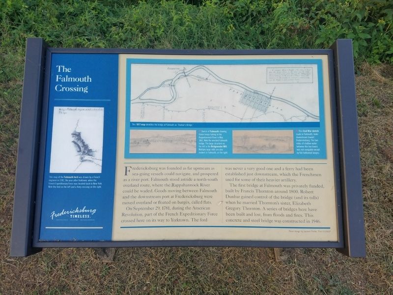
Fredericksburg was founded as far upstream as sea-going vessels could navigate, and prospered as a river port. Falmouth stood astride a north-south overland route, where the Rappahannock River could be waded. Goods moving between Falmouth and the downstream port at Fredericksburg were moved overland or floated on barges, called flats.
On September 29, 1781, during the American Revolution, part of the French Expeditionary Force crossed here on its way to Yorktown. The ford was never a very good one and a ferry had been established just downstream, which the Frenchmen used for some of their heavier artillery.
The first bridge at Falmouth was privately funded, built by Francis Thornton around 1800. Robert Dunbar gained control of the bridge (and its tolls) when he married Thornton's sister, Elizabeth Gregory Thornton. A series of bridges here have been built and lost, from floods and fires. This concrete and steel bridge was constructed in 1946.
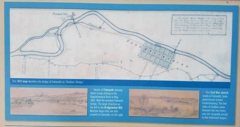
The blue inset at the top of the page includes three photographs. Across the top of the inset is map of the area. It's caption reads:
This 1817 map identifies the bridge
this page online
The caption for the bottom left photo in the inset reads:
Sketch of Falmouth showing Union troops fishing in the Rappahannock River in May 1862. Note the wrecked Falmouth bridge. The large structure on the left is the Bridgewater Mill Multiple large mills are also evident in Falmouth, on the right.
The caption for the bottom right photo in the inset reads:
This Civil War sketch made in Falmouth, looks downstream toward Fredericksburg. The two miles of shallow water between the two towns was not navigable except by flat-bottomed barges.
Topics and series. This historical marker is listed in these topic lists: Settlements & Settlers • Waterways & Vessels. In addition, it is included in the The Washington-Rochambeau Route series list. A significant historical month for this entry is May 1862.
Location. 38° 19.167′ N, 77° 28.398′ W. Marker is in Fredericksburg, Virginia. It is at the intersection of Riverside Drive and Woodford Street on Riverside Drive. Touch for map. Marker is in this post office area: Fredericksburg VA 22401, United States of America. Touch for directions.

Regionally, this marker
Photographed by Kevin W., October 8, 2018
2. Closeup photo from The Falmouth Crossing Marker
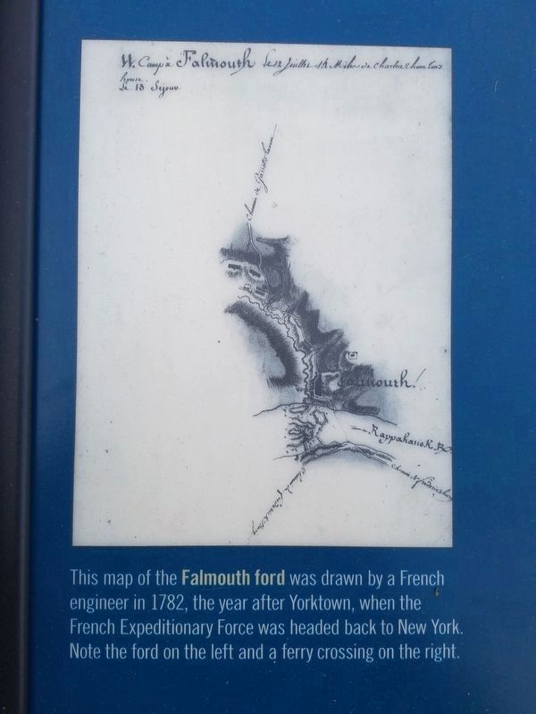
This map of the Falmouth ford was drawn by a French engineer in 1782, the year after Yorktown, when the French Expeditionary Force was headed back to New York. Note the ford on the left and a ferry crossing on the right.
Other nearby markers. At least 8 other markers are within walking distance of this marker: Tobacco and Iron (here, next to this marker); Harnessing The River's Power (about 600 feet away, measured in a direct line); Contact: An Industrial Society Confronts A Native American Culture (about 600 feet away); M 1897 M4 (about 600 feet away); Killed in Action Memorials (about 700 feet away); Veterans of Foreign Wars Eternal Flame (about 700 feet away); Amoroleck Encounters John Smith (approx. 0.2 miles away); Bound for Freedom (approx. 0.2 miles away). Touch for a list and map of all markers in Fredericksburg.
Another marker is no longer nearby. A Walking Tour of Fredericksburg’s Historic Old Mill District
Photographed by Kevin W., October 8, 2018
3. Map photo from The Falmouth Crossing Marker

Photographed by Kevin W., October 8, 2018
4. Tobacco and Iron and the Falmouth Crossing Markers
Credits. This page was last revised on November 3, 2024. It was originally submitted on July 20, 2024, by Kevin W. of Stafford, Virginia. This page has been viewed 519 times since then and 110 times this year. Photos: 1, 2, 3, 4. submitted on July 20, 2024, by Kevin W. of Stafford, Virginia.
