Jamison in Orangeburg County, South Carolina — The American South (South Atlantic)
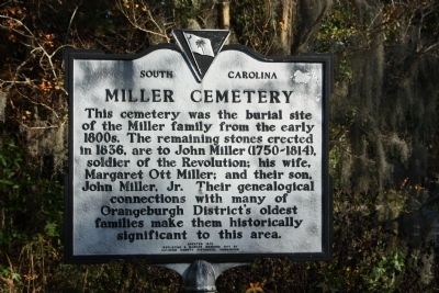
Miller Cemetery
Photographed by Mike Stroud, November 15, 2009
1. Miller Cemetery Marker
Erected 1978 by South Carolina Department of Archives and History, sponsored by the Calhoun County Historical Commission, replacing marker erected 1971. (Marker Number 38-16.)
Topics and series. This historical marker is listed in these topic lists: Cemeteries & Burial Sites • War, US Revolutionary. In addition, it is included in the South Carolina Historical Markers, and the South Carolina, Calhoun County Historical Commission/Society series lists. A significant historical year for this entry is 1836.
Location. 33° 34.784′ N, 80° 48.54′ W. Marker is in Jamison, South Carolina, in Orangeburg County. It is on Waterspring Road (State Highway 38-142) near Lime Kiln Road, on the left when traveling east. Located approx. .5 miles east of US 601. Touch for map.
this page online

Regionally, this marker is in the Lowcountry and in Santee Cooper Country. It is also in the American South and specifically in the Deep South. Globally, it is in North America, the Western Hemisphere, the Western World, and the Anglosphere. Historically, it finds itself in what was once the territory of the Mississippian Culture, one of the original Thirteen Colonies, one of the Confederate States of America, and the Antebellum South.
Other nearby markers. At least 8 other markers are within 6 miles of this marker, measured as the crow flies: Mattie E. Pegues New Homemakers Camp (approx. 3½ miles away); Tabernacle Cemetery (approx. 3.8 miles away); John Adam Treutlen (approx. 4.1 miles away); Bull Swamp Colored School Preservation and Community Center Project (approx. 4.4 miles away); Pewilburwhitcade New Farmers Camp (approx. 4.9 miles away); Alexander S. Salley (approx. 5 miles away); St. Peter AME Church and School (approx. 5.2 miles away); Robert E. Lee Memorial Highway (approx. 5.7 miles away).
Additional commentary.
1.
Photographed by Mike Stroud, November 15, 2009
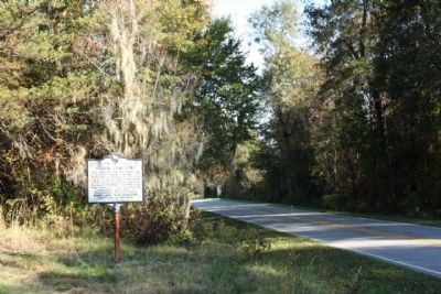
2. Miller Cemetery Marker, seen along Waterspring Road, looking east
This is listed under Orangeburg County in the official South Carolina Department of Archives and History, the South Carolina Department of Education, and the South Carolina Association for Educational Technology.
— Submitted July 22, 2012, by Mike Stroud of Bluffton, South Carolina.
Photographed by Mike Stroud, November 15, 2009
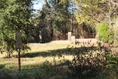
3. Miller Cemetery seen from Waterspring Road
Photographed by Mike Stroud, November 15, 2009
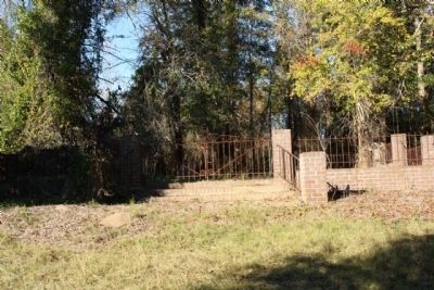
4. Miller Cemetery
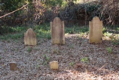
Photographed by Mike Stroud, November 15, 2009
5. Miller Cemetery ,head and foot stones
John Miller (center); his wife,Margaret Ott Miller (right); and their son, John Miller Jr.(left)
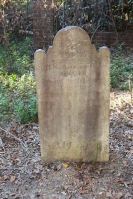
Photographed by Mike Stroud, November 15, 2009
6. John Miller (1750-1854),soldier of the revolution
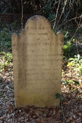
Photographed by Mike Stroud, November 15, 2009
7. Sacred to the Memory of Margaret Miller
Credits. This page was last revised on January 25, 2026. It was originally submitted on December 6, 2009, by Mike Stroud of Bluffton, South Carolina. This page has been viewed 1,561 times since then and 61 times this year. Photos: 1, 2, 3, 4, 5, 6, 7. submitted on December 6, 2009, by Mike Stroud of Bluffton, South Carolina. • Craig Swain was the editor who published this page.
