Near Mechanicsburg in Hampshire County, West Virginia — The American South (Appalachia)
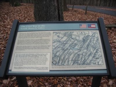
The Civil War in the South Branch Valley
Romney and the South Branch Valley held strategic significance because of their proximity to the Baltimore and Ohio Railroad. The B & O Railroad was a vital transportation link for the North, linking the eastern and western states. Throughout the war, Confederates fought to disrupt traffic on the B & O Railroad. By controlling Romney and the South Branch Potomac Valley, the North could protect a critical stretch of railroad from Confederate raids.
Union troops under the command of Colonel Jacob M. Campbell were ordered to Romney in early March, 1863. Col. Campbell's command included the 54th Pennsylvania Volunteer Infantry, the 1st (West) Virginia Volunteer Infantry, Battery E of the 1st (West) Virginia Light Artillery, and the Ringgold Cavalry (Co. A, 22nd PA Cav.)
Well Anne, We left North Mountain a Friday eaving on the cars, got to Green Springs a Satterday morning, staid thair till Sunday then started for Romney. we go this place at dark. the rodes was vary muddy and it was raining byt we got our knapsacks hauld. we ar campt in the same field we was in when we was hear before. it is a hard looking place. I was over in Romney yesterday and as I was goin down the windays like they did when we was hear befor I seen mules and horses asricking their heads out of the windays of sum of the best houses.
March 11, 1863 letter of Private Joshua Winters, Company G, 1st (West) Virginia Volunteer Infantry, from Civil War Letters and Diary of Joshua Winters edited by Elizabeth Davis Swiger
Topics. This historical marker is listed in this topic list: War, US Civil. A significant historical year for this entry is 1863.
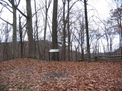
Location. 39° 19.47′ N, 78° 47.601′ W. Marker is near Mechanicsburg, West Virginia, in Hampshire County. Marker is on Mill Ridge Park Road, on the right when traveling east. Located at trail stop 1 on the tour of Fort Mill Ridge Park. Access from Buck Run Road, off US 50 about 2 miles west of Romney, West Virginia. Touch for map. Marker is in this post office area: Burlington WV 26710, United States of America. Touch for directions.
Other nearby markers. At least 8 other markers are within walking distance of this marker. Fort Mill Ridge (a few steps from this marker); Construction of Fort Mill Ridge (a few steps from this marker); The Central Redoubt (within shouting distance of this marker); Interior of the Central Redoubt (within shouting distance of this marker); Control of the Mechanicsburg Gap (within shouting distance of this marker); Engagement with McNeill's Rangers (about 300 feet away, measured in a direct line); An Outpost in Enemy Territory (about 400 feet away); Abandonment of Fort Mill Ridge (about 500 feet away). Touch for a list and map of all markers in Mechanicsburg.
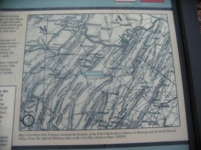
More about this marker. On the right side of the marker is a reproduction of a Map of Northern West Virginia showing the location of the B & O Railroad in relation to Romney and the South Branch Valley. From the Official Military Atlas of the Civil War, Detail of Plate CXXXVI.
Credits. This page was last revised on June 16, 2016. It was originally submitted on December 6, 2009, by Craig Swain of Leesburg, Virginia. This page has been viewed 1,355 times since then and 13 times this year. Photos: 1, 2, 3. submitted on December 6, 2009, by Craig Swain of Leesburg, Virginia.


