Osdorp in Amsterdam, North Holland, Netherlands — Northwestern Europe
Banpaal 1794
⎯⎯⎯
Sloten’s Boundary Stake
Photographed by Andrew Ruppenstein, July 6, 2024
1. Banpaal 1794 / Sloten’s Boundary Stake Marker

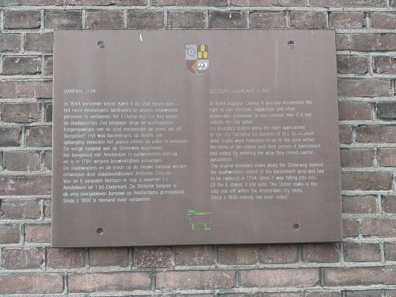
In 1544 verleende keizer Karel V de stad Amsterdam het recht misdadigers, landlopers en andere ongewenste personen te verbannen tot 1 Duitse mij (7.4 km) buiten de stadspoorten. Zes banpalen langs de voornaamste toegangswegen van de stad markeerden de grens van dit ‘bangebied’. Het was bannelingen, op straffe van ophanging, verboden het gebied binnen de palen te betreden. De vorige banpaal aan de Sloterweg begrensde het bangebied van Amsterdam in zuidwestelijke richting en is in 1794 wegens bouwvalligheid vervangen. De stadswapens en de kroon op de nieuwe banpaal werden ontworpen door stadsbeeldhouwer Anthonie Ziesenis. Van de 6 banpalen bestaan er nog 3, waarvan 1 is Amstelveen en 1 bij Ouderkerk. De Slotense banpaal is de enig overgebleven banpaal op Amsterdams grondgebied. Sinds ± 1800 is niemand meer verbannen.
In 1544 emperor Charles V granted Amsterdam the right to ban criminals, vagabonds and other undesirable individuals to one German mile (7,4 km) outside the city gates.
Six boundary stakes along the main approaches to the city indicated the borders of
this page online
The original boundary stake along the Sloterweg marked the southwestern extent of the banishment area and had to be replaced in 1794, since it was falling into ruin. Of the 6 stakes 3 still exist. The Sloten stake is the only one left within the Amsterdam city limits.
Since ± 1800 nobody has been exiled.
Topics. This historical marker is listed in these topic lists: Law Enforcement • Political Subdivisions. A significant historical year for this entry is 1794.
Location. 52° 20.498′ N, 4° 47.933′ E. Marker is in Amsterdam, Noord-Holland (North Holland). It is in Osdorp. It is on Sloterweg, on the right when traveling west. The marker is just a few steps up the side alley off the north side of Sloterweg. Touch for map. Marker is at or near this postal address: Sloterweg 1208, Amsterdam, Noord-Holland 1066 CZ, Netherlands. Touch for directions.

Regionally, it is in Europe, the European Union, Atlantic Europe, the Benelux Low Countries,

Photographed by Andrew Ruppenstein, July 6, 2024
2. Banpaal 1794 / Sloten’s Boundary Stake Marker - wide view
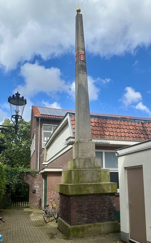
Marker is visible mounted to the wall on the left, with the Banpaal visible on the right.
Other nearby markers. At least 8 other markers are within walking distance of this marker: Dorpsplein / Village Square (about 90 meters away, measured in a direct line); Dorpskerk van Sloten / Sloten Village Church (about 90 meters away); Sloten Netherlands East Indies War Memorial (about 120 meters away); Het Water / The Water (approx. 0.4 kilometers away); Molen van Sloten / Sloten Windmill (approx. half a kilometer away); Hoeve / Farm (approx. half a kilometer away); Willem Hovy (approx. 0.7 kilometers away); Iwan Kanteman (approx. 1.2 kilometers away). Touch for a list and map of all markers in Amsterdam.
More about this marker. For the sake of clarity - when the Banpaal was erected, Sloten was not part of Amsterdam. Amsterdam annexed the village of Sloten in 1921.
Also see . . . De Banpaal van Sloten (Organisaties Sloten-Oud Osdorp, in Dutch).
Excerpt (in translation): The current ban pole dates from the year 1794, as can be seen on the pole. The ban pole is a design by the Amsterdam(Submitted on July 21, 2024.)city sculptor Anthonie Ziesenis (1731-1801). Also clearly visible is the coat of arms of Amsterdam, with the three St. Andrew's crosses. This already indicates that the ban pole does not actually belong to Sloten but to Amsterdam.Photographed by Andrew Ruppenstein, July 6, 20243. Banpaal 1794 / Sloten’s Boundary StakeThe inscription on the banpaal reads, “Terminus Prescriptionis Uiterste Palen Der Ballingen.”
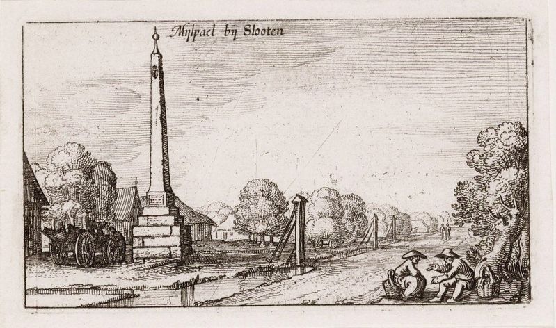
The text on the ban pole can be read: 'Terminus Prosciptionis'; this is Latin for 'Extremes of the Exiles'. This indicates that the ban pole indicated a border, namely the outermost limit of the ban area (jurisdiction) of the city of Amsterdam, which from 1544 extended to one German mile (7,420 meters) outside the then city border, since the construction of the Canal Belt. In the 17th century this was the current Singelgracht. That is why they were also called 'Milestone'. Exiles, people who had been banished from the city, were not allowed to pass the ban pole.
Claes Jansz Visscher (courtesy Stadsarchief Amsterdam via Wikimedia Commons), circa 1607
4. Banpaal 1794 / Sloten’s Boundary Stake
Credits. This page was last revised on July 21, 2024. It was originally submitted on July 21, 2024, by Andrew Ruppenstein of Lamorinda, California. This page has been viewed 126 times since then and 24 times this year. Photos: 1, 2, 3, 4. submitted on July 21, 2024, by Andrew Ruppenstein of Lamorinda, California.
