
Tybee Island in Chatham County, Georgia — The American South (South Atlantic)
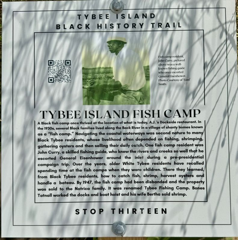
Tybee Island Fish Camp
Tybee Island Black History Trail
Photographed by Brandon D Cross
1. Tybee Island Fish Camp Marker
(caption) Fish camp resident, John Curry, pictured above was a well-known fishing guide who once escorted General Eisenhower. Photo Courtesy of Tom Smith
Erected 2024
this page online
Topics. This historical marker is listed in these topic lists: African Americans • Industry & Commerce • Waterways & Vessels.
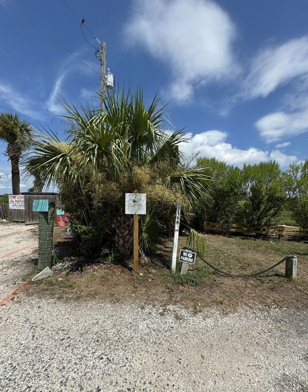
Location. 31° 59.847′ N, 80° 51.267′ W. Marker is on Tybee Island, Georgia, in Chatham County. It is at the intersection of Chatham Avenue and Venetian Drive, on the left when traveling west on Chatham Avenue. 1315 Chatham Avenue is now home to AJ's Dockside Restaurant. Touch for map. Marker is at or near this postal address: 1315 Chatham Avenue, Tybee Island GA 31328, United States of America. Touch for directions.

Regionally, this marker is in Georgia’s Coastal Plain, on the Georgia Coast and the Golden Isles, in Greater Savannah, and on the Sea Islands. It is also in the American South, specifically in the Deep South, and on the Eastern Seaboard. Globally, it is in the North Atlantic Region, North America, the Western Hemisphere, the Western World, and the Anglosphere. Historically, it finds itself in what was once New Spain, the territory of the Mississippian Culture,
Photographed by Brandon D Cross
2. Tybee Island Fish Camp Marker
Other nearby markers. At least 8 other markers are within walking distance of this marker: James Adams’ Oyster House (approx. ¼ mile away); Korean War Veterans Memorial Highway (approx. half a mile away); Nickie’s Fountain (approx. half a mile away); Tybrisa Pavilion 1900/1996 (approx. 0.6 miles away); Savannah Beach Wade-Ins (approx. 0.6 miles away); Tybee Island Orange Crush (approx. 0.6 miles away); Tybrisa Pier and Pavilion (approx. 0.6 miles away); The Tybrisa Pavilion II (approx. 0.6 miles away). Touch for a list and map of all markers in Tybee Island.
Another marker is no longer nearby. The Carbo House (was approx. half a mile away but has been confirmed missing).
Also see . . . Tybee Black History Trail ‘We’re learning about the people who lived here’. (Submitted on July 21, 2024, by Brandon D Cross of Flagler Beach, Florida.)
Additional commentary.
1. The Tybee Island Black History Trail
“The Tybee Island Black History Trail documents the arrival of enslaved Africans at Lazaretto Creek Quarantine Station and follows their ancestral journey to present-day Tybee. The trail uncovers parts of Tybee Island’s history and geographies that remain unfamiliar to most people and explores the legacies of enslavement, segregation and the Civil Rights Movement, including efforts to desegregate Tybee Island’s White beach. The trail also highlights the ongoing efforts of organizations such as Tybee MLK Human Rights Organization , whose volunteers work tirelessly to retain these histories and bring awareness to their importance in the present.”
Tybee MLK Human Rights Organization
— Submitted July 22, 2024.
Credits. This page was last revised on July 22, 2024. It was originally submitted on July 21, 2024, by Brandon D Cross of Flagler Beach, Florida. This page has been viewed 188 times since then and 29 times this year. Photos: 1, 2. submitted on July 21, 2024, by Brandon D Cross of Flagler Beach, Florida. • Bernard Fisher was the editor who published this page.
