Manteo in Dare County, North Carolina — The American South (South Atlantic)
The Lower Lights

Photographed by Ray Gurganus, July 17, 2024
1. The Lower Lights Marker
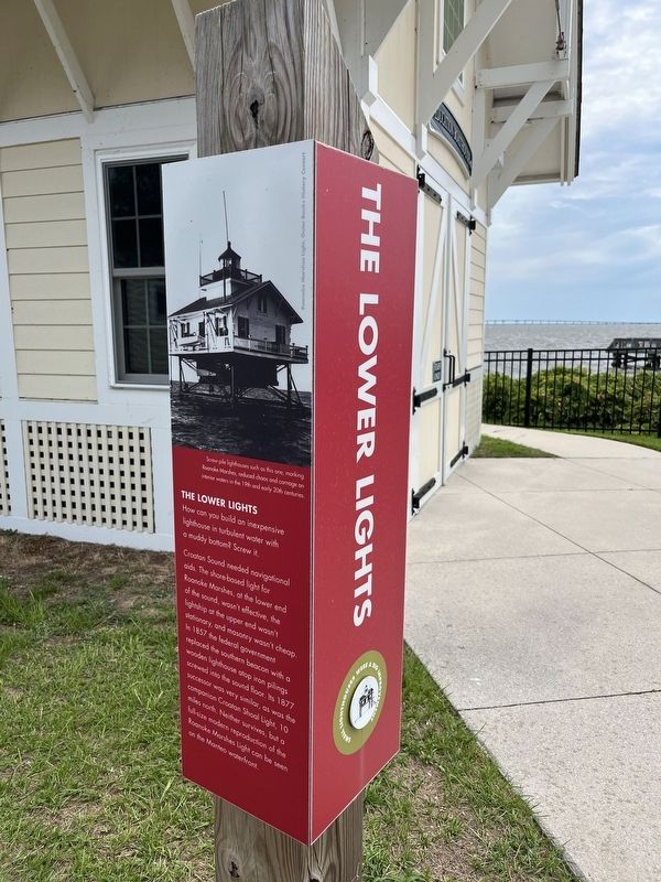
Croatan Sound needed navigational aids. The shore-based light for Roanoke Marshes, at the lower end of the sound, wasn't effective, the lightship at the upper end wasn't stationary, and masonry wasn't cheap. In 1857 the federal government replaced the southern beacon with a wooden lighthouse atop iron pilings screwed into the sound floor. Its 1877 successor was very similar, as was the companion Croatian Shoal Light, 10 miles north. Neither survives, but a full-size modern reproduction of the Roanoke Marshes Light can be seen on the Manteo waterfront.
(caption) Screw-pile lighthouses such as this one, marking Roanoke Marshes, reduced chaos and carnage on interior waters in the 19th and early 20th centuries.
Topics and series. This historical marker is listed in these topic lists: Notable Buildings • Waterways & Vessels. In addition, it is included in the Lighthouses series list. A significant historical year for this entry is 1857.
Location. 35° 55.028′ N, 75° 42.262′ W. Marker is in Manteo, North Carolina, in Dare County. It can be reached from the intersection of Airport Road and Old County Road, on the right when traveling south. On the grounds of the North Carolina Aquarium, near the waterfront. Touch for map. Marker is at or near this postal address: 374 Airport Rd, Manteo NC 27954, United States of America. Touch for directions.

Regionally, this marker is in North Carolina’s Coastal Plain and on the Outer Banks. It is also in the American South, specifically in the Upper South, in the Tidewater, and on the Eastern Seaboard. Globally, it is in the North Atlantic Region, North America, the Western Hemisphere, the Western World, and the Anglosphere. Historically, it finds itself in what
this page online
Other nearby markers. At least 8 other markers are within walking distance of this marker: A Show Boat (a few steps from this marker); A Big Deal (within shouting distance of this marker); Waterman's Workhorse (within shouting distance of this marker); A Moveable Feast (within shouting distance of this marker); Richard Etheridge, 1842-1900 (about 300 feet away, measured in a direct line); a different marker also named Richard Etheridge, 1842-1900 (about 300 feet away); a different marker also named Richard Etheridge, 1842-1900 (about 300 feet away); a different marker also named Richard Etheridge, 1842-1900 (about 400 feet away). Touch for a list and map of all markers in Manteo.
Photographed by Ray Gurganus, July 17, 2024
2. The Lower Lights Marker
Credits. This page was last revised on July 22, 2024. It was originally submitted on July 21, 2024, by Ray Gurganus of Washington, District of Columbia. This page has been viewed 219 times since then and 23 times this year. Photos: 1, 2. submitted on July 21, 2024, by Ray Gurganus of Washington, District of Columbia. • Bernard Fisher was the editor who published this page.
