Glennville in Kern County, California — The American West (Pacific Coastal)
Lynn’s Bull Road
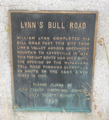
Photographed by Syd Whittle, November 28, 2009
1. Lynn’s Bull Road Marker
Erected 1969 by Kern County Historical Society and Kern County Museum.
Topics. This historical marker is listed in these topic lists: Roads & Vehicles • Settlements & Settlers. A significant historical year for this entry is 1856.
Location. 35° 42.851′ N, 118° 43.652′ W. Marker is in Glennville, California, in Kern County. It is at the intersection of State Highway 155 and Granite Road, on the left when traveling west on State Highway 155. Touch for map. Marker is in this post office area: Glennville CA 93226, United States of America. Touch for directions.

Regionally, this marker is in the San Joaquin Valley, specifically in the Central Valley, and in the Sierra Nevada. It is also on the American Pacific Coast. Globally, it is in North America, on the Ring of Fire, on the Pacific Rim, in the Western Hemisphere, in the Western World, and in the Anglosphere. Historically, it finds itself in what was once New Spain and also Mexico’s Alta California.
this page online
Other nearby markers. At least 8 other markers are within 12 miles of this marker, measured as the crow flies: Lavers Crossing (approx. 1.6 miles away); Glennville Adobe (approx. 1.7 miles away); Woody (approx. 6 miles away); Joseph Weringer, Sr. (approx. 6.1 miles away); Tailholt (approx. 9.4 miles away); Granite Station (approx. 10.1 miles away); Mountain House (approx. 11.1 miles away); Garcés Baptismal Site (approx. 11.4 miles away). Touch for a list and map of all markers in Glennville.
Also see . . . David Lavers. David Lavers, a friend of Lynn, helped him build the “Old Bull Road”. Lavers eventually purchased property in the area and the ranch continues today, being managed by his descendents. (Submitted on December 6, 2009, by Syd Whittle of Mesa, Arizona.)
Additional commentary.
1. William Lynn
Glennville, settled by Madison M. Glenn in 1857, is located northeast of Bakersfield in what is known as Linn’s Valley.
William P. Lynn, a farmer who mainly grew hay and potatoes, first settled in the region in the year 1854. He built the first mill in the county, on Poso Creek but the high waters of 1861-1862 washed away the mill. After the floods, Lynn sold his interests and went to Colorado.
— Submitted December 6, 2009, by Syd Whittle of Mesa, Arizona.
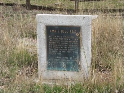
Photographed by Syd Whittle, November 28, 2009
2. Lynn’s Bull Road Marker
Credits. This page was last revised on June 16, 2016. It was originally submitted on December 6, 2009, by Syd Whittle of Mesa, Arizona. This page has been viewed 1,564 times since then and 25 times this year. Photos: 1, 2. submitted on December 6, 2009, by Syd Whittle of Mesa, Arizona.
