South Plaza in Kansas City in Jackson County, Missouri — The American Midwest (Upper Plains)
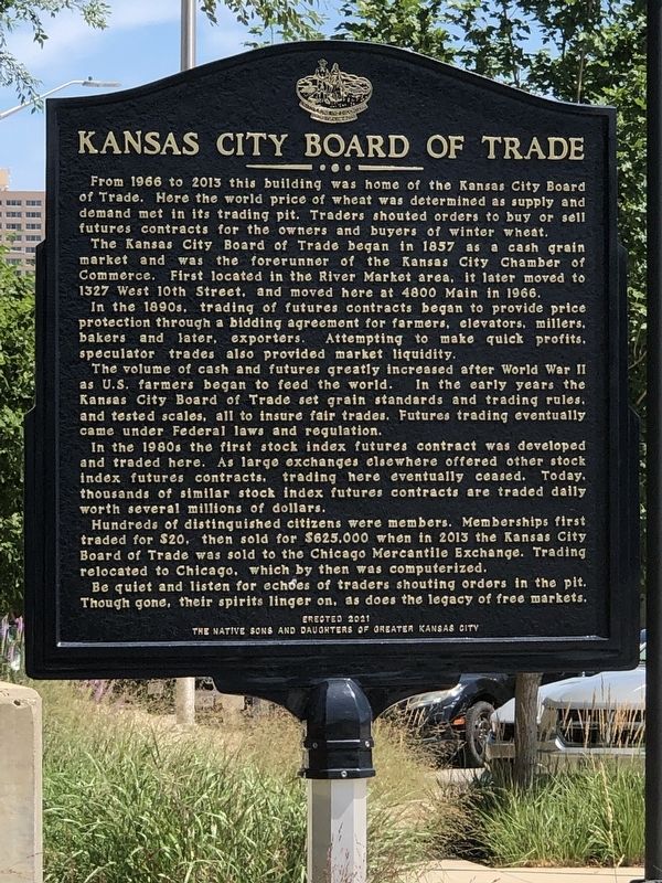
Kansas City Board of Trade
Photographed by Duane and Tracy Marsteller, June 30, 2024
1. Kansas City Board of Trade Marker
The Kansas City Board of Trade began in 1857 as a cash grain market and was the forerunner of the Kansas City Chamber of Commerce. First located in the River Market area, it later moved to 1327 West 10th Street, and moved here at 4800 Main in 1966.
In the 1890s, trading of futures contracts began to provide price protection through a bidding agreement for farmers, elevators, millers, bakers and later, exporters. Attempting to make quick profits, speculator trades also provided market liquidity.
The volume of cash and futures greatly increased after World War II as U.S. farmers began to feed the world. In the early years the Kansas City Board of Trade set grain standards and trading rules, and tested scales, all to insure fair trades. Futures trading eventually came under Federal laws and regulation.
In the 1980s the first stock index futures
this page online
Hundreds of distinguished citizens were members. Memberships first traded for $20, then sold for $625,000 when in 2013 the Kansas City Board of Trade was sold to the Chicago Mercantile Exchange. Trading relocated to Chicago, which by then was computerized.
Be quiet and listen for echoes of traders shouting orders in the pit. Though gone, their spirits linger on, as does the legacy of free markets.
Erected 2021 by The Native Sons and Daughters of Greater Kansas City. (Marker Number 58.)
Topics and series. This historical marker is listed in these topic lists: Agriculture • Industry & Commerce. In addition, it is included in the Kansas City - Native Sons and Daughters of Greater Kansas City series list. A significant historical year for this entry is 1857.
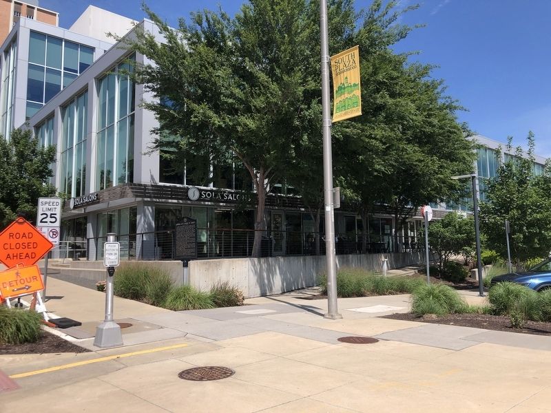
Location. 39° 2.316′ N, 94° 35.242′ W. Marker is in Kansas City, Missouri, in Jackson County. It is in South
Photographed by Duane and Tracy Marsteller, June 30, 2024
2. Kansas City Board of Trade Marker

Regionally, this marker is in the American Midwest, in the Lewis & Clark Corridor, in the Corn Belt, and on the Santa Fe Trail Corridor. Globally, it is in North America, the Western Hemisphere, the Western World, and the Anglosphere. Historically, it finds itself in what was once the territory of the Mississippian Culture, the Louisiana Purchase, and the Antebellum South.
Other nearby markers. At least 8 other markers are within walking distance of this marker: Giralda Tower (approx. ¼ mile away); The Seville Light Fountain (approx. ¼ mile away); The Jesse Clyde Nichols Memorial Fountain (approx. ¼ mile away); The "Fourth Dolphin" (approx. 0.3 miles away); Landing At Westport (approx. 0.3 miles away); Neptune (approx. 0.3 miles away); Wild Boar of Florence (approx. 0.3 miles away); Battle of Westport (approx. 0.3 miles away). Touch for a list and map of all markers in Kansas City.
Also see . . . Kansas City Board of Trade. Wikipedia entry on the exchange, which specialized in hard-red winter wheat contracts. (Submitted on July 22, 2024, by Duane and Tracy Marsteller of Murfreesboro, Tennessee.)
Credits. This page was last revised on July 22, 2024. It was originally submitted on July 22, 2024, by Duane and Tracy Marsteller of Murfreesboro, Tennessee. This page has been viewed 559 times since then and 81 times this year. Photos: 1, 2. submitted on July 22, 2024, by Duane and Tracy Marsteller of Murfreesboro, Tennessee.
