Downtown in Mount Airy in Carroll County, Maryland — The American Northeast (Mid-Atlantic)
The Mount Airy Founding
Historic Downtown, Mount Airy

On this site in front of you (where the caboose now stands) was once the original store and tavern established by Henry Bussard in 1837. The store served the local community on Parr's Ridge, and provided a rest stop for weary travelers upon the Westminster Road. Three hundred feet west of the tavern was a small pond, fed by four natural springs. A one room, one and a half story log home, once belonging to Gustavus Dorsey, stood to your left. Henry Bussard owned all of the surrounding land, and sold the right of way to the Baltimore & Ohio Railroad in 1838 to build a new rail line into what is today, Mount Airy.
As the new railway was being completed, Henry Bussard shared his plans for a new town with the railroad's Chief Civil Engineer, Benjamin Latrobe, Jr. which included a new house on the hill, a wagon yard, a tavern, and a depot. The Baltimore & Ohio Railroad finally blasted through the ridge behind you in June of 1839, and the town of "Mount Airy" was born.
For many years, Henry Bussard operated his store as both the post office and the train station, where he served as the postmaster and the station agent
this page online
In 1869, the railroad finally built a small, wooden passenger house located where the train station now stands. In 1890, John B. Runkles built a grain mill on the location of Henry Bussard's tavern.
[Captions:]
The B&O Railroad built the first wooden passenger station in 1869, located behind you where the station stands today.
Bill of lading receipt signed by Henry Bussard, station agent for the B&O Railroad.
Excerpt from Martenet's Map of Carroll County, 1862 showing the original store and station, located in front of you.
Topics and series. This historical marker is listed in these topic lists: Industry & Commerce • Railroads & Streetcars • Settlements & Settlers • War, US Civil. In addition,
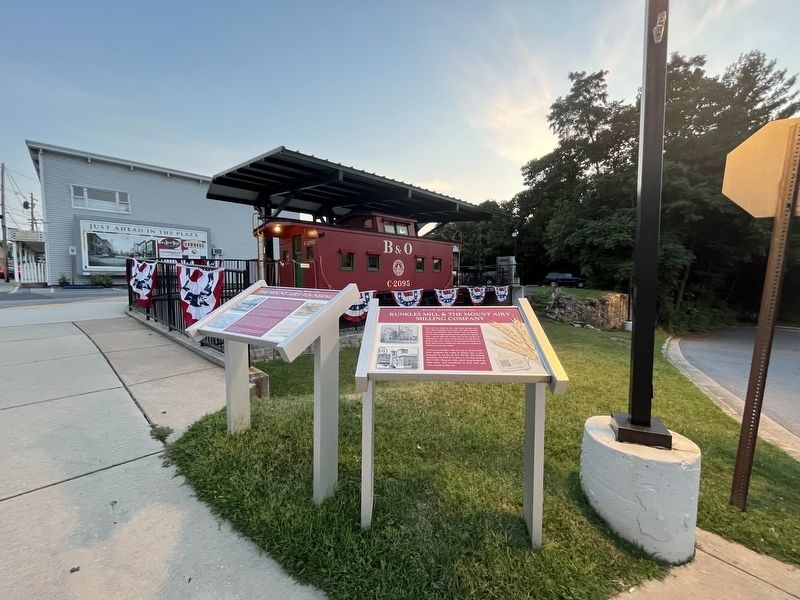
Location. 39° 22.626′ N, 77° 9.26′ W. Marker is in Mount Airy, Maryland, in Carroll County. It is in Downtown. It is on North Main Street (Maryland Route 808) south of Prospect Road, on the right when traveling south. Touch for map. Marker is at or near this postal address: 2 N Main St, Mount Airy MD 21771, United States of America. Touch for directions.

Regionally, this marker is in the Baltimore Metro Region and in Central Maryland. It is also in the American Mid-Atlantic. Globally, it is in North America, the Western Hemisphere, the Western World, and the Anglosphere. Historically, it finds itself in what was once one of the original Thirteen Colonies and also the Antebellum South.
Other nearby markers. At least 8 other markers are within walking distance of this marker: Runkles Mill & The Mount Airy Milling Company (here, next to this marker); The Mount Airy Station (a few steps from this marker); Sledding in Mount Airy in the Past (within shouting distance of this marker); Railway Express Agency Baggage Wagon (within shouting distance of this marker); William Hood Building (within shouting distance of this marker); First National Bank Building (within shouting distance of this marker); The Gillis Building (within shouting distance of this marker); Railroad Storage Building (within shouting distance of this marker). Touch for a list and map of all markers in Mount Airy.
Other markers no longer nearby. Runkles Mill and The Mt. Airy Milling Company (was here, next to this marker but has been replaced with another marker now near it); The Mount Airy Rail Yard (was here, next to this marker but has been replaced with another marker now near it).
Related marker. Click here for another marker that is related to this marker. This marker has replaced the linked marker.
Credits. This page was last revised on July 22, 2024. It was originally submitted on July 22, 2024, by Devry Becker Jones of Washington, District of Columbia. This page has been viewed 473 times since then and 98 times this year. Photos: 1, 2. submitted on July 22, 2024, by Devry Becker Jones of Washington, District of Columbia.
