Downtown in Mount Airy in Carroll County, Maryland — The American Northeast (Mid-Atlantic)
Runkles Mill & The Mount Airy Milling Company
Historic Downtown, Mount Airy
Photographed by Devry Becker Jones (CC0), July 14, 2024
1. Runkles Mill & The Mount Airy Milling Company Marker
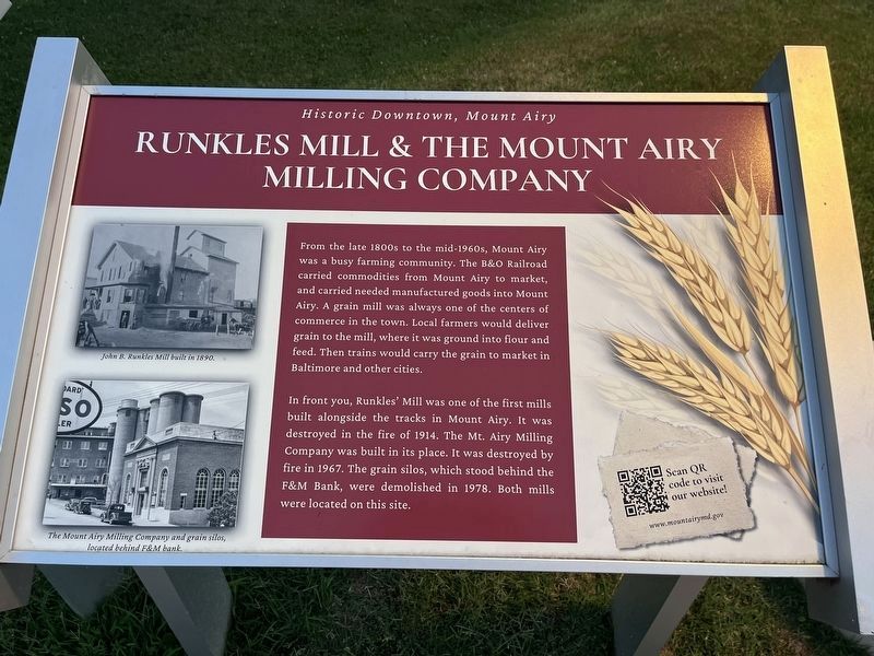
From the late 1800s to the mid-1960s, Mount Airy was a busy farming community. The B&O Railroad carried commodities from Mount Airy to market, and carried needed manufactured goods into Mount Airy. A grain mill was always one of the centers of commerce in the town. Local farmers would deliver grain to the mill, where it was ground into flour and feed. Then trains would carry the grains to market in Baltimore and other cities.
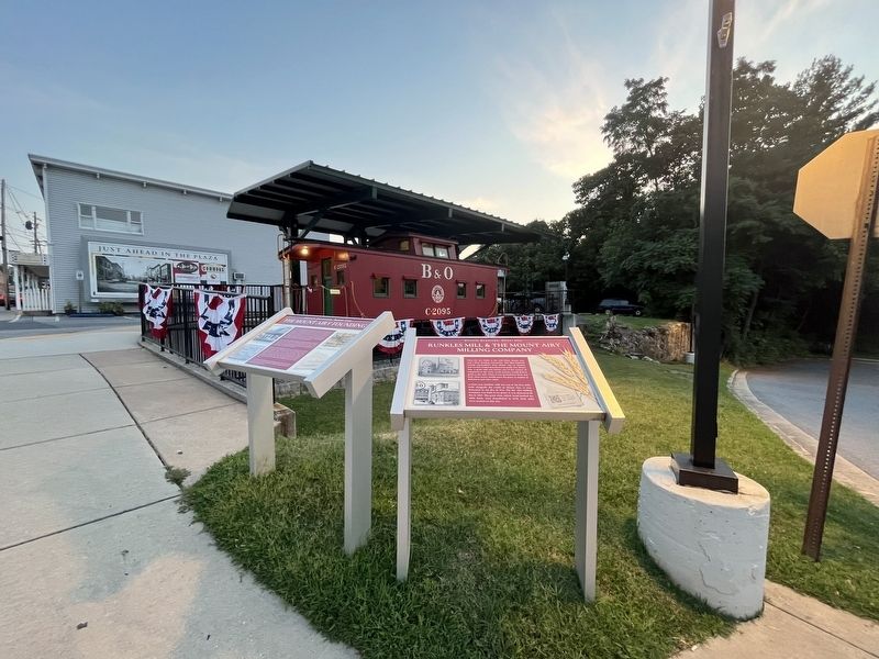
In front of you, Runkles' Mill was one of the first mills built alongside the tracks in Mount Airy. It was destroyed in the fire of 1914. the Mt. Airy Milling Company was built in its place. It was destroyed by fire in 1967. The grain silos, which stood behind the F&M Bank, were demolished in 1978. both mills were located on this site.
Topics and series. This historical marker is listed in these topic lists: Agriculture • Industry & Commerce. In addition, it is included in the Baltimore and Ohio Railroad (B&O) series list. A significant historical year for this entry is 1914.
Location. 39° 22.628′ N, 77° 9.26′ W. Marker is in Mount Airy, Maryland, in Carroll County. It is in Downtown. It is
this page online

Regionally, this marker is in the Baltimore Metro Region and in Central Maryland. It is also in the American Mid-Atlantic. Globally, it is in North America, the Western Hemisphere, the Western World, and the Anglosphere. Historically, it finds itself in what was once one of the original Thirteen Colonies and also the Antebellum South.
Other nearby markers. At least 8 other markers are within walking distance of this marker: The Mount Airy Founding (here, next to this marker); The Mount Airy Station (a few steps from this marker); Sledding in Mount Airy in the Past (within shouting distance of this marker); Railway Express Agency Baggage Wagon (within shouting distance of this marker); First National Bank Building (within shouting distance of this marker); William Hood Building (within shouting distance of this marker); The Gillis Building (within shouting distance of this marker); Railroad Storage Building
Photographed by Devry Becker Jones (CC0), July 14, 2024
2. Runkles Mill & The Mount Airy Milling Company Marker
Other markers no longer nearby. Runkles Mill and The Mt. Airy Milling Company (was here, next to this marker but has been replaced with another marker now near it); The Mount Airy Rail Yard (was here, next to this marker but has been replaced with another marker now near it).
Related marker. Click here for another marker that is related to this marker. This marker replaced the linked marker.
Credits. This page was last revised on July 22, 2024. It was originally submitted on July 22, 2024, by Devry Becker Jones of Washington, District of Columbia. This page has been viewed 281 times since then and 41 times this year. Photos: 1, 2. submitted on July 22, 2024, by Devry Becker Jones of Washington, District of Columbia.
