Mt. Carmel in McCormick County, South Carolina — The American South (South Atlantic)
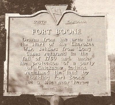
Fort Boone
Driven from the area at the start of the Cherokee War, settlers from Long Canes returned in the fall of 1760 and, under the protection of a party of Chickasaw Indians, reclaimed the land by building Fort Boone near here.
Erected 1980 by McCormick County Historical Commission. (Marker Number 33-8.)
Topics and series. This historical marker is listed in these topic lists: Military • Notable Places • Settlements & Settlers • Wars, US Indian. In addition, it is included in the South Carolina, McCormick County Historical Commission series list. A significant historical year for this entry is 1760.
Location. Marker has been reported missing. It was located near 34° 3.554′ N, 82° 27.017′ W. Marker was in Mt. Carmel, South Carolina, in McCormick County. Marker was on Mt. Carmel Road (State Highway 823) near Old Charleston Road. Touch for map. Marker was in this post office area: Mount Carmel SC 29840, United States of America. Touch for directions.
Other nearby markers. At least 10 other markers are within 6 miles of this location, measured as the crow flies. Birthplace of Calhoun (about 300 feet away, measured in a direct line); Mulberry A.M.E. Church (approx. 0.3 miles away); Battle of Long Cane (approx. 3.7 miles away); Forest Lawn Memory Gardens Veterans Monument (approx. 4 miles away); Lebanon Presbyterian Church (approx. 4.3 miles away); Mt. Carmel Historical District (approx. 4.8 miles away); Fort Charlotte (approx. 4.9 miles away); Patrick Calhoun Burial Grounds (approx. 5.6 miles away); Parsons Mountain World War II Memorial (approx. 6 miles away); Parsons Mountain (approx. 6 miles away). Touch for a list and map of all markers in Mt. Carmel.
More about this marker. The marker is listed in several guides published in 1999. It has since gone missing. The remnants of Fort Boone can be seen from 823 about 1/2 mile before you reach the dirt road. The remnants are in a meadow on the north side of 823. The meadow is fenced with barbed wire.
Also see . . .
1. Anglo-Cherokee War. The Anglo-Cherokee War (1758–1761) (Cherokee:"war with those in the red coats" or "war with the english"), also known (from the Anglo-European perspective) as the Cherokee War, the Cherokee Uprising, the Cherokee Rebellion, was a conflict between British forces in North America and Cherokee Indians during the French and Indian War. (Submitted on December 6, 2009, by Brian Scott of Anderson, South Carolina.)
2. The Chickasaw Nation. Official website of the Chickasaw Nation. (Submitted on December 6, 2009, by Brian Scott of Anderson, South Carolina.)
3. Thomas Boone. Thomas Boone was the 7th Royal Governor of New Jersey (after the position became solely "Governor of New Jersey) and the 28th Royal Governor of South Carolina. (Submitted on December 6, 2009, by Brian Scott of Anderson, South Carolina.)
Additional commentary.
1. The Long Canes Reclaimed
With indomitable courage that typified the Scotch-Irish pioneers and the resilience of their human spirit, the Long Canes settlers returned from the Waxhaws during the fall of 1760, bringing their hopes and dreams bravely to begin anew.
The first order of business for Patrick Calhoun was to construct a permanent fort for the protection of the settlement. Calhoun recruited a band of Cherokee Indians to serve as a vanguard for the workmen.
Lieutenant Governor William Bull reported the erection of Fort Boone to the Council on October 17, 1760:
"As they are a Party of far Chickasaws that are ready ti go against the Cherokees, & have remain'd for some weeks usefully employed in covering the late settlers of Long Canes in their attempt to resettle there by building a fort..."
Fort Boone, named for Governor Thomas Boone, was located on Mary Calhoun Noble's land near the home of Alexander Noble. the palisade fort was constructed of poplar logs. the blockhouse with portholes, twenty feet square, one and a half stories, was likewise built of poplar logs, hewed and notched in such a manner as to bring the faces of the logs in contact with one another. The wide chimney, built of stone, took up most of one end of the blockhouse. The fort was armed with swivel guns and blunderbusses.
Fort Boone was located on the east side of the south fork of Calhoun Creek, south of the junction of White Creek and Hilburn Creek.
Fort Boone also served the settlers as schoolhouse, meetinghouse, and church. Lower Long Cane Church, organized at Fort Boone, was the predecessor of Hopewell Presbyterian Church. (Source: The Making of McCormick County by Bobby F. Edmonds (1999), pgs 32-33.)
— Submitted December 6, 2009, by Brian Scott of Anderson, South Carolina.
Credits. This page was last revised on September 17, 2020. It was originally submitted on December 6, 2009, by Brian Scott of Anderson, South Carolina. This page has been viewed 2,882 times since then and 105 times this year. Photo 1. submitted on December 6, 2009, by Brian Scott of Anderson, South Carolina.
